Climate outlooks
-
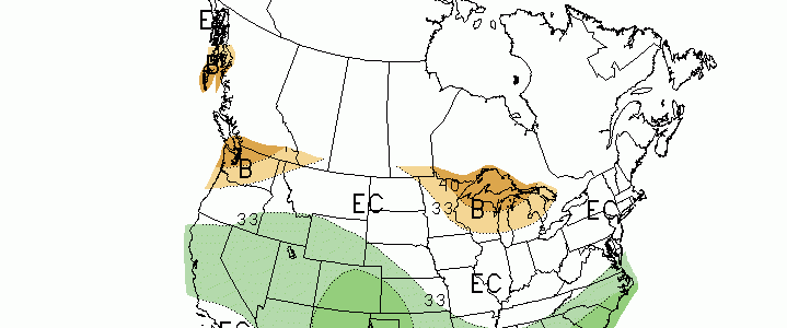
The Climate Prediction Center issued their new monthly and 3-month outlooks for temperature and precipitation this week. They show that for April and April-June, there is an increased chance of above normal rainfall across the Southeast. Temperatures in April have an equal chance of above-, near- or below-normal conditions, while the longer term temperature forecast…
Posted in: Climate outlooks -
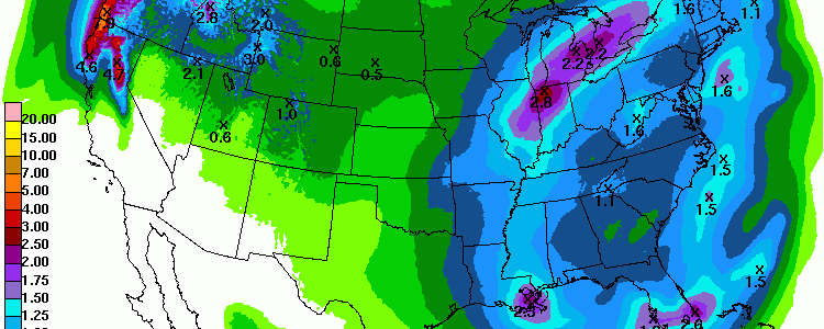
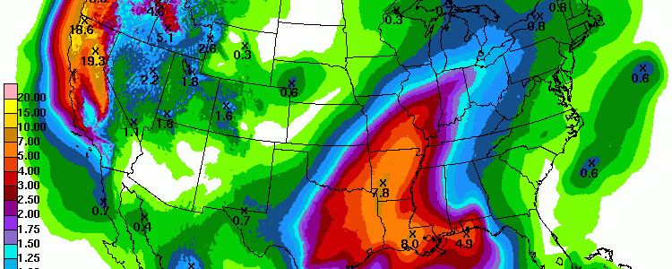
The latest QPF map shows that most of the Southeast should receive some rain this week but that it will be below normal amounts. The exception is along a line in south-central Florida, which should experience wet conditions associated with a stationary front in the area.
Posted in: Climate outlooks -
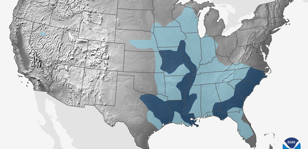
NOAA released their latest outlook for spring today. It shows a increased chance of above normal precipitation in our region. Because of this, they are predicting a moderate risk of spring flooding in parts of the Southeast. You can read about the outlook and watch a 3-minute video on the US outlook at https://www.climate.gov/news-features/videos/2016-spring-climate-and-flood-outlook.
-
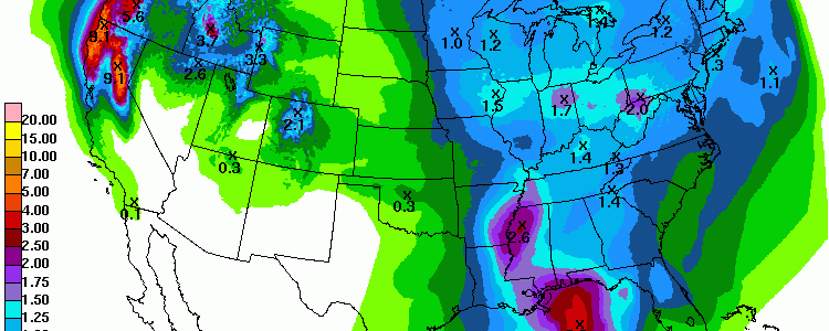
The 7-day QPF shows that the western portion of the Southeast should get the most rain in the next week. This will occur in two batches. The first event is a continuation of the rainy conditions that have plagued Louisiana, Arkansas and Mississippi this week in association with a cut-off low that is moving very…
Posted in: Climate outlooks -

According to weather forecast models, the next two weeks across the Southeast have a very high probability of above-normal temperatures for at least the next two weeks. Rainfall is also expected to be fairly light for the next week. These conditions should rapidly increase soil temperatures and dry them out, allowing farmers to prepare their fields…
-
The latest 7-day QPF map shows that most of next week’s rain will stay in Alabama and the western part of our region. Most areas will not see any rain until Thursday. Nationally, the biggest rainfall is expected to be northern California, which will be experiencing an “atmospheric river” event that will bring up to…
Posted in: Climate outlooks -

The latest QPF map shows that large portions of the Southeast will receive less than half an inch of rain in the next seven days. This is welcome news for farmers who are waiting for their soil to dry out so they can get out and work the fields, but is less good for those…