Climate outlooks
-
After a nice Saturday and Sunday, rain should start to move through the Southeast on Sunday night through Monday. It should clear out midweek, but rain will return to the area late in the week. The heaviest amounts will be in Alabama and northern Georgia, with lighter amounts elsewhere.
Posted in: Climate outlooks -
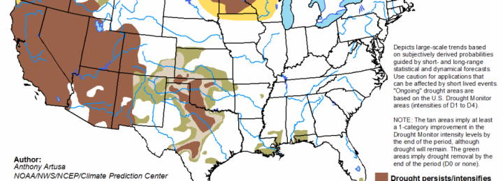
EDENotes, the blog of the Extension Disaster Education Network, posted their spring outlook this week at https://blogs.extension.org/edenotes/2015/03/25/weather-wednesday-spring-outlook/. As I noted earlier, the forecast calls for an increased chance of above normal precipitation in April through June in the Southeast. ProFarmer also published an article describing the expansion of drought in the Northern and Central Great…
-
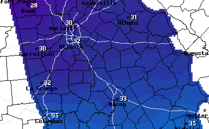
Earlier this week I noted that we were in for some cold weather and possible frost this coming weekend. I wanted to give you an update on the general situation, although you will want to get detailed forecasts from the National Weather Service or another source as the cold weather moves in. The cold front…
-
Even though we’re past the average date for last frost in parts of the Southeast, it is not too late for a cold blast to move through the area. Early signs for next weekend, Saturday March 28 and Sunday March 29, show that another surge of cold air is expected to move into the area…
-

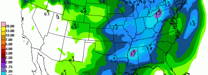
After a beautiful Saturday, Sunday should be soggy across the region. Rain chances will decrease somewhat mid-week but pick up again on Thursday and Friday, when the focus shifts south to Florida. Amounts could be as much as 2.5 inches in some areas for the week.
Posted in: Climate outlooks -
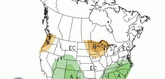
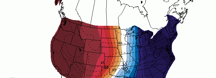
The extended forecast for the next two weeks has an increased chance of cool and wet conditions according to the Climate Prediction Center. They also released their new forecasts for April and for April through June. Both the 1-month and 3-month forecasts show equal chances of below, above or near normal temperature but both the…
Posted in: Climate outlooks -

We’re about halfway through March, and so far for the month the Southeast has been warmer and drier than normal across almost the entire region. The warmth has been especially strong in Florida and southern Georgia. Dry conditions in southern Alabama have contributed to the continuing drought there. Generally the coolest temperatures have corresponded with…