I was not able to post yesterday due to problems with WordPress, but we’re back today! This morning’s temperatures across the state are above freezing, but in north central GA, just barely, with the UGA Weather Station at Blue Ridge getting down to 33.4 F right around sunrise on Sunday. It would not surprise me if a few isolated areas did see some frost or light freezing conditions, but this would be only at a few scattered locations.
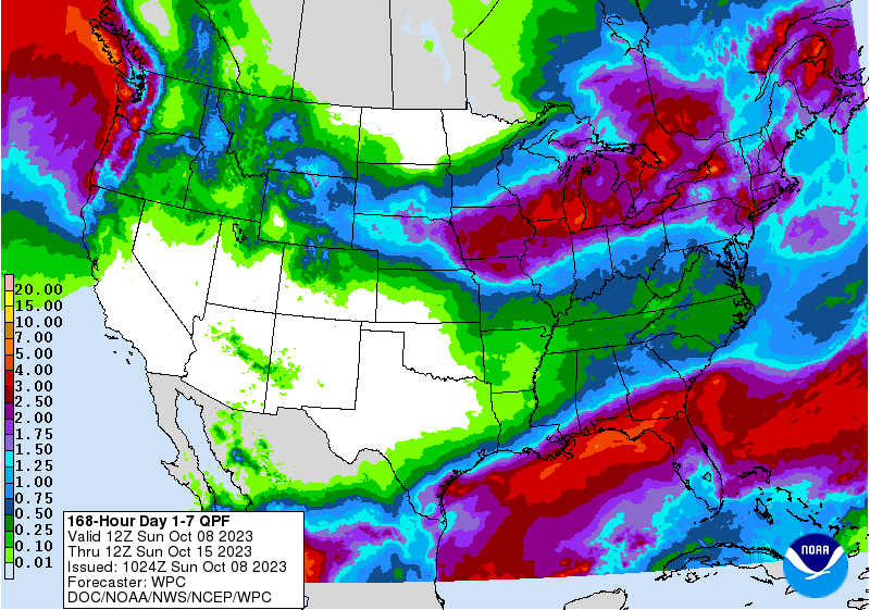
Fortunately, this will be the coldest morning of the week, and the next chance of a frost is likely to be mid-month around the October 17-21 time frame. But more cold weather is coming after that, as you might expect. Rainfall for the next three days will be nonexistent across Georgia. Mid-week will bring heavy rain to the southern half of the state and lighter showers to northern Georgia. The end of the week will bring heavier rain to northern Georgia while southern GA sees less than mid-week. Rainfall in north GA should be about an inch, but southern areas could see several inches as a front stalls across that part of the state.