Sources of weather and climate data
-
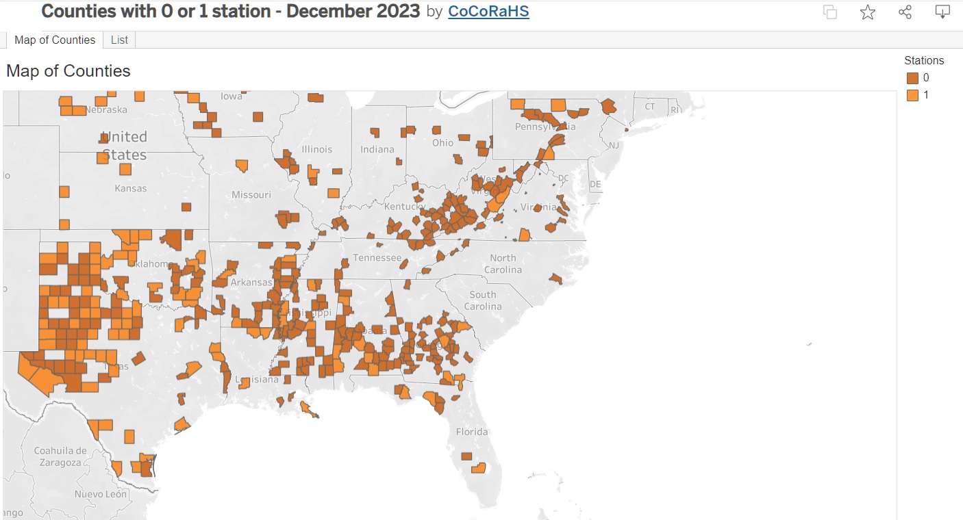
The fine folks at CoCoRaHS posted this map showing counties across the country that had only one or no precipitation observers. I am sad to see so many counties in Georgia that don’t have any observers, not even at extension offices. South Carolina, North Carolina, and Florida are doing a much better job of getting…
-

I want to take a minute to celebrate the 40th anniversary of the Regional Climate Centers, a climate resource for the United States. In the Southeast, our partner is the Southeast Regional Climate Center, located in North Carolina, and they can provide an amazing amount of climate information, including the Perspectives tool that is used…
-

I was disappointed that we did not get more rain this weekend. A lot of Georgia was very dry in November, and we were hopeful that we would get a couple of inches of rain in northern Georgia to help alleviate some of the drought there. But most of the rain was confined to the…
Posted in: Sources of weather and climate data -

Since 2014, when this blog started, I’ve run a couple of articles about when the average date of the coldest day of the year is for everywhere in the United States. Here is an update that now includes an interactive map to show you when you can expect the coldest day of the year to…
-
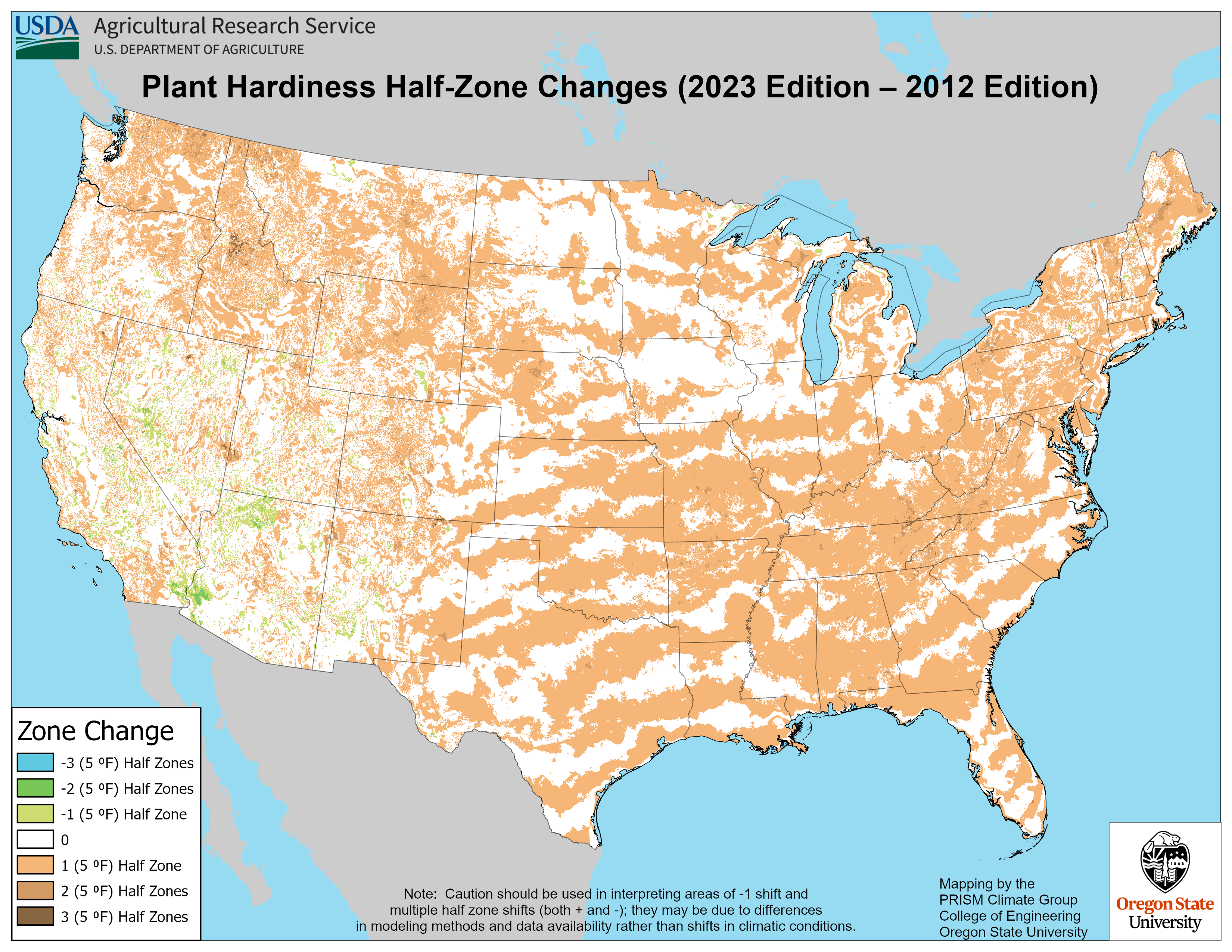
The USDA published a new Plant Hardiness Zone map about a week ago. The previous map was produced in 2012 and since that time gardeners have used it to determine what plants are suitable for their yards. The Plant Hardiness Zone map is based on the average lowest temperature a location receives sometime each winter.…
-
This week we are expecting a big change in the prevailing weather pattern as a strong cold front moves through the region from northwest to southeast on Tuesday and Wednesday. The front will not have a lot of precipitation with it but will bring sharply colder and drier air to a lot of the region…
-

If you ever get asked about what kinds of disasters have hit your county or community, you should check out the new Atlas of Disaster put together by Rebuild by Design and available here as a PDF file. They also have PDFs of individual staetes, such as this one for Georgia at GEORGIA.pdf (rebuildbydesign.org). You…