Interesting weather images
-

A recent satellite-derived image from NASA published this week shows the deviation of vegetation from average “greenness”. This is a measure of how healthy and abundant the vegetation is at this point in time. You can see the big red area over the Southeast indicating that vegetation is behind normal conditions, or “less green” than…
-
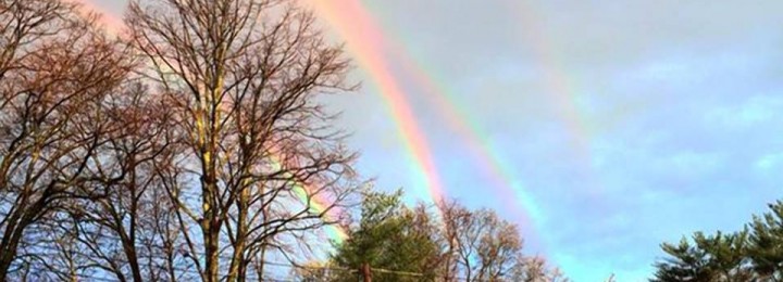
All my meteorologist friends were talking about the picture of four rainbows captured by Amanda Curtis while she was waiting for a train on Long Island earlier. Some media outlets called it a quadruple rainbow, but after looking at the optics, it was determine instead to the a double rainbow accompanied by a double reflected…
-
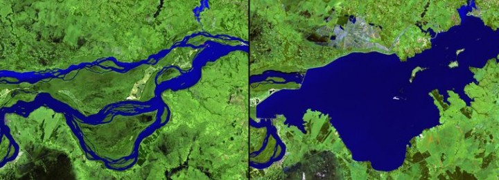
This week VOX published a series of spectacular images which show how humans are changing the planet through agriculture and urbanization as well as abandonment of areas under drought and nuclear disasters. You can view these images at https://www.vox.com/2015/4/7/8352381/anthropocene-NASA-images.
-
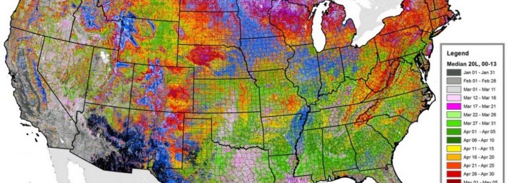
I ran across a fascinating set of maps on the average date of greenup on agricultural lands today. This set of maps is provided by ForWarn, which is the satellite-based tracking service of the US Forest Service. You can find them at https://forwarn.forestthreats.org/highlights/918#. One of the most interesting things to me is the extent to…
Posted in: Interesting weather images -
I’ve seen a couple of interesting stories on groundwater today that I thought I would pass along. One is on the continuing crisis in the groundwater levels in California due to a combination of drought and extensive pumping, mostly by agricultural producers. You can read that story from the New York Times here. The story…
-
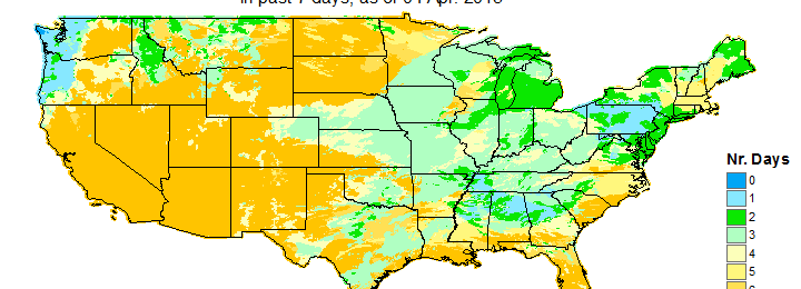
Here are a couple of sites that you might find useful in looking at current conditions across the United States. The two maps below show the departure from average greenness across the United States from the US Forest Service. You can find these maps at https://www.wfas.net/index.php/avhrr-ndvi-moisture–drought-47. They show satellite-derived vegetation status across the country. These particular…
-

Now that spring is here and warmer, more humid air is entering the US, severe weather and tornado chances are increasing across the country. There is an excellent animation that shows how the region of severe weather occurrence moves around the country at the NOAA Storm Prediction Center at https://www.spc.noaa.gov/new/SVRclimo/climo.php?parm=anySvr. The area of most likely…