Interesting weather images
-

If you have looked at the Keeling curve for carbon dioxide concentration that I have shown in past blog postings, you may be wondering why there is a yearly cycle in the concentration of carbon dioxide. The graph below shows the last two years of carbon dioxide in the atmosphere, as measured on Mauna Loa…
-

Today marks the fourth anniversary of one of the most deadly outbreaks of tornadoes ever to hit the Southeast. It was part of a superoutbreak of tornadoes and severe weather that lasted from April 25 to 28 across the Southeast in 2011. Wikipedia has an entry which describes the full extent of the event, including…
-

If you watch television weather, you may have noticed a product that shows simulated radar maps for up to 15 hours ahead of time. These are based on forecast models and can help you plan outdoor activities that are sensitive to rainfall. You can get these animated maps for yourself at WeatherBELL at https://weather.graphics/hrrr/hrrr_gif.php. The map…
-

A recent satellite-derived image from NASA published this week shows the deviation of vegetation from average “greenness”. This is a measure of how healthy and abundant the vegetation is at this point in time. You can see the big red area over the Southeast indicating that vegetation is behind normal conditions, or “less green” than…
-
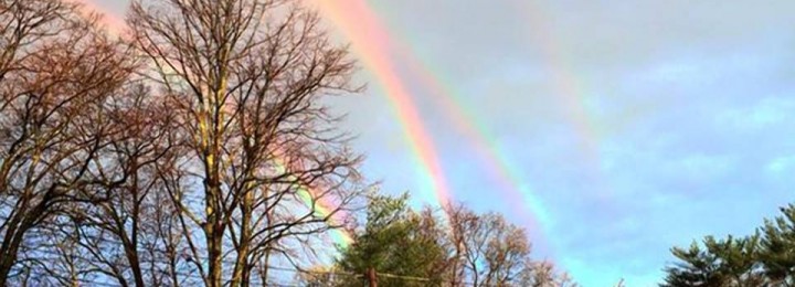
All my meteorologist friends were talking about the picture of four rainbows captured by Amanda Curtis while she was waiting for a train on Long Island earlier. Some media outlets called it a quadruple rainbow, but after looking at the optics, it was determine instead to the a double rainbow accompanied by a double reflected…
-
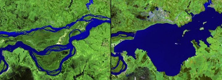
This week VOX published a series of spectacular images which show how humans are changing the planet through agriculture and urbanization as well as abandonment of areas under drought and nuclear disasters. You can view these images at https://www.vox.com/2015/4/7/8352381/anthropocene-NASA-images.
-
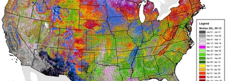
I ran across a fascinating set of maps on the average date of greenup on agricultural lands today. This set of maps is provided by ForWarn, which is the satellite-based tracking service of the US Forest Service. You can find them at https://forwarn.forestthreats.org/highlights/918#. One of the most interesting things to me is the extent to…
Posted in: Interesting weather images