-
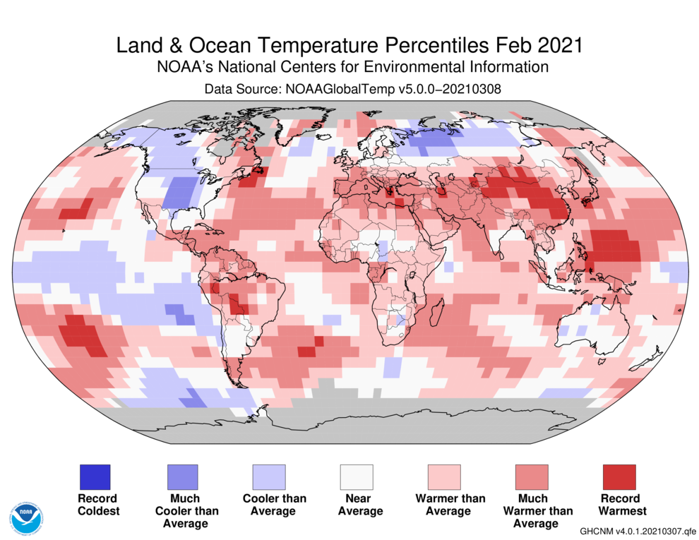
The latest monthly and winter climate summary for the globe was released by NOAA this week. It shows that it was the coldest February for the earth as a whole since 2014, with the significant cold outbreak in the central US helping to drive down the temperatures. But the globe as a whole was still…
Posted in: Climate summaries -
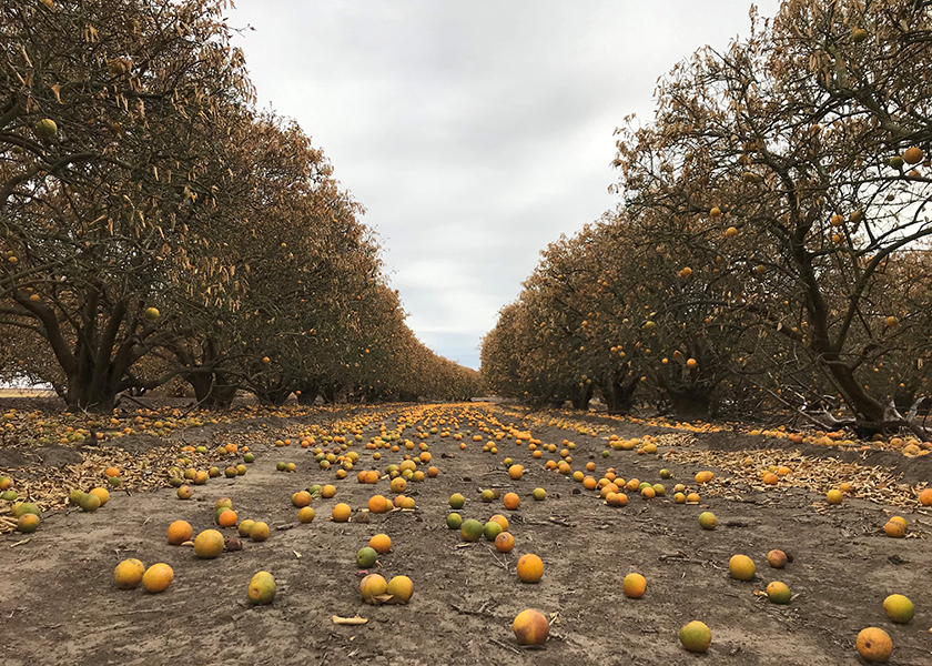
The Packer published a heartbreaking video from the Texas Farm Bureau this week which showed some of the destruction of vegetable and citrus crops in Texas due to last month’s frigid temperatures. Losses are estimated to be at least $600 million, although could be more since they don’t know yet if the citrus trees will…
-
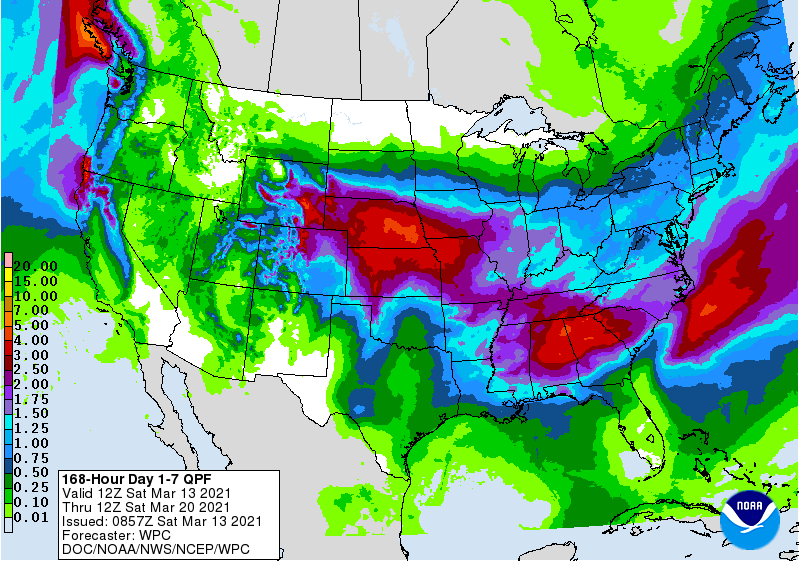
Two quick-moving storms will bring several inches of rain to northern parts of the Southeast this week, while southern areas are mostly dry. The first storm, which is bringing heavy snow to the Denver area this weekend, will push into the Southeast by Tuesday morning, bringing our first batch of rain. A trailing front across…
Posted in: Climate outlooks -
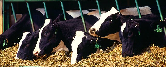
The University of Georgia CAES News Team posted a story this week on some recent research showing that cows that are kept free of heat stress produce more milk and enjoy a better quality of life. Cows can be kept more comfortable by a combination of misters and fans, which keep the heat stress low…
-
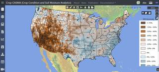
Earlier this week, the USDA released a new soil moisture tool that is powered by NASA satellite data. The Crop Condition and Soil Moisture Analytics (Crop-CASMA) app provides access to high-resolution data from NASA’s Soil Moisture Active Passive (SMAP) mission and the Moderate Resolution Imaging Spectroradiometer (MODIS) instrument. It will help researchers, meteorologists and farmers…
-
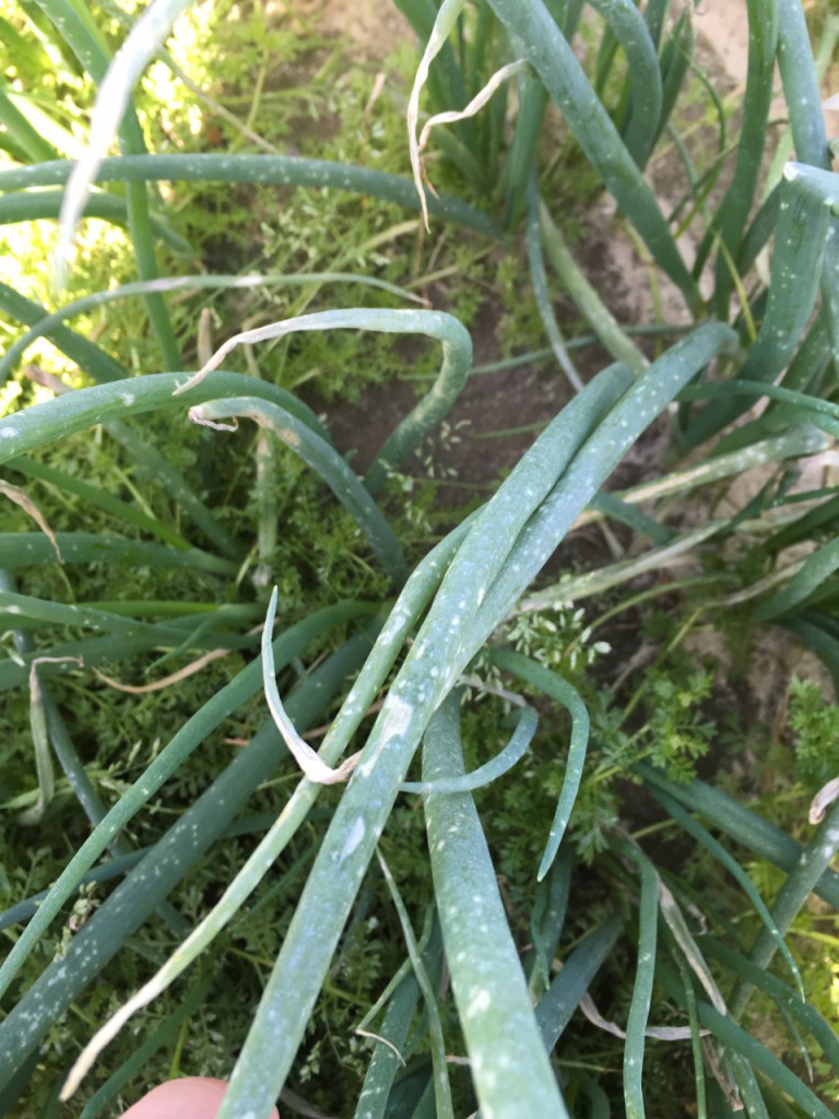
All of the rain that has fallen in southeast Georgia in the last month has caused problems for onion farmers. The wet conditions have contributed to problems with fungal diseases, especially as the weather has warmed up. In spite of the problems, overall the crop looks good, according to growers there, but they need to…
-
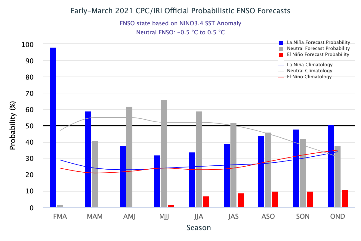
The latest ENSO outlook was released today. It shows that La Nina is still hanging on now, but that neutral conditions are expected to return later this spring and last through summer. The current forecast for next fall and winter is for La Nina to return in a “double dip”, which happens fairly frequently with…