Tools for climate and agriculture
-

Here is a nice corn growing degree day (GDD) tool for the US available from Nutrien at Nutrien GDD Tool (ag-wx.com). You can input the location, planting date, and maturity level and get a curve that shows the corn development stage. It is based on PRISM gridded weather data developed by Oregon State University. Some…
-
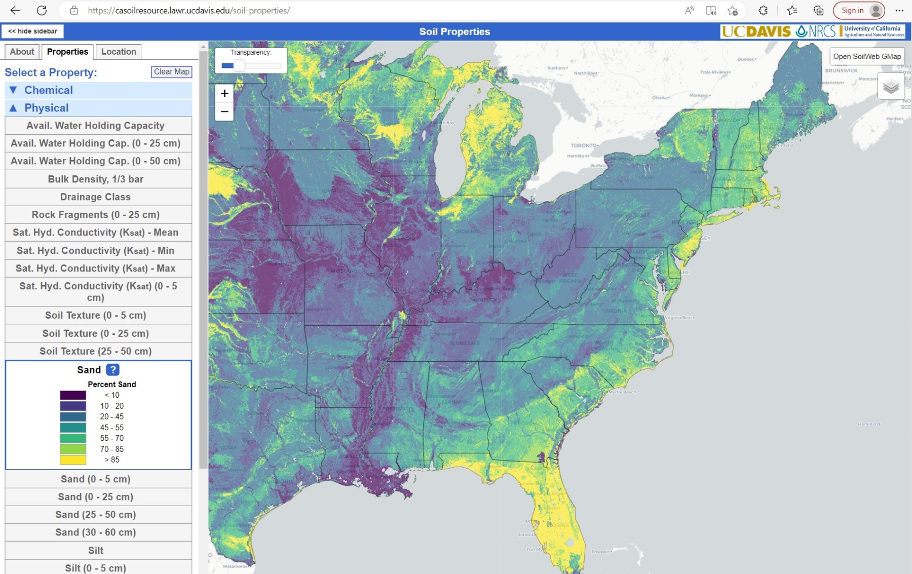
While the focus of this blog is on climate and agriculture, a good understanding of agriculture also requires knowledge of the soil that you are growing your crops in. I was intrigued to hear about this website that provides a way to do interactive mapping of a number of soil properties across the country at…
-
An ongoing study funded by the National Oceanic and Atmospheric Administration that is being conducted by the University of Alabama-Huntsville, the University of Florida and the University of Georgia is developing methods for identifying and quantifying the effect of flash drought with each university focusing on different strategies. Flash drought is often not captured by…
-
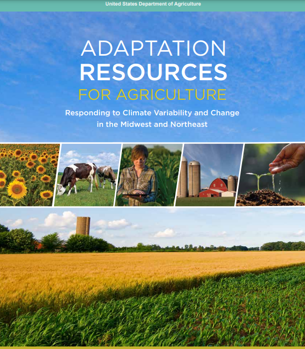
I recently ran across this USDA publication describing methods for adapting agriculture to increasing climate variability and climate change. While the publication is focused on the Midwest and Northeast, there are a lot of very good lessons for producers in the Southeast as well. I encourage you to take a look at it and see…
-
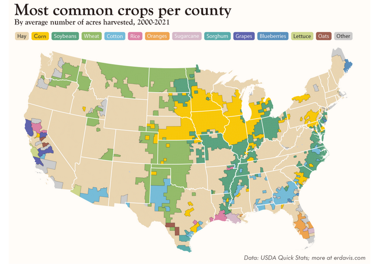
Here’s a neat data project showing the most common crop by acreage for every county in the United States. The overall winner is—hay! Of course, there is a lot of variation, with the Corn Belt having the most acres in corn (big surprise!), South Georgia in cotton, and eastern North Carolina in sorghum. There are…
-
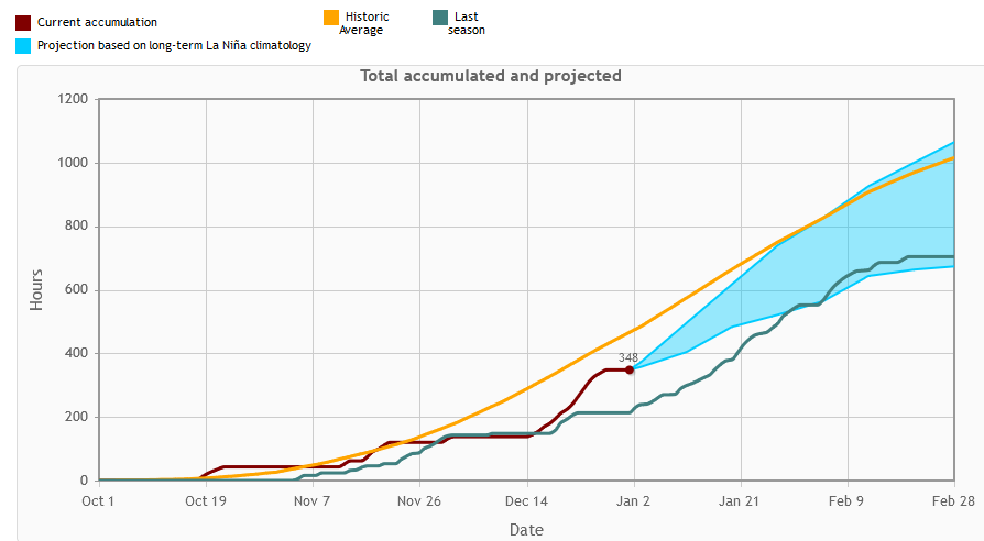
Chill hours are basically accumulations of the time that an area experiences a temperature below 45 degrees F, although there are several variations on this basic idea. Fruit trees need a certain amount of cold weather while they are dormant to set a good crop of fruit for the next growing season. This year, because…
-

As we get closer to the cold and snow that is expected in the next few days, you may be interested in viewing where the biggest impacts are occurring, especially if you are going to be traveling. NOAA has a good map depiction of where winter storm impacts are expected to occur over the next…