Tools for climate and agriculture
-

Historically, people have figured out the flood risk for their property using FEMA flood plain maps, which can be cumbersome to use. Here is a new free and simple tool which provides a quick evaluation of the flood risk on your property on a 1-10 scale, taking into account both historical floods and future climate…
-

Today’s Drought Monitor shows that all of the lingering drought has been removed from the Southeast, although there are still a few small areas where residual abnormally dry conditions still exist. But large parts of the western US are in bad drought conditions. Where can you go to get more drought information? The National Integrated…
-
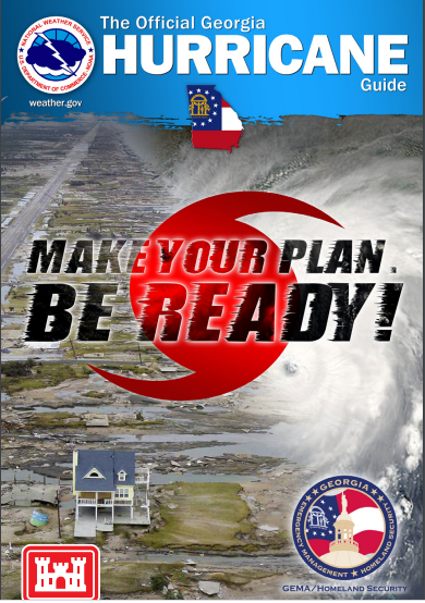
As of yesterday, we have already had ten named storms in the Atlantic, and the latest seasonal forecast says we can expect another 10-12 more named storms. Even if only a couple of them hit near Georgia, they could be devastating. So now is a great time to take advantage of the temporary lull in…
-

You probably read my weekly drought updates for the United States. But here is a drought tool that goes beyond the US to cover the whole globe. It is called Copernicus and provides a zoomable global map which highlights areas where drought is affecting agriculture. In this map the months are divided into ten-day periods…
-
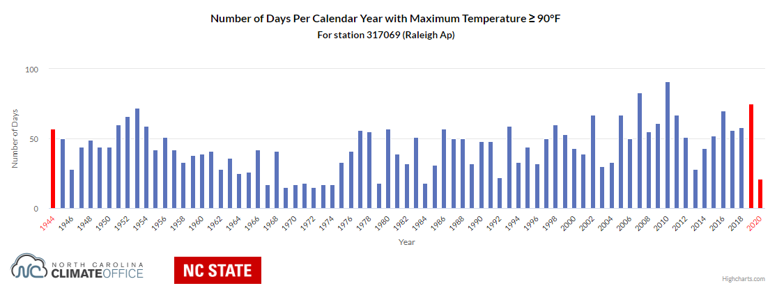
The North Carolina Climate Office posted an article today which describes a new tool that is coming out of their office. It allows viewers to find the frequency of climate events above a set threshold. For example, it can find the number of days per year that are above 90 F at a given location.…
-
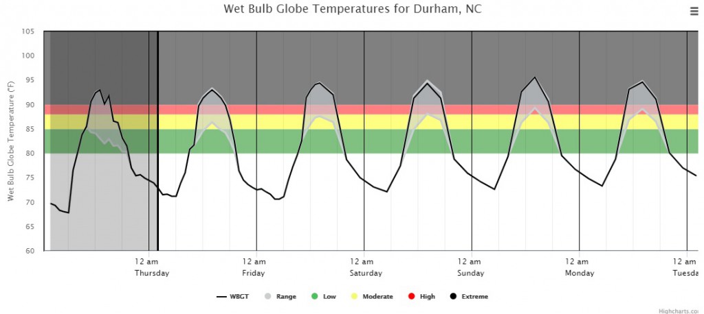
Do you know what Wet Bulb Globe Temperature is? The Wet Bulb Globe Temperature (WBGT) is a measure of the heat stress in direct sunlight, which takes into account: temperature, humidity, wind speed, sun angle and cloud cover (solar radiation). This differs from the heat index, which takes into consideration temperature and humidity and is…
-

A new set of maps produced by the research and technology nonprofit First Street Foundation shows that FEMA estimates of areas prone to flooding may be underestimating the number of properties that are at risk by as much as 6 million, which would bring the total number to 14.6 million, according to a Bloomberg article…