Pam Knox
-
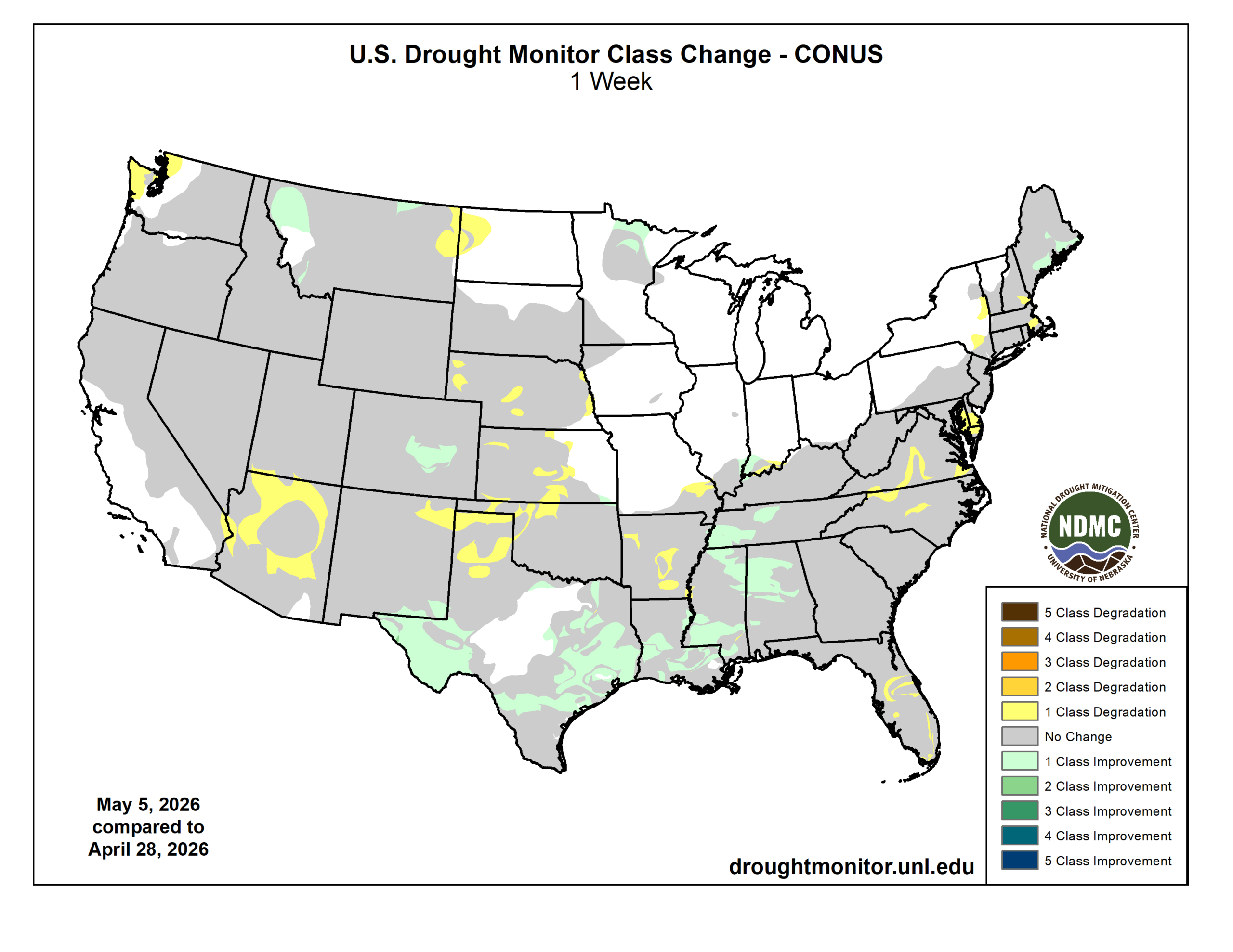
The latest Drought Monitor map, released earlier today, shows that for Georgia and South Carolina, there were no changes from last week. There was rain after the cutoff date of Tuesday morning, so it is likely there will be more changes next week when the next map comes out. Alabama saw a large area of…
Posted in: Drought -

The latest 7-day QPF map shows that most of the region should get rain again this week, but the heaviest amounts are expected to fall in northern Alabama and NW Georgia as well as Tennessee. Other areas will see less rain, especially SE Georgia and the Florida peninsula, which did not get much from the…
Posted in: Climate outlooks -

The updated monthly outlook for May 2026 was released last week by NOAA’s Climate Prediction Center. It shows that nearly all of the region does not show a tendency towards above or below normal precipitation or temperature. However, the southwest corner of Alabama does show a slight tendency towards wetter than normal conditions linked to…
Posted in: Climate outlooks -

If you have ever flown in an airplane, you may have felt some bumps along the way as the plane navigated through an area of turbulent air. While those bumps can be scary to new fliers, most seasoned fliers know that a little jumpy air is not that unusual and is usually more of an…
-
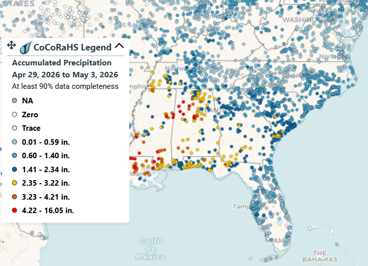
The rainfall that the Southeast got since the cutoff for the last Drought Monitor map on the morning of April 28 shows that many areas got at least half an inch and some areas got 2-3 inches in the last few day. However, this time of year normal rainfall is about an inch a week,…
-

The latest Drought Monitor, released today, shows that everywhere in the Southeast is in drought except for a tiny sliver on the east coast of Florida just north of Miami, which is only abnormally dry. Almost 60% of the region is in extreme (D3) drought due to almost no rainfall and warm temperatures. Fortunately, since…
Posted in: Drought -

Since today is the last day of the month, the summary maps are not quite complete but still show how much warmer and drier than normal most of the Southeast was this month. Note that there were parts of the region that received less than 5 percent of the normal precipitation. No wonder the drought…
Posted in: Climate summaries