-
In honor of the holiday today, I am taking the day off to spend with my family. Hope you are doing the same!
-

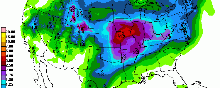
While we have been dry here in the Southeast, the region to our west has been inundated by heavy rains, leading to problems getting into the fields to plant soybeans and cotton. The rainfall map below shows the 30-day departure from normal precipitation, including the soggy mess over east Texas and parts of Louisiana. You…
-
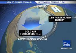
The Capital Weather Gang posted a new blog article this week describing the impacts of a warmer Arctic, as sea ice continues to disappear. One of the likely consequences of less sea ice is the development of a Greenland block, which is an atmospheric pattern that locks the circulation in place (similar to the Omega…
-
The latest 7-day QPF map shows that most of the Southeast will get less than half an inch in the next week, with what little that comes falling later in the time period. This is likely to increase the area under moderate drought. We will see when the next drought map comes out on Thursday.
-

While we’ve been relatively cool in the Southeast for the past few days as an upper level passed over us (and some snow was even seen in the mountains of Georgia and North Carolina), hot weather is dominating the central part of the United States and up into Canada. The map below shows the temperature…
-

The Climate Learning Network sent out their May newsletter this morning and announced that their new web site has now officially launched. You can visit it at https://www.climatelearning.net/ to get news about climate and agriculture around the country, announcements of new resources and webinars, and other great information. Don’t forget to sign up for their newsletter…
-
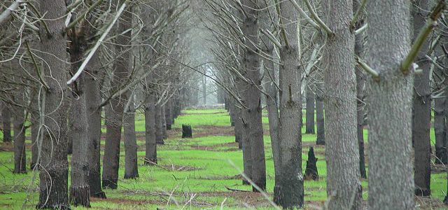
Columbia Metropolitan magazine posted a story recently on the importance of the timber industry to South Carolina. Did you know that timber is SC’s top crop? Forest product industries now have an estimated economic impact of more than $18 billion in the state, according to the South Carolina Forestry Commission, and the annual value of…