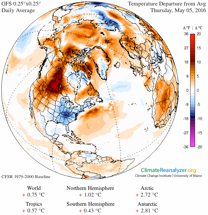
While we’ve been relatively cool in the Southeast for the past few days as an upper level passed over us (and some snow was even seen in the mountains of Georgia and North Carolina), hot weather is dominating the central part of the United States and up into Canada. The map below shows the temperature anomalies from yesterday, with a big hot spot over Alberta and the western US under a strong ridge of high pressure. Temperatures in that part of Canada were in the 90s while we were in the 60s yesterday.
There have been a lot of news stories about the fires on television, radio and online. Here is a sampling describing some of the most interesting things about the fires.
The Capital Weather Gang posted a story about the weather behind the hot spot, a pattern called an “Omega Block”. You can read about here.
The entire town of Fort McMurray, Alberta, was forced to evacuate due to the fires (Washington Post story here). A number of people that were evacuated had to be moved a second time when the winds shifted and the fire moved in a new direction. The Globe and Mail reported on why the fire reached the town and how it spread so fast here. They noted that black spruce and aspen in the forests there are especially good fuel for the fires.
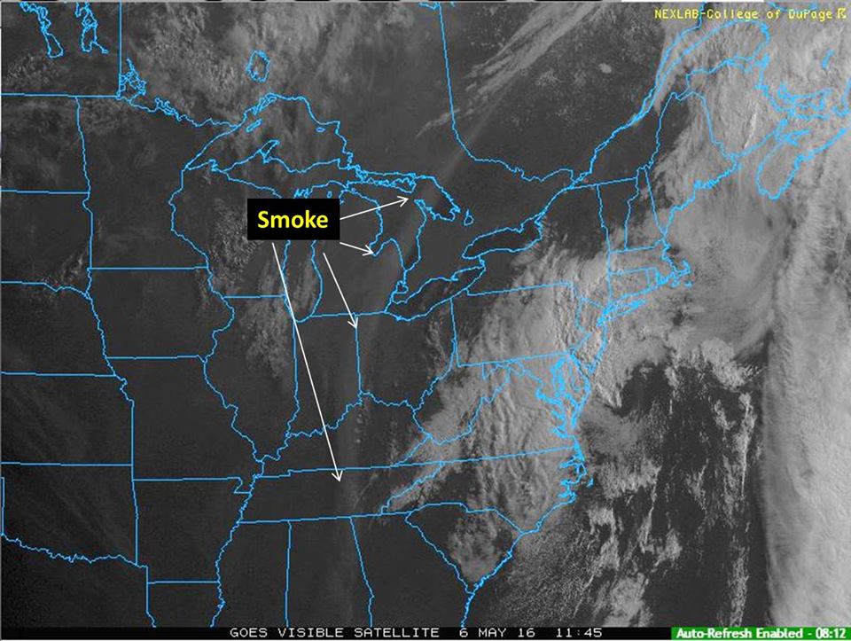
The CIMSS satellite blog provides some good pictures of the blaze from above here. More smoke pictures can be found on the American Geophysical Union blog here.
And finally, Bob Henson and Jeff Masters of Weather Underground discuss the Fort MacMurray disaster and what it means for our preparedness for future climate extremes, whether or not the climate is changing at https://www.wunderground.com/blog/JeffMasters/the-fort-mcmurray-disaster-getting-beyond-is-it-climate-change/.