-
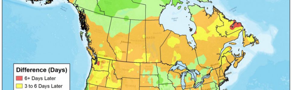
The Weather Channel posted an interesting map earlier this month showing how the date of the peak heat in the summer has changed over time. Parts of the US are peaking later in the summer, but in most of the Southeast, the average date of the highest temperature is actually coming several days earlier now…
-

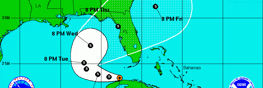
The 11 pm outlook for Tropical Depression 9 shows a consistent pattern with earlier forecasts. The low is expected to become a Tropical Storm sometime tomorrow and should eventually move northeast over the northern Florida panhandle. The forecast cone has narrowed considerably with a better developed center and more consistency between computer models. The storm is…
Posted in: Tropical weather -
Eleven years ago, Hurricane Katrina made landfall on the Gulf Coast. One of the hardest hit areas was the Mississippi Coast, where Stennis Air Force Base is located. Many NOAA personnel were located there and suffered severe personal losses from the direct hit. Last year they put together a story site which contains information about…
-

AgWeb reported this week that losses to Louisiana agriculture from the recent floods will be at least $110 million. Damage to soybeans was estimated at $46 million, $44 million for rice and $3 million for sugarcane. You can read more about it and watch the AgDay video report here. Modern Farmer also ran a story…
-
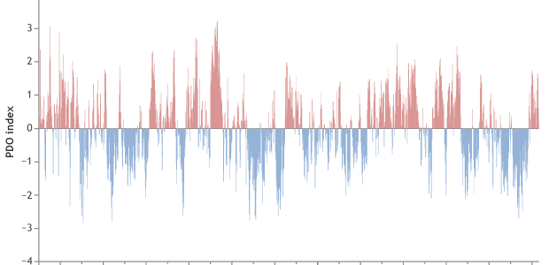
In this blog I talk a lot about El Niño, La Niña and ENSO and their impacts on the climate of the Southeast, which are statistically quite significant, at least in winter. But there are other atmospheric oscillations that can also affect climate over time. One of these other oscillations is the Pacific Decadal Oscillation.…
Posted in: Climate science -
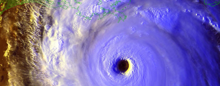
What a day this has been in the tropics! In this morning’s post, hurricane watchers were worried that Investigation 99L might dissipate before becoming a tropical storm. But as of tonight, Invest 99L has become Tropical Depression #9 and the National Hurricane Center is now producing forecast information for its likely path later this week.…
-
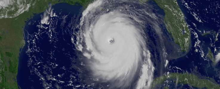
Harrison Sincavage posted an article at iWeatherNet today about the shocking (to me and other meteorologist friends) statement that the National Hurricane Center put out about the expected impacts of Hurricane Katrina, which was approaching maximum storm intensity in the Gulf of Mexico on this date eleven years ago today. If you’ve never read the warning,…