-
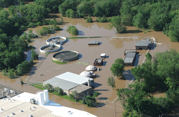
As the climate gets warmer, floods become more frequent (and droughts too), and sea level also floods more land near the coast. Architect magazine posted an interesting story recently about how professional architects and city planners are looking at trends in flooding to plan future developments and plan for replacing current infrastructure like culverts. You…
Posted in: Climate and Ag in the news -

Even though news stories across the media are talking about the end of the decade and the start of a new decade, whether or not it is really the end of the decade is a matter of some debate. For climatologists, the next normal period of 1991-2020 is still a year from ending. Normal temperature…
Posted in: Climate and Ag in the news -
Occasionally I get asked about where to find calculators to determine climate footprints by teachers or farmers. Here are a few sites that can help provide estimates of your climate footprint. Note that these would not be sufficient for a producer who is trying to show a detailed evaluation, but they can serve as a…
Posted in: Tools for climate and agriculture -

If you love looking at images of weather from space, you will enjoy looking at this collection of fascinating images from Stu Ostro at The Weather Channel. He has captured many images of hurricanes, lightning, clouds, and fires in his yearly summary. Note that these are mostly satellite images, not surface images of clouds. You…
-
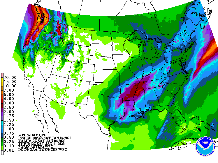
The latest 7-day QPF map shows that most of the Southeast should see relatively little rain in the next week. The exception is a swath stretching from SW Alabama to the northeast all the way to western NC and VA, which should see more rain, especially late in the week. Warmer and wetter than normal…
Posted in: Climate outlooks -
A journal article released today in Science Advances shows that when springlike temperatures occur earlier in the year, plants green up earlier and draw more moisture out of the soil, changing the water balance by increasing evapotranspiration and drying out the soil earlier in the growing season. It could also amplify summer droughts by reducing…
-
The Southeast Farm Press posted a reminder this week that the annual Georgia Ag Forecast series will be held at five different locations around Georgia near the end of January. This event provides information about last year’s harvests of Georgia crops and an outlook for prices and other information for the coming year. You can…