-
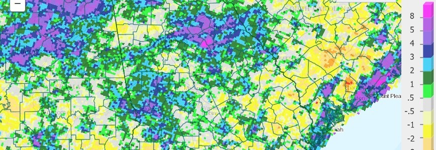
Precipitation across Georgia in August 2015 varied from over ten inches near the coast and in north central Georgia to less than 2 inc hes in the southwest corner of the state. A few isolated areas received over 15 inches during the month, according to CoCoRaHS observers. Temperatures were very close to normal across the state. The…
-
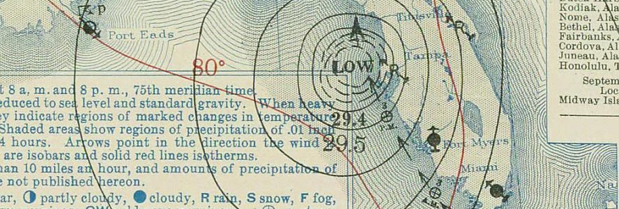
Today marks the 80th anniversary of the Labor Day Hurricane of 1935, which was the most intense category 5 storm to ever hit the US coast. It hit in the Florida Keys and killed over 500 people with winds that reached up to 185 mph. It made a second landfall later near Cedar Key as…
-
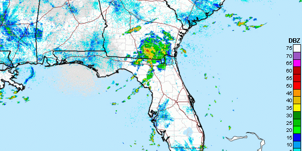
What is left of Tropical Storm Erika is now drifting northeast into the south-central and southeastern areas of Georgia. The radar this morning shows some locally heavy rain in the center of the weak circulation northeast of Valdosta. There is also a secondary band of almost stationary rain northwest of the main blog of rain…
-
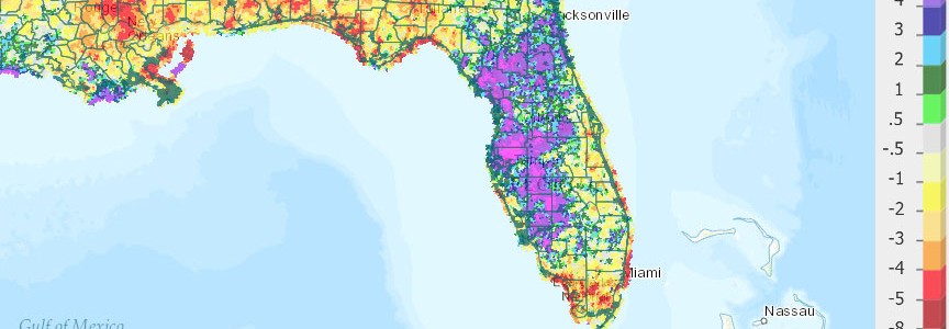
The latest Florida climate summary for August 2015 is now available. You can find it at https://climatecenter.fsu.edu/products-services/summaries/climate-summary-for-florida-august-2015.
Posted in: Climate summaries -
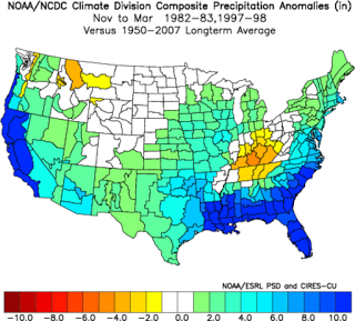
Here is a recent article I wrote for Georgia Organics. You can also read it at https://georgiaorganics.org/2015/08/what-does-the-godzilla-el-nino-mean-for-georgia-farmers/. There’s been a lot of hype in the popular news this month about the prospects for a very strong El Nino, which is developing in the eastern Pacific Ocean and is expected to peak this winter. El Nino…
-

After all the dire predictions of rain for the Southeast, today is relatively sunny and dry. What happened to the predictions of heavy rain from the remains of TS Erika? The radar shows the blob of rain that was formerly Erika spinning just off the west coast of Florida. So far very little of that…
-

The monthly climate summary for August 2015 for North Carolina is now available. You can find it at https://climate.ncsu.edu/climateblog?id=152&h=5666e5c1.
Posted in: Climate summaries