Tropical weather
-

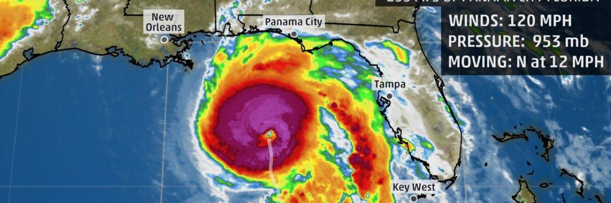
As expected, Tropical Storm Zeta was named today and is expected to make landfall as a hurricane on Wednesday along the Louisiana coast. So far this time it looks like eastern LA is more likely to be hit, but there is still some time for things to change. The storm is then expected to pass…
-

The latest 7-day QPF map shows that this coming week will be quite a bit rainier than the last couple due to the passage of what is likely to be Tropical Storm Zeta (now tropical depression 28) mid-week. The heaviest rain from Zeta should fall in parts of Alabama and Georgia Tuesday night through Thursday…
-

When you see a headline like this, you just have to stop, don’t you? This is from Morning Ag Clips, which discusses the potential for harm to the poultry industry as hurricanes become stronger, wetter, and potentially more frequent (although the research on this is not clear). While most poultry houses are not built near…
-
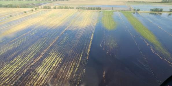
According to a story posted in Southeast Farm Press, Alabama’s late-planted cotton has done better than earlier-planted varieties this year. The earlier crops were hit hard by the wet and windy conditions from tropical storms this year and lost quality and yield because of the adverse conditions. The later crop has benefited from the more…
-
Do you wonder why Hurricane Michael intensified so much just before it made landfall in 2018? A new study by NASA scientists looks at this question. The new study, published in Nature Communications, identifies pre-storm conditions that can contribute to this rapid intensification – an important step in improving the ability to forecast it. The study…
-

The latest named storm formed today in the subtropical Atlantic Ocean. It is named Epsilon, only the second time this name has been used. It is about a month earlier than the previous Epsilon formed in 2005. Remember that the Atlantic tropical season officially goes until November 30. Epsilon is predicted to become a hurricane…
-
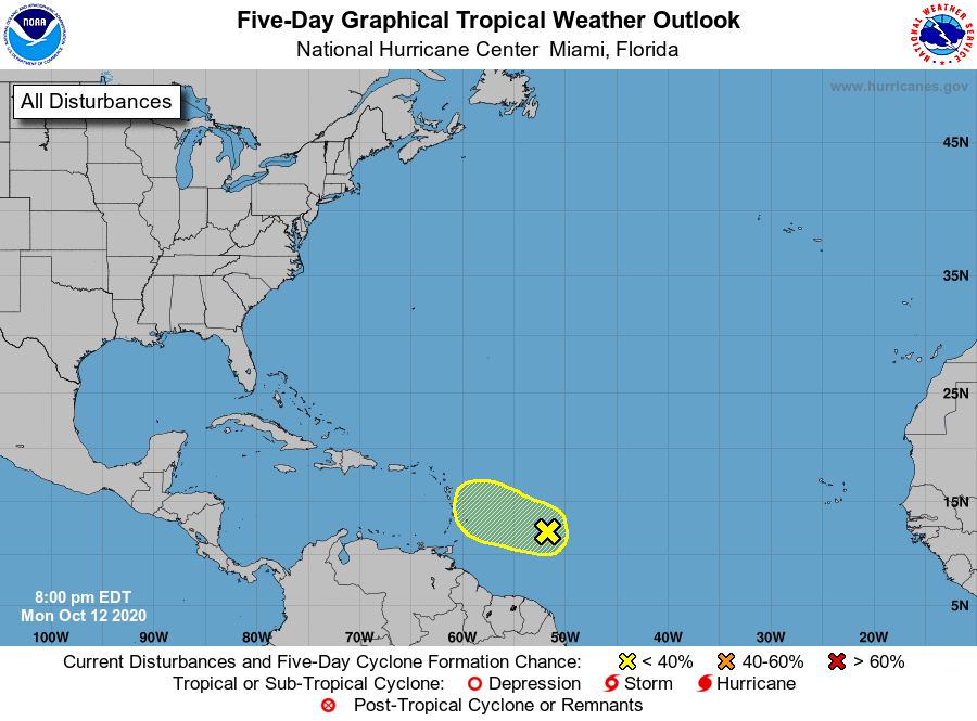
The latest 5-day tropical outlook for the Atlantic shows just one area of investigation. This wave has only a 30 percent chance of developing into a tropical storm in the next five days, and once it gets farther west will run into stronger wind shear, which will make any development more difficult. We are still…