Tools for climate and agriculture
-

The National Weather Service has recently updated their website for the national precipitation maps, which is based on radar-estimated rainfall. You can find it at https://water.noaa.gov/. It allows the display of stream gauge observations as well as forecasts and also allows you to display daily, monthly, and yearly precipitation amounts. You can turn on county…
-
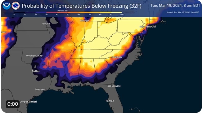
We’ve been watching the long-range forecasts for colder weather for a while now, and it looks like there is a good chance of frost and freezing weather for the next three days, with the coldest weather occurring on the morning of Tuesday, March 19. Freezing weather occurs when the temperature drops below 32 F and…
-
I received this message on the SmartIrrigation apps from Dr. George Vellidis of UGA at Tifton. If you are in Georgia and use the SmartIrrigation apps in your production, you will want to get the updated apps as discussed below. Note that only the Corn, Cotton, and Soybean apps are affected by this update at…
Posted in: Tools for climate and agriculture -
Do you ever wonder how fast the wind is blowing when you are outside? If you don’t have an anemometer to measure the wind speed directly, you may be able to use visual cues to estimate how fast the air is moving by watching the movement of trees or the appearance of waves on a…
-
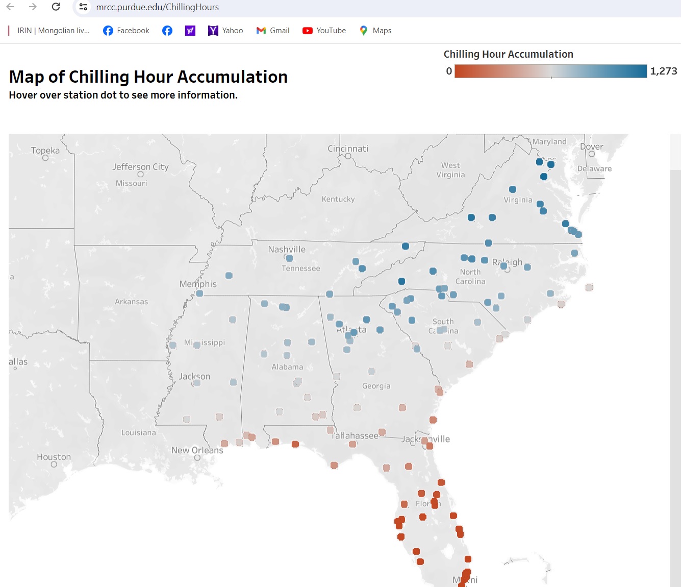
If you are a fruit farmer or someone else who needs to access chill (or chilling) hours for your crops, here is a new resource that may be of use to you. The Midwestern Regional Climate Center has produced some national maps that allow you to get calculated chilling hours for airport stations across the…
-
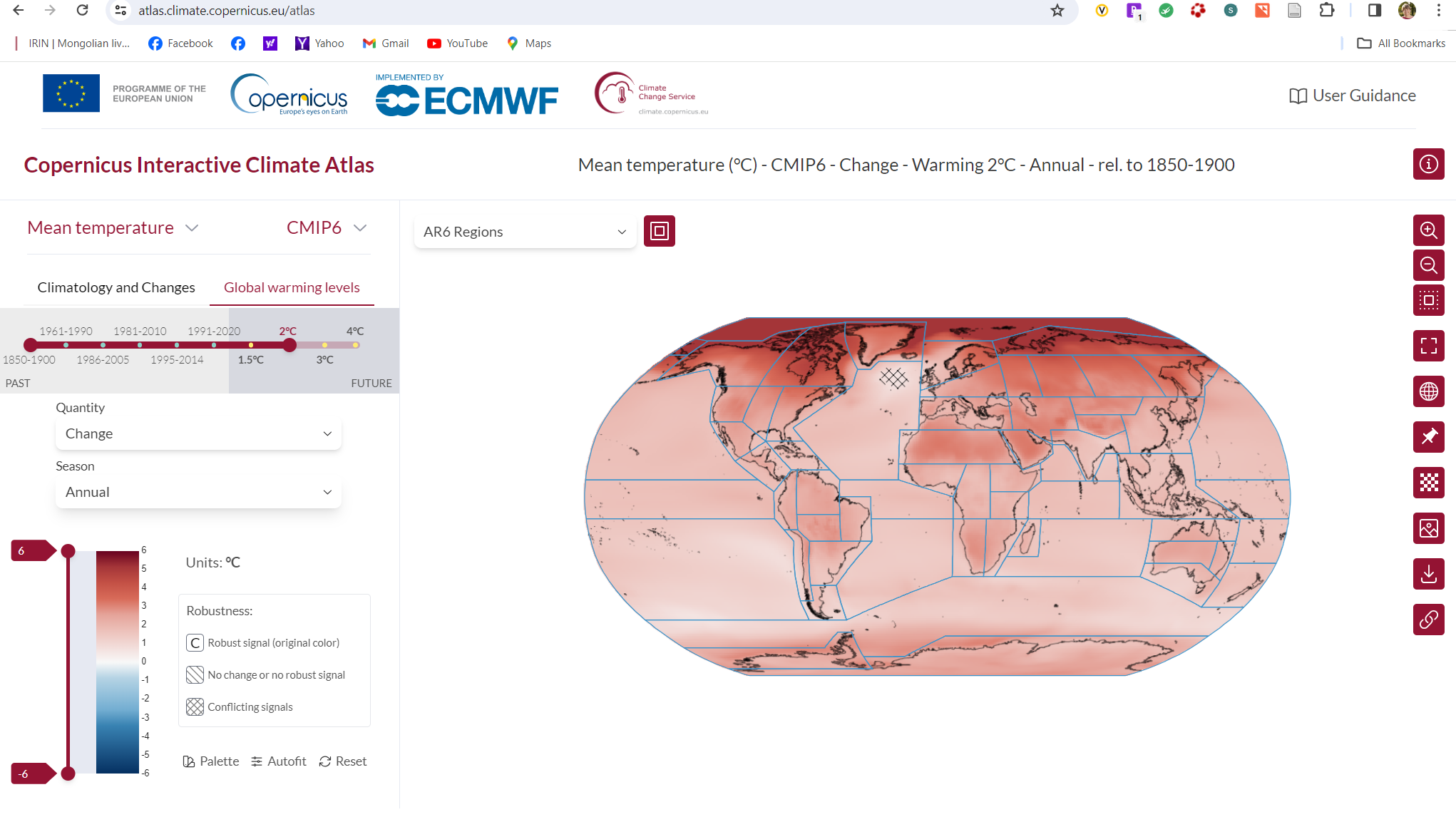
The Copernicus Interactive Climate Atlas, launched by the Copernicus Climate Change Service (C3S*) on 20 February, is set to be an important new resource for policymakers looking to formulate effective climate policy and for other users needing to visualise and analyse climate change information. This new tool from C3S, which builds on the Interactive Atlas of the…
-
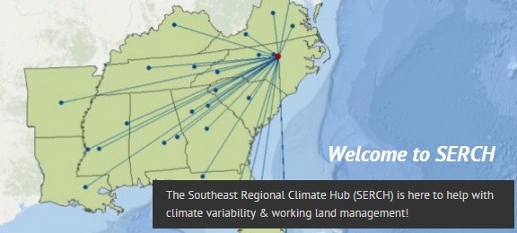
The USDA issued a press release today celebrating the 10-year anniversary of the founding of the USDA Climate Hubs. I have worked with our Southeast Regional Climate Hub in Raleigh for most of that time, and they are a great resource for us in the Southeast. You can read some of my previous blog posts…