We’ve been watching the long-range forecasts for colder weather for a while now, and it looks like there is a good chance of frost and freezing weather for the next three days, with the coldest weather occurring on the morning of Tuesday, March 19. Freezing weather occurs when the temperature drops below 32 F and ice begins to form inside cells, causing permanent damage, but frost can occur in higher temperatures as high as 36 F as the surfaces of plants, cars, etc. become sources of ice crystal formation that can cause damage to those surfaces. On the 19th, we expect many areas to experience some period of temperatures at or below 32 F, depending on your location, and so damage to sensitive plants like peaches, blueberries, strawberries, and vegetables is likely, especially if the sub-freezing temperatures last for a few hours.
Note that these forecasts are likely to change somewhat in the next day so keep checking for updated information. Also note that the forecasts could be too warm if the wind dies down more than expected, which would cause more radiative cooling. And of course local conditions may vary with topography. The good news is that once this cold spell is over, there is currently no sign of another cold outbreak before the end of March for anywhere but Virginia and the Southern Appalachian highlands, although we have had frost in April before so we are not completely out of the frost season yet.
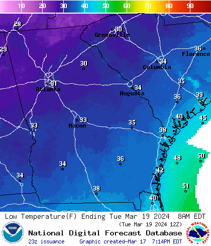
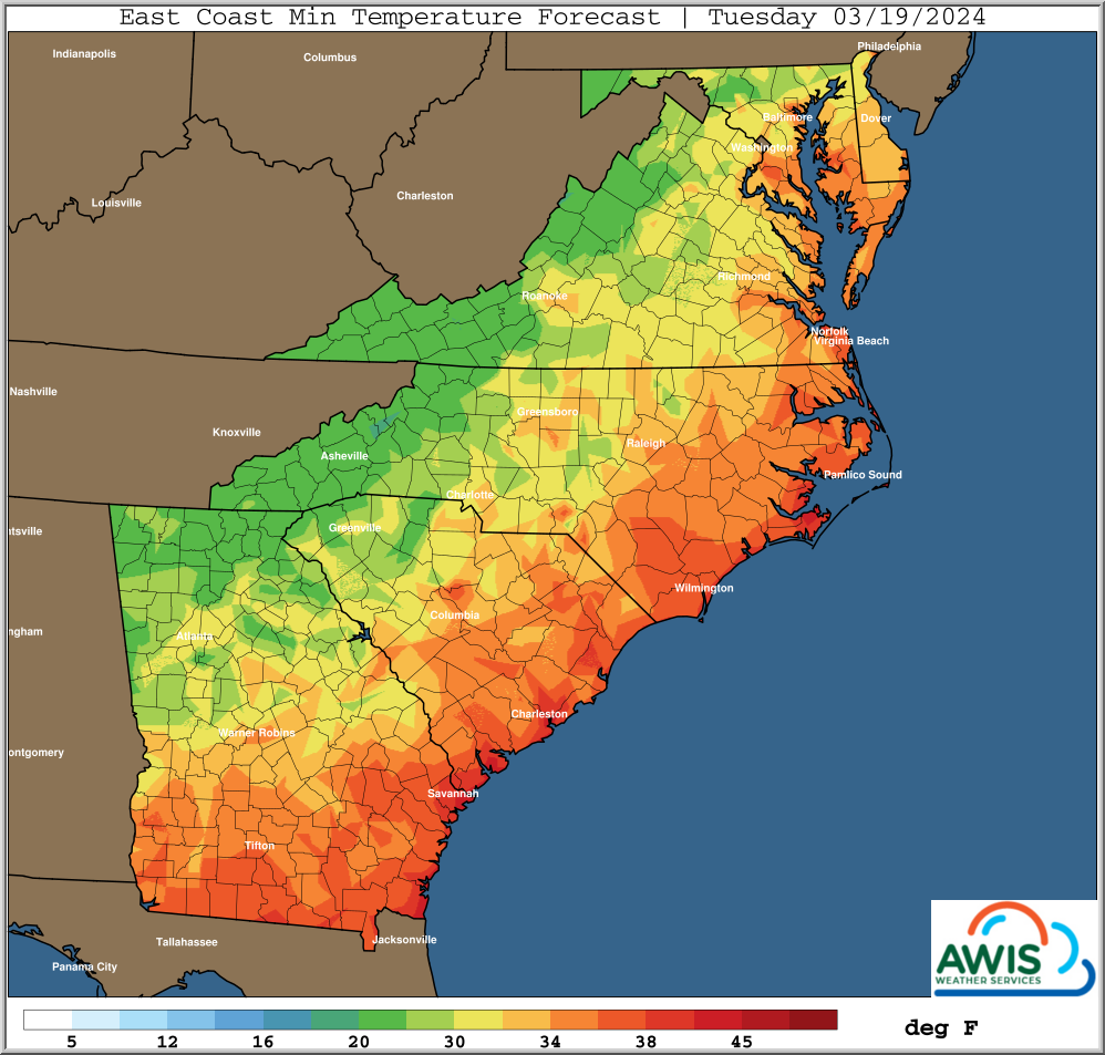
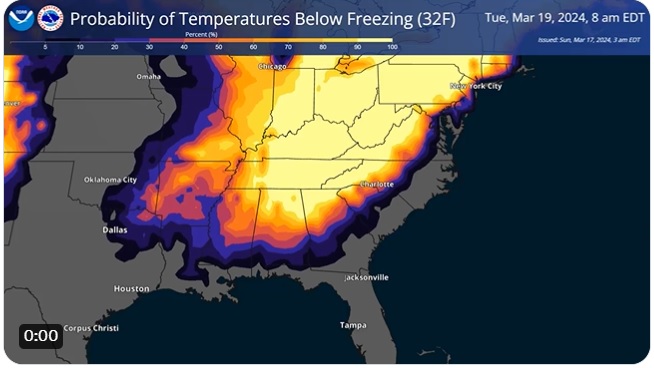
Below I have posted some forecast maps for Tuesday morning that show the extent of cold temperatures. The first map shows the graphical NWS forecast for Georgia (you can get other regions by going to https://graphical.weather.gov/ and clicking on your area). It shows that freezing temperatures are expected across all of northern Georgia and parts of southwestern GA. The second map shows a slightly different version published in the Strawberry blog and produced by AWIS. It shows more detail due to their own modeling but does not show the cold temperatures in SW Georgia west of Albany. (It has an odd temperature color scale with variable intervals between shading, I am not sure why.) The third map shows the probability of temperatures below 32 F, which provides an estimate of how likely freezing weather is. Note that there is essentially no chance of freezing conditions on the coastal plain along the East Coast and south into Florida.
If you are in an area where frost or freezing conditions are likely, you are no doubt trying to determine whether you should use frost protection on your crops if they are at a vulnerable state. You can find a publication on commercial freeze protection for fruits and vegetables at https://site.extension.uga.edu/colquittag/files/2021/03/frost-and-freeze-protection.pdf. You can find information on where to get frost and freeze forecasts at https://site.extension.uga.edu/climate/2017/10/where-to-get-frost-and-freeze-forecasts/. You can find information on where to get hourly forecasts to determine the length of time below 32 F at https://site.extension.uga.edu/climate/2018/03/where-to-get-hourly-weather-forecast-information/.