Tools for climate and agriculture
-
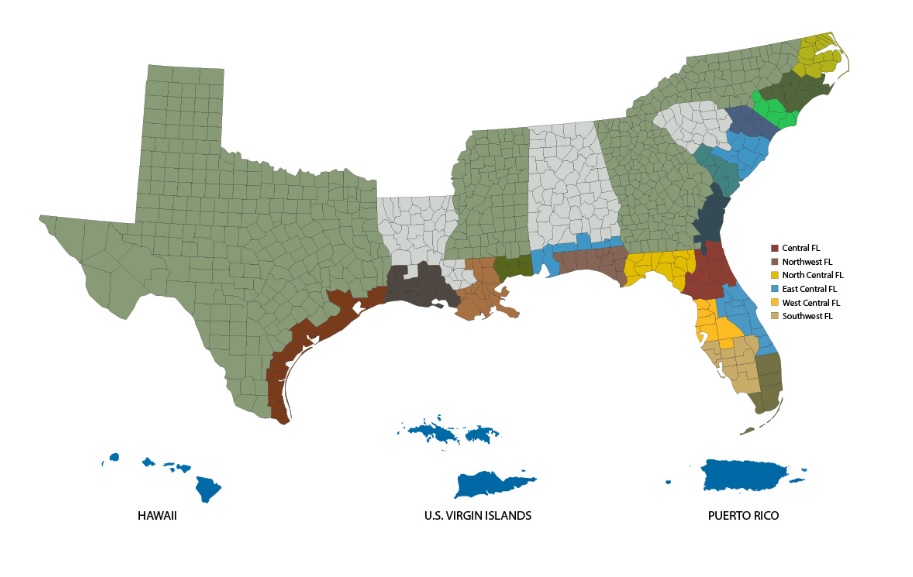
If you are in a coastal county and are likely to be threatened by extreme weather related to coastal storms, you might find these information sheets to be useful. They contain phone numbers, links, and other information for use in emergency situations, particularly tropical storms and hurricanes. You can find the map of available counties…
-
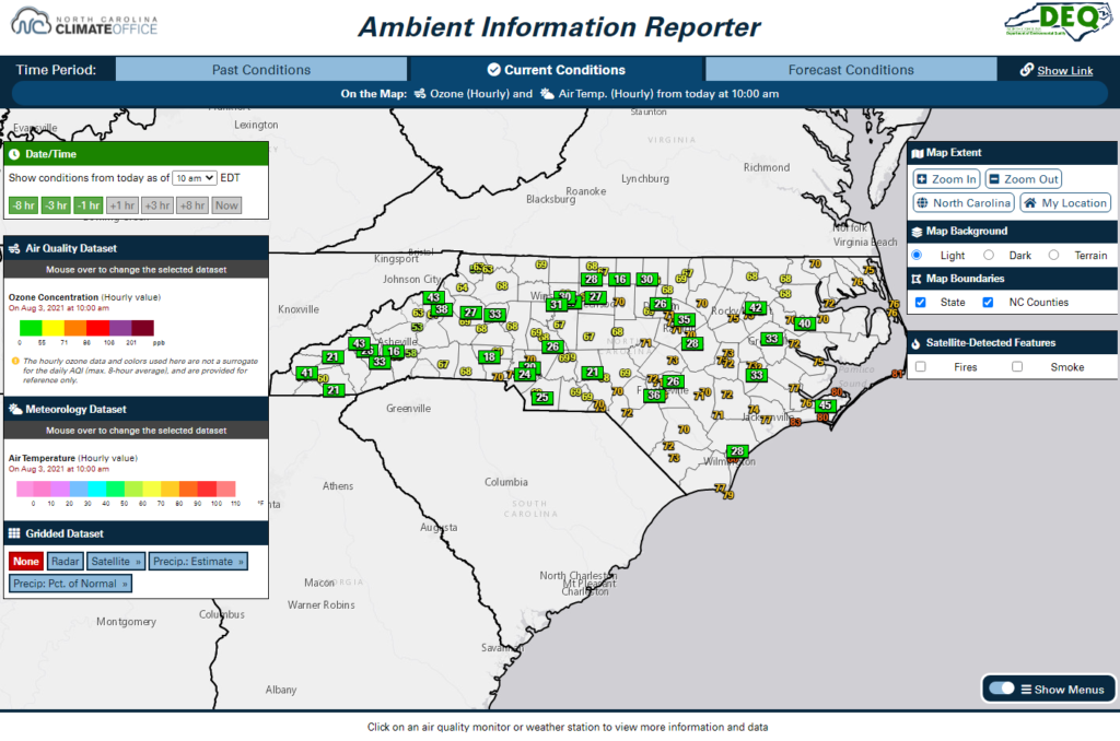
If you are interested in air quality information and weather data in North Carolina, this new website might be of use to you. The Ambient Information Reporter, or AIR, tool combines a wealth of statewide weather observations from the North Carolina ECONet and National Weather Service with air quality monitors and forecasts from the NCDAQ,…
-
Here is a useful article for those of you who are home gardeners and are starting to think about planting fall crops. It’s from The Garden Professors blog, the other blog I contribute to. This one is written by John Porter of University of Nebraska Extension. He includes a map that shows fall frost dates…
-
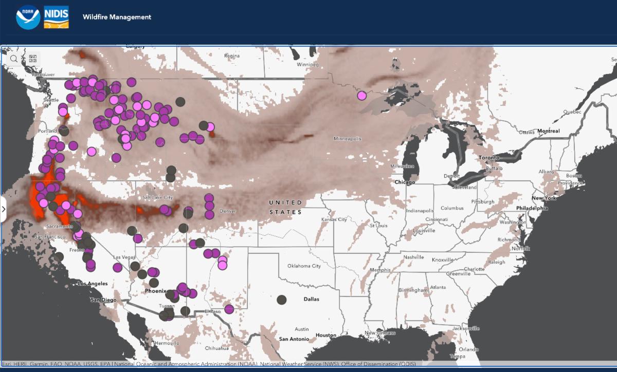
NIDIS is pleased to announce two new interactive features on Drought.gov that will make it easier for decision makers and the public across the U.S. to share timely, reliable drought information. First, new customization and sharing options for all maps make it easier than ever to create custom, high-quality maps to include in drought or risk mitigation…
-

The new Intergovernmental Panel on Climate Change issued their newest report today, and the news was filled with the disturbing results of the new study today. I am not going to address that today because you can read that from other news sources but did want to mention something associated with it that was overshadowed…
-

This week NOAA announced that there is a new section of the US Climate Resiliency Toolkit that is devoted to the Southeast. The section features narratives, tools, and case studies on the impacts of climate change across the Southeast, and information on how people can build resilience to them. You can check out the new…
-

Here’s a great new tool for mapping the new normals to any area across the US. The Northeast Regional Climate Center has produced this new tool at NCEI Gridded Normals Mapper (rcc-acis.org). It allows you to look at monthly or annual normals for states, counties, and other regional designations. After you look at that part…