Climate outlooks
-
The latest monthly and 3-month outlook maps were released this week by NOAA. They show that while the central part of the US is more likely to experience colder than normal air, here in the Southeast we are continuing to lean towards warmer conditions than usual. Wetter conditions than usual are also expected for the…
Posted in: Climate outlooks -
The latest monthly Water Resources Outlook from the NWS Southeast River Forecast Center is now available on YouTube for April 2020. You can view it here.
Posted in: Climate outlooks -
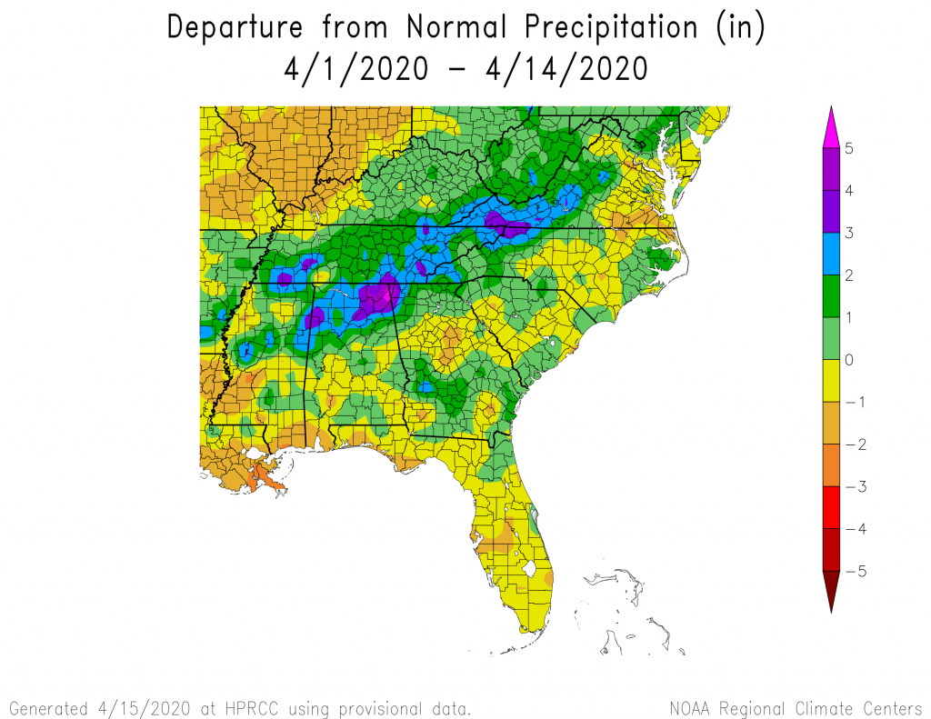
We are half-way through April 2020, so here is a quick look at our current climate conditions. The map of temperature departures shows a continuation of above normal temperatures for April so far, although the temperatures have been somewhat closer to normal than in previous months. This pattern looks likely to continue through the end…
-
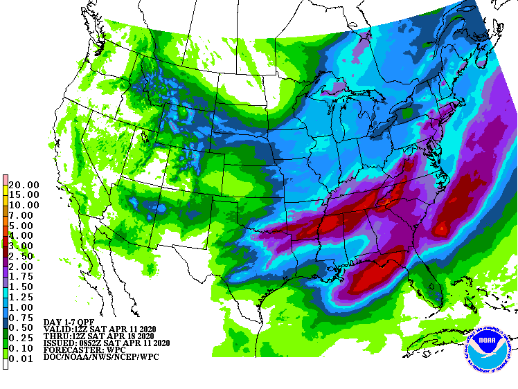
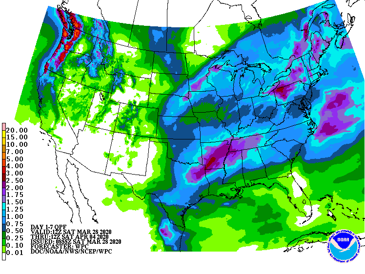
The latest 7-day QPF map shows two areas of heavy rain this week. The northern streak is linked to the major storm that will pass through our area on Sunday, bringing not only rain but a significant chance of severe weather, including high winds, hail and long-track tornadoes. (I will post separately on this later…
-
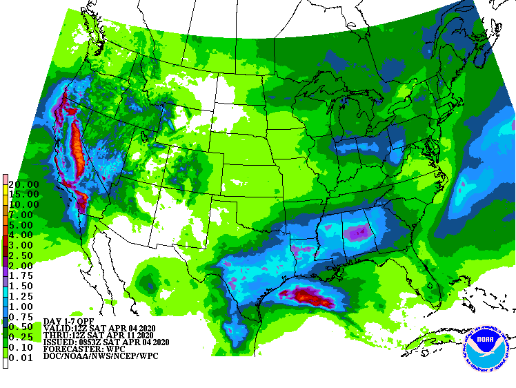
The latest 7-day QPF map shows that the largest rain amounts this week are expected to fall in central Alabama and Georgia, with southern areas, the Carolinas, and the Florida peninsula expecting much less than normal. This could lead to an increase or expansion in drought in the areas that are already experiencing dry conditions…
Posted in: Climate outlooks -

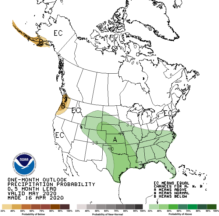
The latest monthly outlook from NOAA’s Climate Prediction Center shows that warmer and wetter than normal conditions are expected to continue through most of the Southeast for the next month. The only place without a tilt towards wet conditions is the Florida peninsula, where dry conditions have persisted over the last few weeks. In a…
Posted in: Climate outlooks -
The latest 7-day QPF map shows that northern stretches of the region should see seasonal rain this week, but southern parts will see little to no rain again, which is likely to make dry conditions worse. The rain will mostly fall in the middle of the week, Tuesday through Thursday, with a dry weekend for…
Posted in: Climate outlooks