October 2018
-

Yale Environment 360 has an interesting story which shows how different climate zones around the world are shifting in response to warming temperatures. The article shows 7 pairs of maps describing changes in climatic variables like plant hardiness zones and the “tornado alley” over time. I think you will be interested to see how some…
-
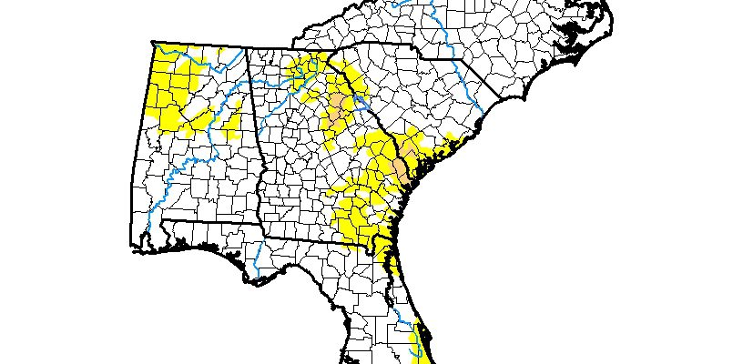
The latest Drought Monitor, released earlier this week, shows that there has been a significant expansion of abnormally dry conditions in eastern parts of Georgia, with a smaller expansion in Alabama. The amount of moderate drought in the region remains steady at just about 1 percent of the total area. The heaviest rain in the…
-

As you know if you’ve been following this blog, an El Niño appears to be forming in the Eastern Pacific Ocean and is expected to develop over the next couple of months and last through the winter (gory details of the technical discussion can be found at https://www.cpc.noaa.gov/products/analysis_monitoring/lanina/enso_evolution-status-fcsts-web.pdf). A number of forecasters are expecting that unlike…
-

The Southeast Farm Press posted a story this week about the winner of this year’s wheat yield contest, from Cherokee County, AL. Farmer Nick McMichen mentioned that the weather in spring was very favorable for wheat development and also was excellent for minimizing diseases. But he said what really made the difference was careful attention to…
-
In case you were not able to attend the meeting for agricultural producers held in Tifton earlier this week, a video of the meeting and slides along with some links to disaster resources are now available on the UGA FARE blog. This contains information about UGA emergency resources, NRCS disaster resources, info for organic farmers,…
-

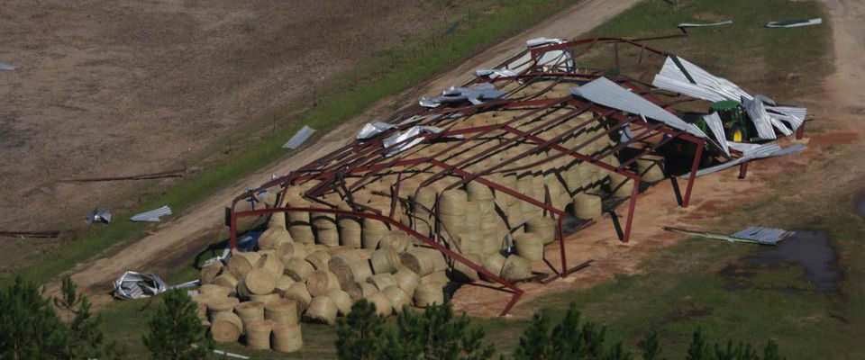
While the amount of damage to Alabama agriculture from Hurricane Michael is considerably less than damage to Georgia agriculture, it is still a staggering blow to producers in the southeast corner of that state. Damage was spread across all sectors of the farm economy, with losses to crops leading the way at $120 million. You…
-

The High Plains Regional Climate Center provides ACIS maps of climate information for the US. I use these maps when I make my own climate summaries. But until now, these have only been produced as static maps. Now, HPRCC has announced that their maps are also being made available as shapefiles which you can use…