-

The New Republic has a long article discussing the problems that Miami FL is already undergoing due to rising sea levels. The sea levels are rising from a combination of long-term trends, increased ocean temperatures, and melting ice caps. They are projected to rise in the future, although the rates at which the rise will…
-
The latest 5-day QPF map shows that the next five days should be quite dry across most of the Southeast, bringing cheer to water-logged farmers in many parts of the region except southeast Georgia and Florida, where rainfall has been scarce. Early next week, after that respite, the rain is expected to make a comeback…
Posted in: Climate outlooks -

Today marks the 40th anniversary of the wreck of the Edmund Fitzgerald, an ore-carrying cargo ship that went down in eastern Lake Superior on November 10, 1975 in a very strong mid-latitude cyclone with extremely high waves. Twenty-nine sailors went down with the ship that night. The cause of the wreck is still not completely…
-
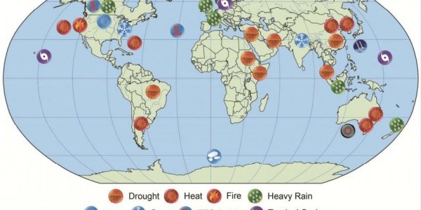
Last week NOAA released their annual evaluation of 28 separate weather disasters that occurred in 2014 along with a discussion of which if them were affected by trends linked to changing climate and other human factors like changes in land use. This evaluation is published by the American Meteorological Society and is based on evaluations…
-

The Guardian posted a story today on the impacts of severe drought followed by flooding rain on supplies of cabbage in North Korea. The cabbage is fermented to make kimchi, a staple dish that gets many families through the winter. Prices of cabbage and other ingredients have gone up by 50 percent if they are…
-

Rome Ethredge posted an update on the impacts of the rainy conditions on peanut and cotton harvest on the Seminole Crop E News blog. I’ve posted it here because it shows how tough the recent rains have been on Georgia farmers. You can also look at it at https://seminolecropnews.wordpress.com/2015/11/09/rainy-weather/. Recent rains have brought cotton and peanut…
-
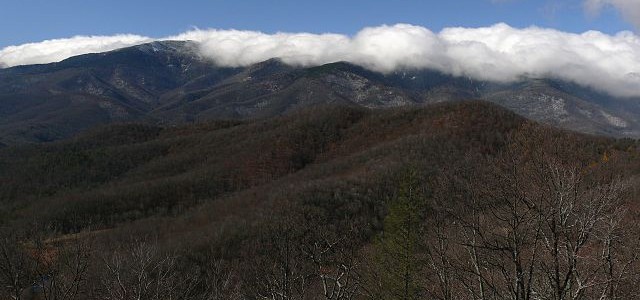
Have you ever wondered how the local topography affects your local climate conditions? Jake Crouch of NOAA’s Climate.gov has a nice blog post which describes how mountains and valleys affect climate. Even though the mountains in the Southeast are not as tall as those in the West, they do provide quite a bit of climate…