-
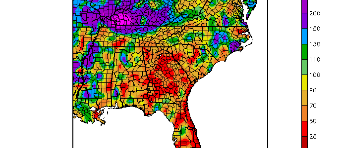
Virtually all of the Southeast was warmer and drier than normal in July 2016, according to maps from the High Plains Regional Climate Center. The precipitation deficit is even more striking when you look at the percentage of normal and see that large chunks of the region got less than 50% of their normal rainfall.…
Posted in: Climate summaries -

Today marks the 40th anniversary of the devastating flash flood that hit the Big Thompson canyon in Colorado, killing 144 people and causing tremendous damage to the area on that Saturday evening in 1976. The flood was not well predicted due to the high elevation, which reduced radar visibility of the storm that funneled all…
-
One of the comments I often hear when giving talks about changes in climate is that a change in annual average temperature is not very useful for most farmers, since temperature varies on a wide variety of scales and they can adapt to a fairly wide range of climate conditions. A recent article published in…
-
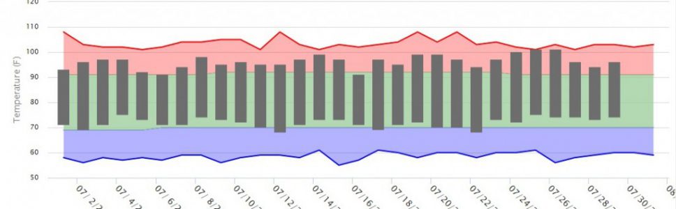
Growing Georgia reprinted a story by Merritt Melancon of UGA on the recent string of very hot days here in Athens and other parts of Georgia yesterday. You can read it here. Another story about the hot weather appeared this morning in OnlineAthens.com here. Both of them use information I provided from a number of…
-
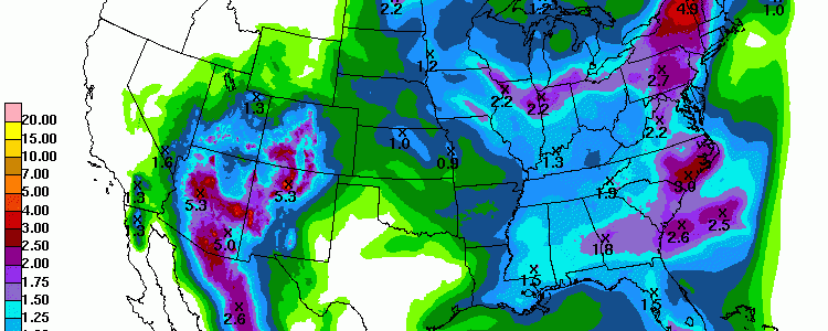
The latest 7-day QPF shows that most of the Southeast should receive some much-needed rain this week, although northern Georgia and the east coast of Florida will miss most of it, which could increase dry conditions in those regions. Warmer than normal conditions are expected, especially in southern Alabama and Georgia and into Florida. Also…
Posted in: Climate outlooks -
If you’re tired of hot summer weather, you might enjoy a chance to think about cool winters. North Georgia Weather published a blog article on the relationship between ENSO phase and the likelihood of getting a cold winter in the Southeast back in September 2015. You can read it at https://www.northgeorgiawx.com/weather-blog/category/el-nino. The statistics show that about…
-

I got a request from one of the Georgia extension agents for some average evapotranspiration data. You might be asked about this too, so I thought I would post the information here. I found these curves for some Georgia locations from a paper published by Suleiman and Hoogenboom in the Journal of Irrigation and Drainage…