-
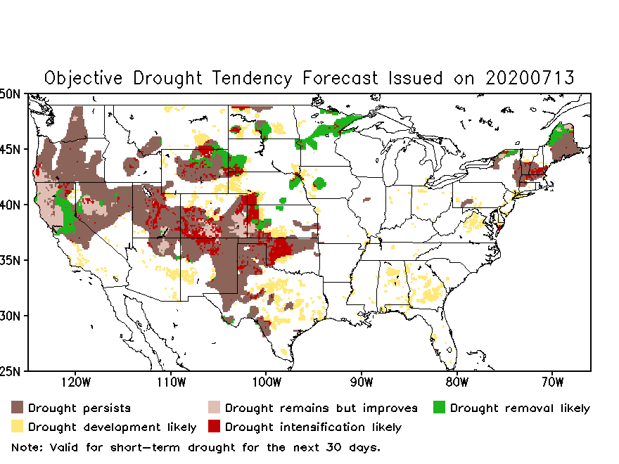
We’ve had a lot of rain this year so far, and cooler temperatures in recent weeks have helped keep the water balance in good shape. But in the last week temperatures have soared, and with little rain in the forecast the chance of a dry spell or flash drought developing has increased. This week temperatures…
-
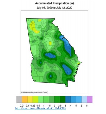
I received a comment today from one of our UGA Extension agents about the weekly rainfall map in the Georgia Crop Progress Weather and Condition Report. She said that she had received a note from one of the producers in her area complaining that the map did not catch the area of low precipitation near…
-
With high pressure firmly in place over the Southeast for the next week, we can expect to see temperatures and heat stress rise to dangerous levels. This will affect both outdoor workers and livestock. Producers will want to keep careful track of worsening conditions and take appropriate actions to reduce the effects of the combination…
-
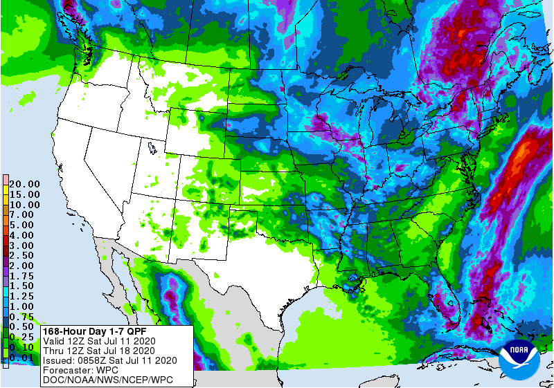
The latest 7-day QPF map shows that most of the Southeast should get less than half an inch of rain this week along with above-normal temperatures. The exception is the Florida peninsula, which is expected to get at least an inch. Most of our rain will stay off the East Coast, so other than widely…
Posted in: Climate outlooks -
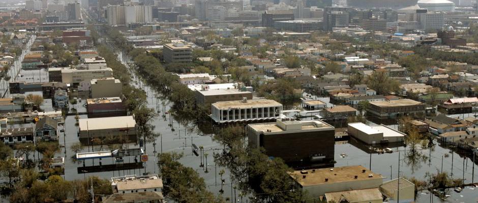
It’s the season of the year when disasters seem to become more common in the Southeast due to hurricane season, but really weather and climate disasters can happen any time of year (remember ice storms and Snowmageddon?). Often when these events occur, a disaster is declared, sometimes well in advance of the storm. But what…
Posted in: Climate and Ag in the news -

The 6th tropical storm of the year has formed as expected off the coast of North Carolina. It is expected to move north and may affect coastal Virginia before moving towards DC, New York, and New England. The impacts on the Southeast will be confined to areas near the coasts of North Carolina and Virginia.…
Posted in: Tropical weather -
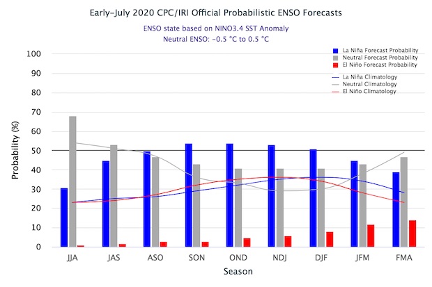
If you’ve been following conditions in the Eastern Pacific Ocean lately, you know that the temperatures there have been showing the characteristic pattern of colder than normal temperatures along the equator. This is the signature sign of a La Nina. While a La Nina is not officially called until the conditions have lasted for 4…