Tools for climate and agriculture
-

There have been many stories published about the upcoming solar eclipse in August 2017, which will be visible across the Southeast. You can see a movie of what it will look like at your location by going to https://eclipsemega.movie/simulator?lat=31.45046290000001&lng=-83.50849729999999 and entering your location in the box.
-
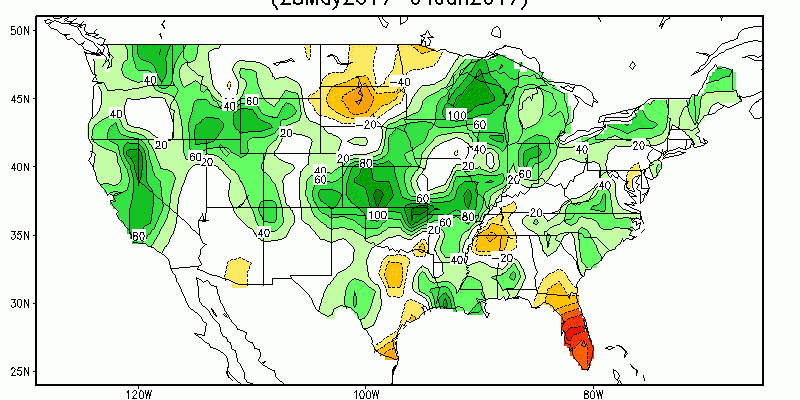
If you are looking for maps on conditions relating to current drought, precipitation, soil moisture, agriculture or water supply, a great place to start is the “Data, Maps and Tools” page of the Drought Portal at https://www.drought.gov/drought/data-maps-tools. It has an amazing array of maps and tools that are well-organized into different categories that can be accessed…
-

If you ever have to provide risk assessments for your county or city and need tornado information, this web site might help you identify historical tornadoes in your area. It’s from the Midwestern Regional Climate Center but includes information for all of the United States. It seems pretty straightforward to use. You can see it…
-
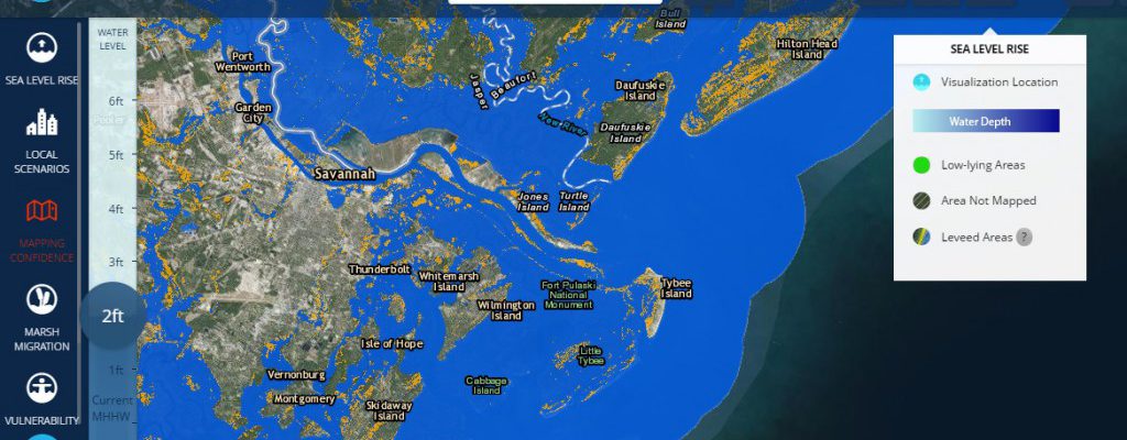
Here are a couple of different tools I’ve run across this week which look at the effects of rising sea levels on coastal areas of the US. The Tides and Currents site at https://tidesandcurrents.noaa.gov/sltrends/sltrends.html shows how local sea level rise differs from global sea level rise. The total sea level rise is a combination of rising…
-
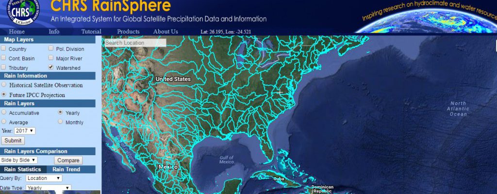
A new mapping tool that allows you to look at historical and projected trends in precipitation from satellite and ground-based data is now available at https://rainsphere.eng.uci.edu/. According to a description of the tool in the Bulletin of the American Meteorological Society (link), CHRS RainSphere was designed as an educational tool that allows users to quickly and…
-
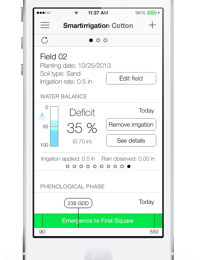
At a meeting today I was reminded that there are a number of smartphone apps designed to help farmers with irrigation planning available from the University of Florida IFAS, USA NIFA and the University of Georgia. While these started in the Southeast, some of them are now expanding to other parts of the country based…
Posted in: Tools for climate and agriculture -
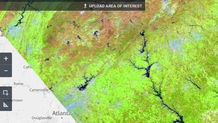
GeoAwesomeness.com posted a story about a new source of satellite data on land cover to its web site this week. It is a viewer which allows you to look at several different land cover satellites, including LandSat and MODIS and search for local coverage very quickly. I have just tried it out for a few…