Tools for climate and agriculture
-

The USDA Southwest Regional Climate Hub’s recent newsletter noted an online article that may be of use to some of you in looking ahead to planning for the future. This is especially important if you are considering purchasing land or switching to new crops which may respond differently to climate than what you are growing…
-

The USDA’s Southwest Regional Climate Hub has a new online curriculum on agriculture and climate change available for K-12 educators and students. I haven’t had a chance to look at it yet, but even though it was written for the Southwest, I’m sure it contains information that would be valuable to the Southeast as well.…
-

In a post last week I noted that we are now in a La Niña watch, which means that conditions in the eastern Pacific Ocean are reflecting a developing La Niña as characterized by colder than normal ocean temperatures off the coasts of Peru and Ecuador stretching almost halfway west across the Pacific Ocean. This…
-

If you are interested in seeing what tropical storms have passed close to your location in the past, you should try out NOAA’s Hurricane Track archive at https://coast.noaa.gov/hurricanes/?redirect=301ocm. It allows you to select a location and a radius of interest and provides information on all of the storms that have passed within that circle since…
-
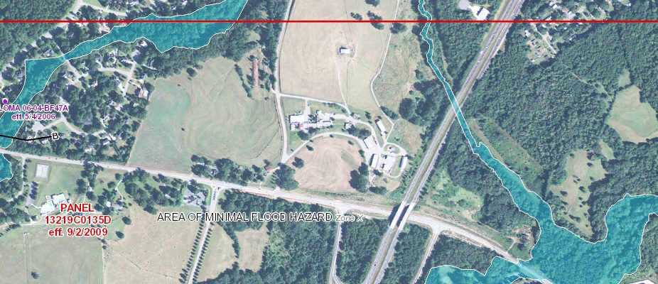
If you are following Hurricane Harvey, you know that one of the hazards most likely from the storm is torrential flooding rains. People in Texas have been warned that if they live in a flood plain, they should evacuate. Of course in the case of Harvey, there is likely to be so much rain that…
-

In my meetings this week I was reminded that many farmers use USDA planting zones to determine what varieties of trees and crops to plant. Hardiness zones are related to the average coldest day of the year. Here is an interesting comparison of how these zones have changed over time due to the warming trend…
-

NOAA has a new tool in their Climate Resiliency Toolkit which allows you to look at the migration of a variety of sea life over time. It’s called OceanAdapt and you can read about it at https://toolkit.climate.gov/tool/oceanadapt or go directly to the link at https://oceanadapt.rutgers.edu/regional_data/. It includes information for dozens of different species and covers…