Tools for climate and agriculture
-
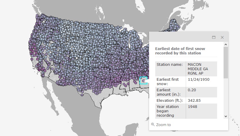
If you are tired of hot weather and want to think cool thoughts, you can enjoy this map which shows the date of the first snowfall of the season for each station that collects snowfall information. Read more about it and try it out here.
-

The National Drought Mitigation Center has published a new listing of fact sheets that describe a variety of USDA’s drought recovery resources. You can read about it at https://drought.unl.edu/Publications/News.aspx?id=353 or go directly to the brochure at https://drought.unl.edu/archive/documents/NDMC/Flyers/USDA-USDM-2pager.pdf.
-
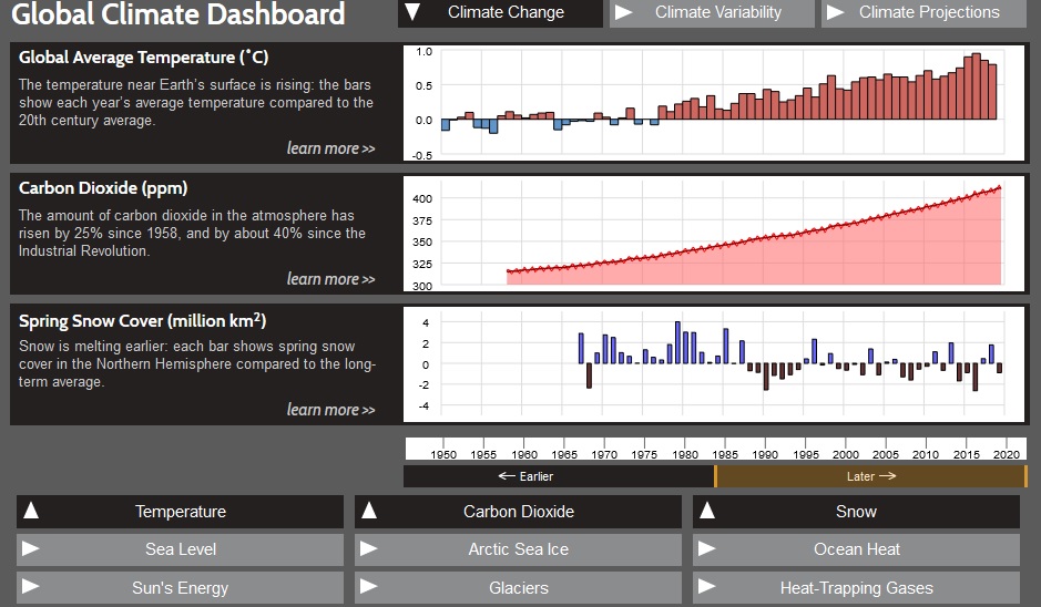
The Global Climate Dashboard is a NOAA tool which allows you to look at trends in climate over time for a variety of variables like sea level, carbon dioxide content in the atmosphere, and incoming sunlight. You can read more about it here. Or you can access it directly along with other maps and tools…
-
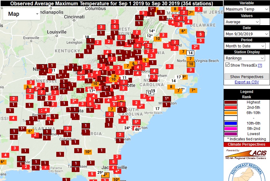
Because of the dry conditions across a lot of the Southeast in September, many stations in the region reported their highest ever average maximum temperature for the month, according to maps from the Southeast Regional Climate Center’s Perspectives tool (https://sercc.com/perspectives). Minimum temperatures were also ranked in the top five at many places but almost none…
-
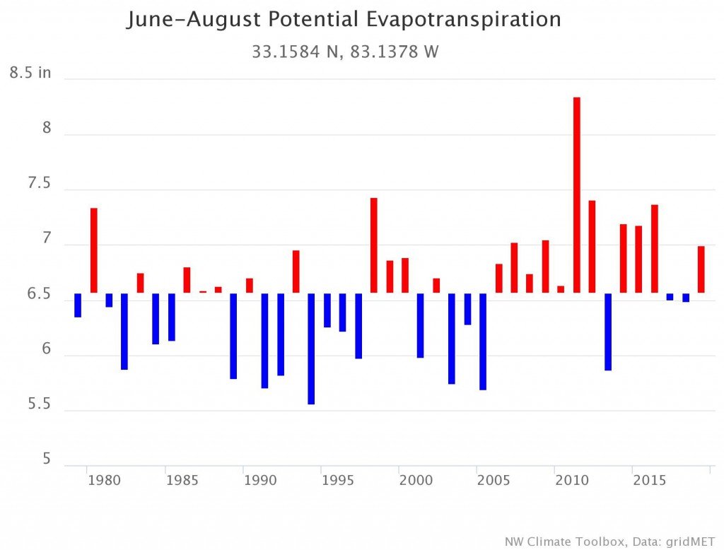
The Climate Toolbox is an online source of climate information from a consortium of agencies in the Northwest. However, a number of their tools are available for the entire lower 48 states. You can view historical data for many different climate variables, including degree days, chill portions, evapotranspiration, and streaks of days below certain threshold…
-
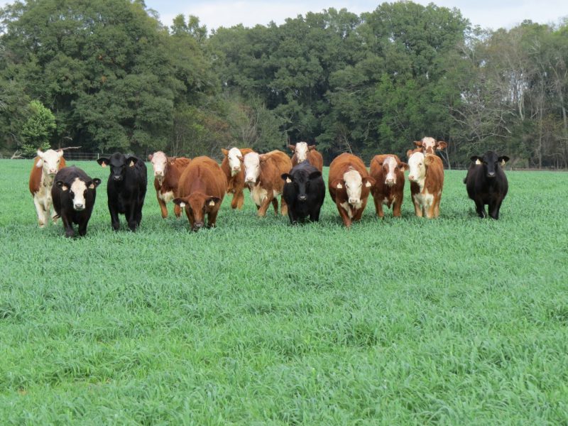
Now that it is fall, livestock producers are starting to think about how to feed their cattle over the winter. If you use warm-season forages, then you have to feed hay or grain to your cattle over the winter months. Adding cool-season annual forages to the mix can cut costs and keep your cattle healthy.…
-
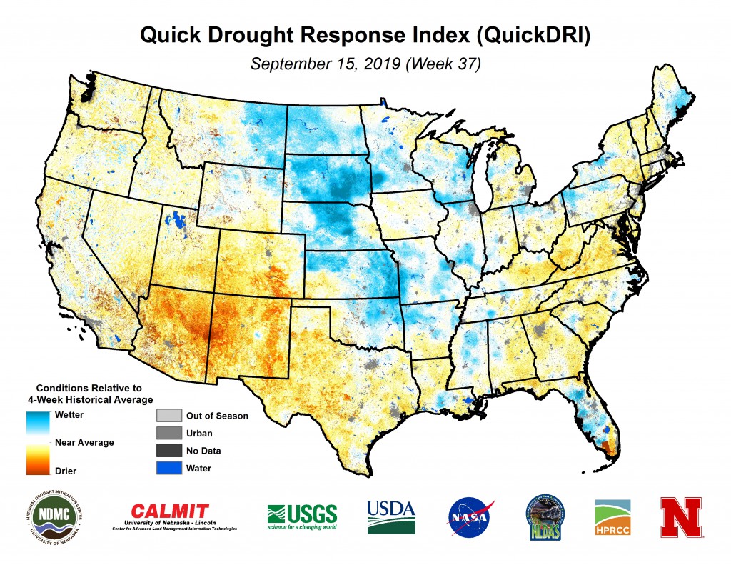
In our Drought Monitor Forum this week, we are being reminded of the variety of tools that are available to help monitor drought conditions across your region. You can find a list of many of these tools, including the Historical Drought Atlas, soil moisture maps, and vegetation drought response index, on the Drought Monitor site…