Sources of weather and climate data
-
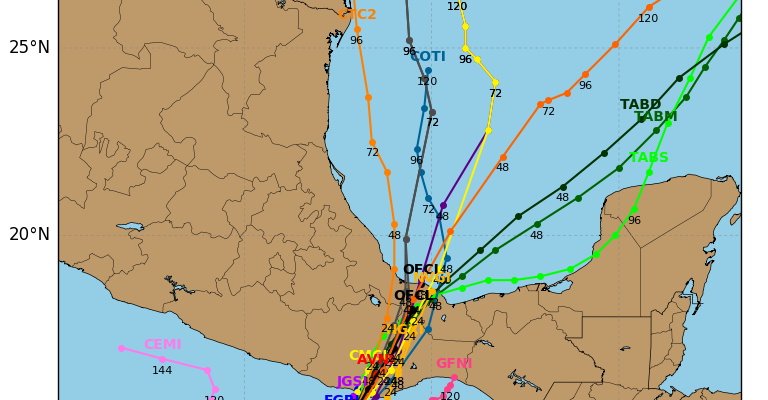
Today is the beginning of the Atlantic Tropical Season. In June, most of our storms, if they form, are likely to come from the Gulf of Mexico or along the East Coast. But we may actually get our first storm of the official season (remember, TS Arlene came and went very quickly in April) from…
-
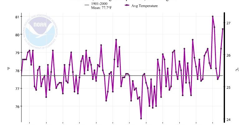
Today marks the first day of summer for meteorologists. Summer is officially June, July and August in the climatologist’s calendar. It is also the first day of the Atlantic tropical storm season, which looks like it could be a bit more active than usual. Here’s a graph showing the average temperature trend for the Southeast…
-
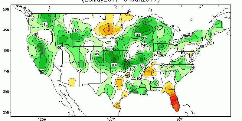
If you are looking for maps on conditions relating to current drought, precipitation, soil moisture, agriculture or water supply, a great place to start is the “Data, Maps and Tools” page of the Drought Portal at https://www.drought.gov/drought/data-maps-tools. It has an amazing array of maps and tools that are well-organized into different categories that can be accessed…
-

One of the frustrations of trying to keep track of rainfall across your county is the scarcity of rain gauges you may have access to. There are a number of networks that collect rainfall information, including the NWS coop network, the UGA automated monitoring network (or FAWN in Florida, or one of the other university…
Posted in: Sources of weather and climate data -

If you ever have to provide risk assessments for your county or city and need tornado information, this web site might help you identify historical tornadoes in your area. It’s from the Midwestern Regional Climate Center but includes information for all of the United States. It seems pretty straightforward to use. You can see it…
-
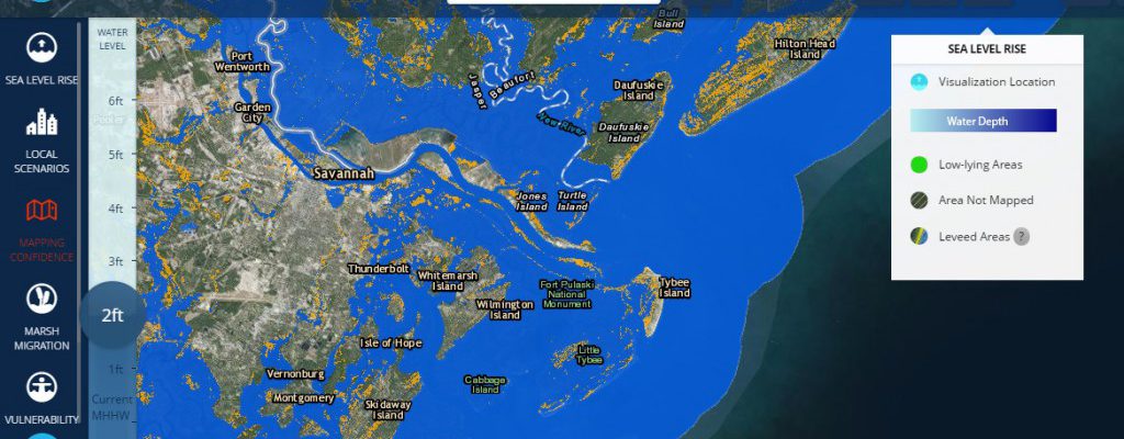
Here are a couple of different tools I’ve run across this week which look at the effects of rising sea levels on coastal areas of the US. The Tides and Currents site at https://tidesandcurrents.noaa.gov/sltrends/sltrends.html shows how local sea level rise differs from global sea level rise. The total sea level rise is a combination of rising…
-
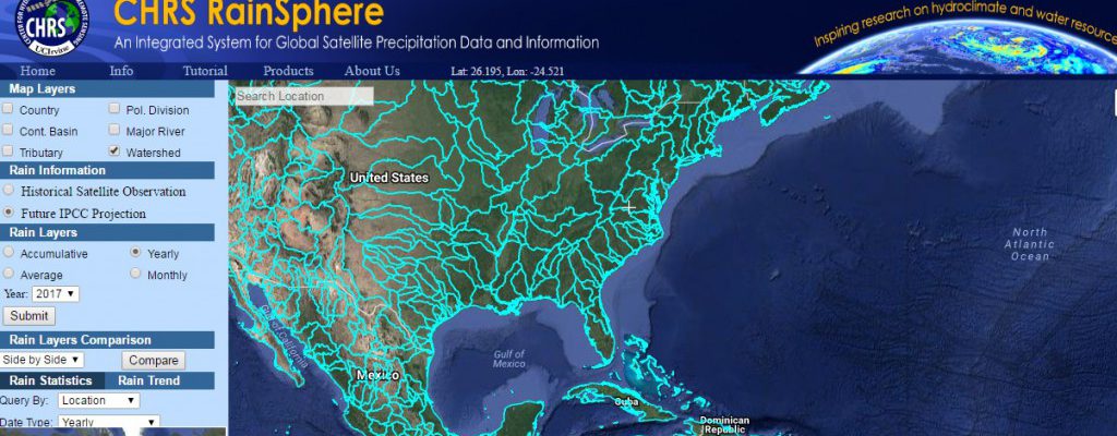
A new mapping tool that allows you to look at historical and projected trends in precipitation from satellite and ground-based data is now available at https://rainsphere.eng.uci.edu/. According to a description of the tool in the Bulletin of the American Meteorological Society (link), CHRS RainSphere was designed as an educational tool that allows users to quickly and…