Interesting weather images
-
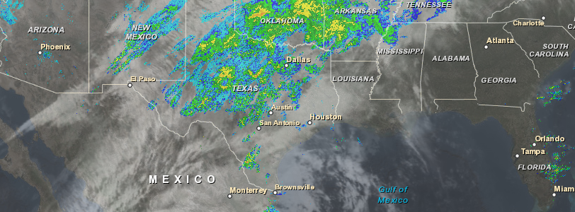
This combined satellite and radar image today shows the moisture streaming northeast from Tropical Storm Sandra into the front draped through Texas and points northeast. Fortunately for the Southeast, most of this moisture will not affect us but could cause flooding in the central US. Sandra is the strongest hurricane to hit so late in…
-
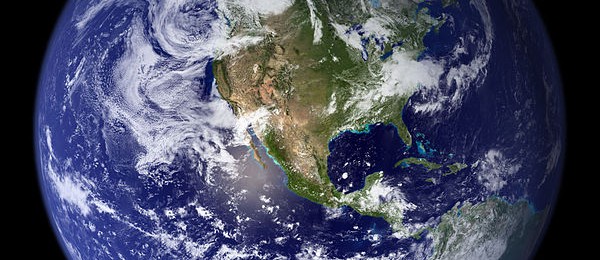
If you have a hard time visualizing the age of the Earth and human history, you might enjoy watching this 3-minute video showing an animated timeline of the Earth’s history, including the development of the atmosphere and life. You can see it at Business Insider athttps://www.businessinsider.com/animated-timeline-earth-history-2015-11.
-

Rome Ethredge published a striking article describing some of the problems that farmers have been having due to the recent wet conditions in his blog at Seminole Crop E News today. The blog article shows several pictures of soybeans that sprouted in the combine when the farmer had to stop harvesting for two weeks due…
-

Grazing the Net posted a link to a compelling video on a rescue of some trapped cattle who were threatened by a wildfire. The storm spotter for Channel 6 in Oklahoma City was out watching fires in the area when he noticed some cattle trapped by a fence as the fires approached. He opened a…
-
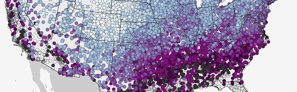
Up in Michigan, where I was born, thinking about snow in November is a regular occurrence. Here in the Southeast, snow does not usually hit until much later, if ever. The Daily Mail just published a NOAA map of the median date of first measurable snowfall with a link to an interactive version that…
-
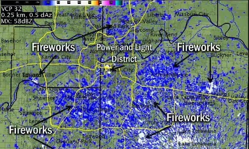
As the World Series ended last night with the Royals on top, the skies lit up with amateur fireworks across Kansas City. In fact, there was so much smoke and debris they were visible on the NWS radar. You can read about it at Deadspin here. Radar has been known to pick up migrating birds,…
-

Many of my meteorology friends have posted this fantastic photo of Kelvin-Helmholtz waves over Breckenridge CO yesterday. These clouds often form on windy days (faster wind on top of the wave versus the bottom…wind shear), when there’s a difference in densities of the air, for example, during a temperature inversion. They’re often good indicators of…
Posted in: Interesting weather images