Interesting weather images
-

Grazing the Net posted a link to a compelling video on a rescue of some trapped cattle who were threatened by a wildfire. The storm spotter for Channel 6 in Oklahoma City was out watching fires in the area when he noticed some cattle trapped by a fence as the fires approached. He opened a…
-
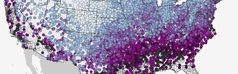
Up in Michigan, where I was born, thinking about snow in November is a regular occurrence. Here in the Southeast, snow does not usually hit until much later, if ever. The Daily Mail just published a NOAA map of the median date of first measurable snowfall with a link to an interactive version that…
-
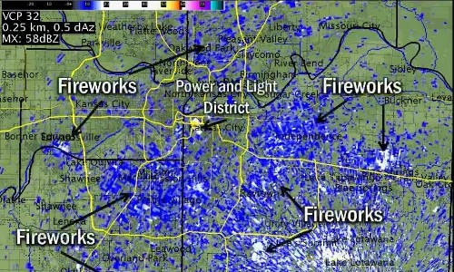
As the World Series ended last night with the Royals on top, the skies lit up with amateur fireworks across Kansas City. In fact, there was so much smoke and debris they were visible on the NWS radar. You can read about it at Deadspin here. Radar has been known to pick up migrating birds,…
-

Many of my meteorology friends have posted this fantastic photo of Kelvin-Helmholtz waves over Breckenridge CO yesterday. These clouds often form on windy days (faster wind on top of the wave versus the bottom…wind shear), when there’s a difference in densities of the air, for example, during a temperature inversion. They’re often good indicators of…
Posted in: Interesting weather images -

A rare occurrence of a tropical cyclone (equivalent to a hurricane in the Atlantic) making landfall on the Arabian peninsula is expected to occur this week as Chapala moves west towards Yemen and Oman. Some areas of the desert countries could receive up to 8 years’ worth of rain in 1 to 2 days. Chapala…
-
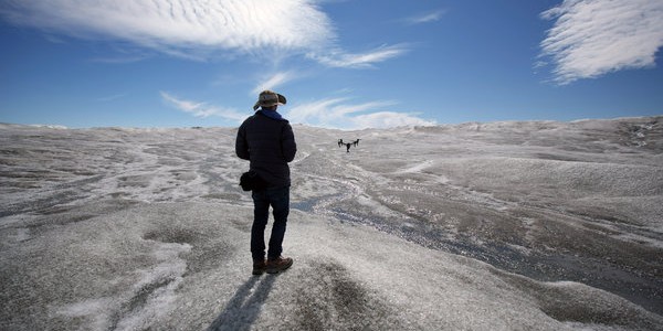
The New York Times published some spectacular pictures of the ice melting in Greenland this summer which were taken by a drone. You can see these images at https://www.nytimes.com/2015/10/28/insider/a-drones-vantage-point-of-a-melting-greenland.html?_r=0 and read more about how the video was taken at the Huffington Post here. If you are interested in why the melting of the Greenland ice sheet is…
-

Along the East Coast today many roads were underwater from a combination of extremely high tides, onshore flow, remains of the flooding in South Carolina, and rising sea levels. A number of roads were forced to close, including the access to Tybee Island along the Georgia coast near Savannah. This is the third time in…