Interesting weather images
-
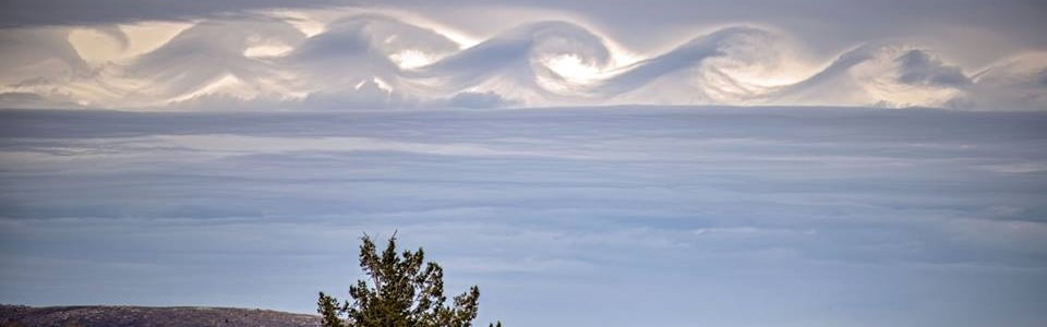
My Facebook feed this week has been abuzz with a recent photo of Kelvin-Helmholtz waves taken by Brad Peterson in Utah earlier this week. K-H waves are caused by rolls of turbulence between two smoothly flowing layers of air and were named for scientists Lord Kelvin and Hermann von Helmholtz. Over time the waves grow…
-
TIME magazine has just come out with their compilation of the most spectacular weather images of the year. There’s no doubt that these twelve photos are amazing, but since I have many meteorologist friends who are also photographers, I’ve seen some other photos which rival these. Take a look and see what you think. https://time.com/4142830/extreme-weather-photos-2015/?xid=newsletter-brief…
-
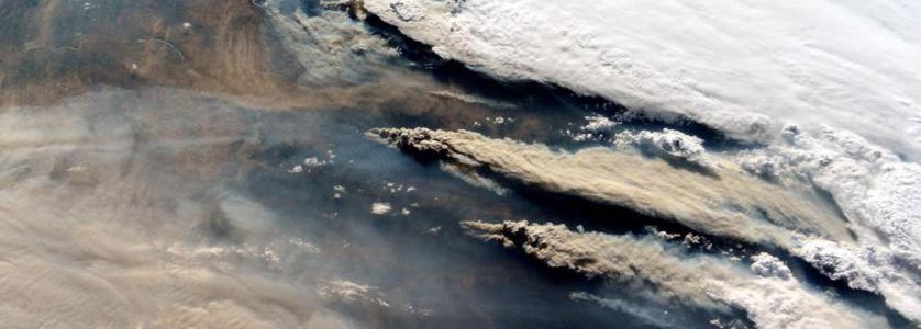
National Geographic is known for their fabulous photographs of scenery, people and infrastructure. In the past week I’ve run across a couple of interesting slide shows from NG that describe the importance of soil on life and how remote sensing by cameras and other instruments can highlight natural and man-made changes in the environment over…
-
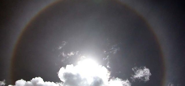
Now that we are getting into the colder months, you can expect to see more atmospheric optical effects related to ice crystals high up in the sky, although it’s so cold up there that some of them can occur any time of year. One of the most common and spectacular of these is the halo,…
-
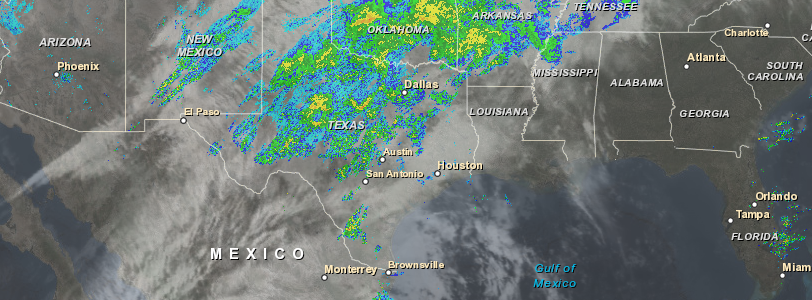
This combined satellite and radar image today shows the moisture streaming northeast from Tropical Storm Sandra into the front draped through Texas and points northeast. Fortunately for the Southeast, most of this moisture will not affect us but could cause flooding in the central US. Sandra is the strongest hurricane to hit so late in…
-
If you have a hard time visualizing the age of the Earth and human history, you might enjoy watching this 3-minute video showing an animated timeline of the Earth’s history, including the development of the atmosphere and life. You can see it at Business Insider athttps://www.businessinsider.com/animated-timeline-earth-history-2015-11.
-

Rome Ethredge published a striking article describing some of the problems that farmers have been having due to the recent wet conditions in his blog at Seminole Crop E News today. The blog article shows several pictures of soybeans that sprouted in the combine when the farmer had to stop harvesting for two weeks due…