Climate outlooks
-

The latest 7-day QPF forecast shows that intermittent showers are expected to occur on and off all week, with the driest period likely to be mid-week and the driest areas away from the mountains and the coasts. Today parts of the Southeast are feeling the effects of remnant tropical depression Laura as it passes through…
Posted in: Climate outlooks -
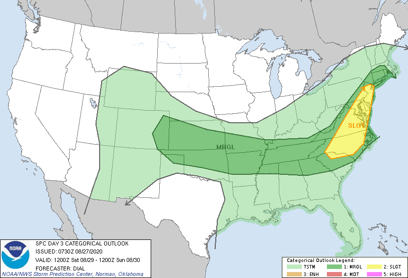
As TS Laura continues its path through the US and turns towards the east over the next couple of days, the Southeast will continue to be in the right front quadrant of the storm. That means that there will be ample fuel for rain showers and some potential isolated severe weather as Laura moves through…
-
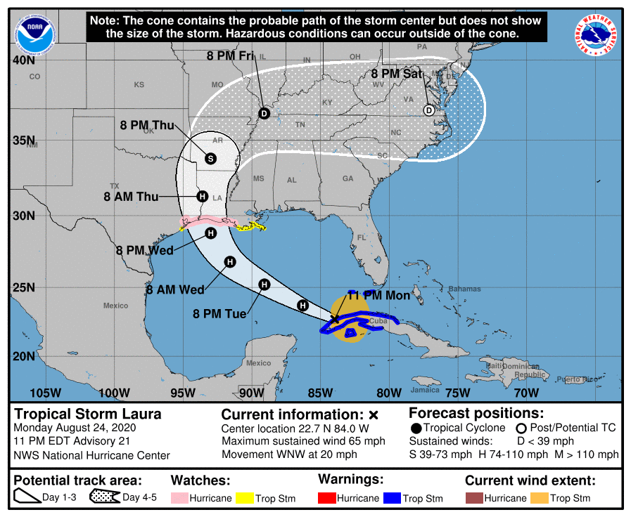
Late Wednesday evening or early Thursday morning Hurricane Laura is expected to make landfall as a major hurricane somewhere near the Texas-Louisiana border. The models still show some variation in path, and it could got a little farther west to Galveston-Houston, so the barrier islands there are being evacuated as a precaution along with many…
-
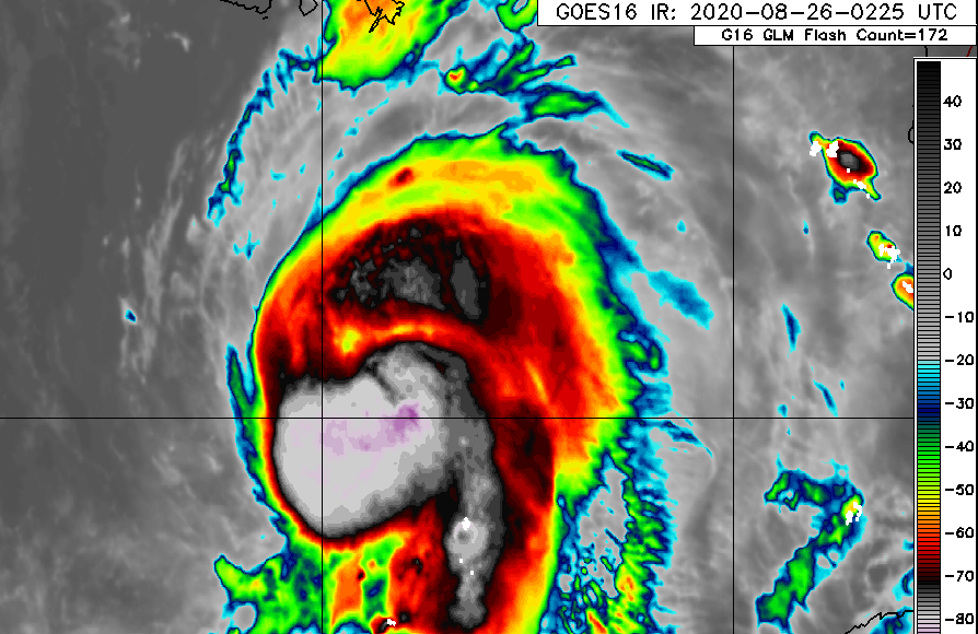
As of 11 pm on August 24, Marco is fading rapidly and was just downgraded to a tropical depression. It is not expected to last much longer. The center did make landfall over Louisiana before it turned west, but most of the rain was in the right front quadrant, where it brought scattered heavy showers…
Posted in: Climate outlooks -

With the forecast track of TS Laura moving steadily to the west, that puts most of the likely impacts of the storm well to the west of our region. But we can still expect some rain from the storm, mostly in the form of scattered lines of thunderstorms which could have locally gusty winds and…
-

The latest projected path of TS Laura, which is now just west of Puerto Rico, is for it to follow along Hispaniola and and Cuba before entering the Gulf of Mexico. The southern tip of Florida could see some winds and rain from the storm, but most of the peninsula will avoid the heaviest winds.…
-
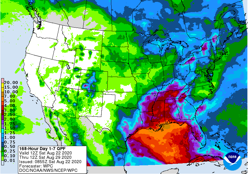
With two tropical storms expected to be in the Gulf of Mexico this week, it should be no surprise that most of the rain we are likely to get is linked to those two rainmakers, especially in the states near the Gulf. This morning’s 7-day QPF map shows that there is a lot of rain…
Posted in: Climate outlooks