Climate outlooks
-
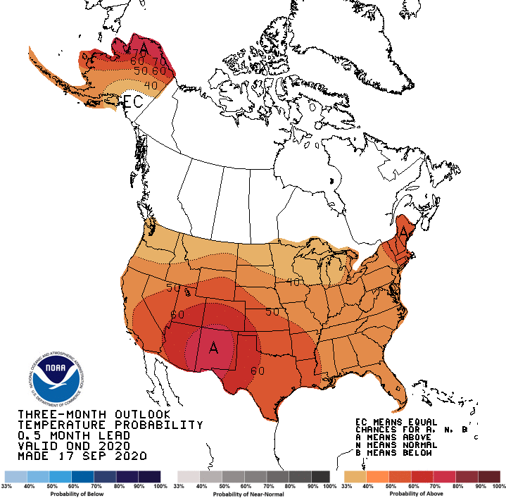
NOAA’s Climate Prediction Center released their updated outlook for October this week. It shows that most of the Southeast is now leaning towards cooler and drier conditions than normal. The Florida peninsula is the only area that is expected to be warmer and wetter than normal. This is weighted mainly towards the first half of…
Posted in: Climate outlooks -
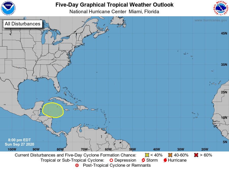
The Atlantic is quiet now, with no named storms in existence and nothing immediately threatening on the horizon. However, the 5-day outlook does show an area in the Caribbean that has a 20% chance of developing in the next five days. The models indicate that it could become a tropical storm by the end of…
-
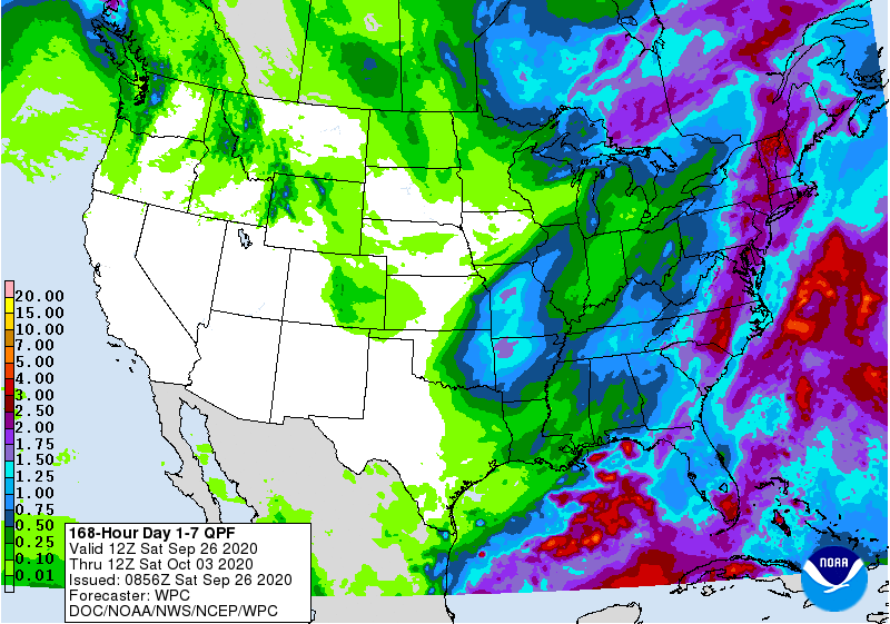
A strong cold front will move through the region early next week, bringing some rain and much cooler temperatures to the area after the front passes. The end of the week should be dry for most areas as the colder air settles into place. The coolest mornings are expected to be Friday October 2 and…
Posted in: Climate outlooks -

With a La Nina advisory in effect, that means we can expect to see several months of La Nina conditions across the Southeast, although the strength of the signal will depend on how strong and how long the La Nina is. Here is a good general discussion on the likely climate effects from Kirk Mellish…
-
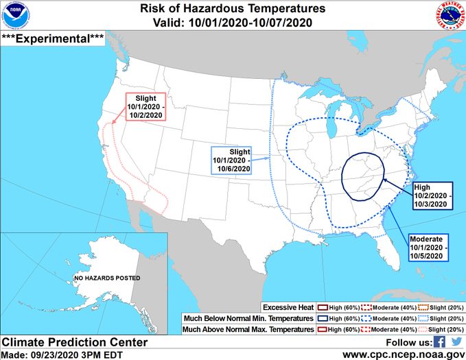
While we can’t predict exact temperatures more than a week out, we are starting to get a hint from medium-range weather models that a significant outbreak of cold air will move into the Southeast early in October. In particular, the nights of October 2-4 could see temperatures into the 30’s across the Southern Appalachians and…
Posted in: Climate outlooks -
Yesterday we added three named tropical storms to the list–Wilford in the central Atlantic, Alpha near Portugal (!) and Beta in the Gulf of Mexico. Blowoff from TS Beta is currently providing cloud cover to parts of the Southeast, including Alabama, Georgia, and the Carolinas. TS Beta is expected to slowly gain strength to a…
Posted in: Climate outlooks -
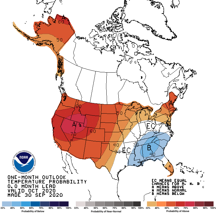
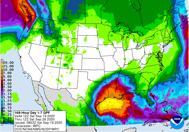
The latest climate outlook from the Climate Prediction Center shows that October and October through December are both expected to be warmer than normal. Precipitation for October is expected to be above normal in Florida and along the coasts but could be drier than normal farther inland, away from tropical weather. For the October through…
Posted in: Climate outlooks