-

The Southeast Farm Press posted a story this week by Eddie McGriff of Alabama Extension discussing how good the cotton yields for both irrigated and dryland fields in Alabama this year. This in spite of the drought that has deepened over the area over the last few months. Eddie noted that “We, in Alabama and…
-
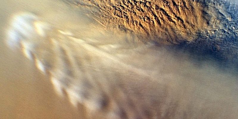
You might not think about it right away, but several of the planets in the solar system have atmospheres that are in some ways similar to what we have on Earth. After all, gases follow the same basic physical rules no matter what planet they are on. EOS.org posted an interesting story earlier this month…
-
I woke up to the sound of rain on the roof and I smiled because there is no more welcome sound after a long dry spell. But will the rain be helpful for farmers trying to find grazing for their cattle? Dr. Dennis Hancock, UGA pasture specialist, put out a note about this yesterday in…
-
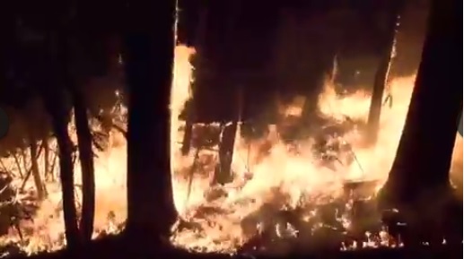
High winds with gusts to 70 mph ahead of the cold front that is moving into the Southeast caused forest fires in North Carolina and Tennessee to flare up, resulting in a panicked evacuation of Gatlinburg TN late in the evening on the 28th. You can see pictures and video of the smoke and fire…
-

The cloudy weather today in Athens is exciting after days of blue skies because it is a hint of things to come. We are expecting rain for the first time in what seems like months (in some places, it literally IS months) over the next few days, and people are getting pumped up. I am…
-
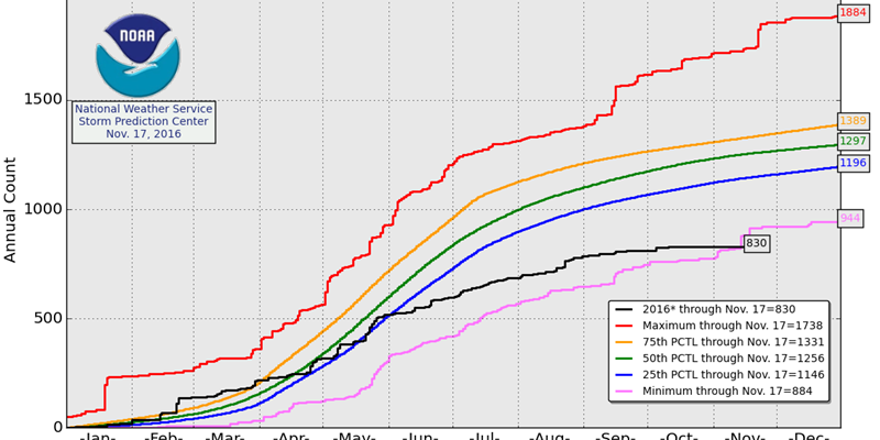
According to NOAA as reported in The Weather Whisperer at AgWeb here, 2016 had the lowest number of tornadoes on record at 830 as of November 17. The entire month of November had only one tornado as of November 23, according to the Capital Weather Gang here. A vigorous storm system that is moving through…
-
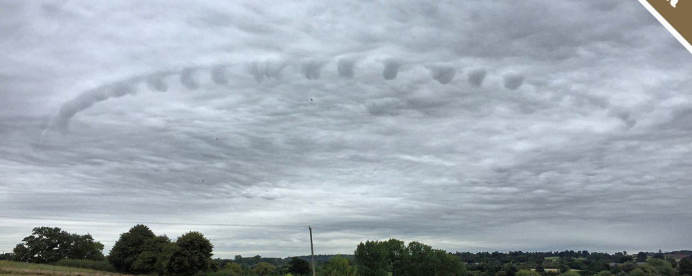
The Cloud Appreciation Society’s monthly cloud picture for November showed a mysterious ring in the cloud layer over Warwickshire, England. Where did it come from? You can read the detective story at EarthSky at https://earthsky.org/earth/mystery-cloud-appreciation-society-pretor-pinney-nov-2016. The Cloud Appreciation Society is a great place to look at other pictures of clouds too. You can visit them at https://www.cloudappreciationsociety.org.