-
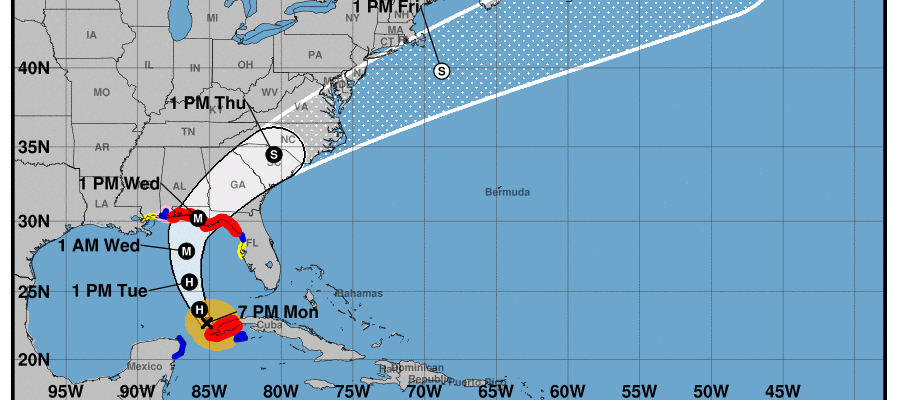
While I am traveling, I can’t provide frequent updates on Hurricane Michael, but here are some places to go and get information. As of 8 pm tonight, Michael is a category 1 storm expected to get stronger before it makes landfall, probably sometime on Wednesday afternoon on the Florida Panhandle. It is currently expected to…
-
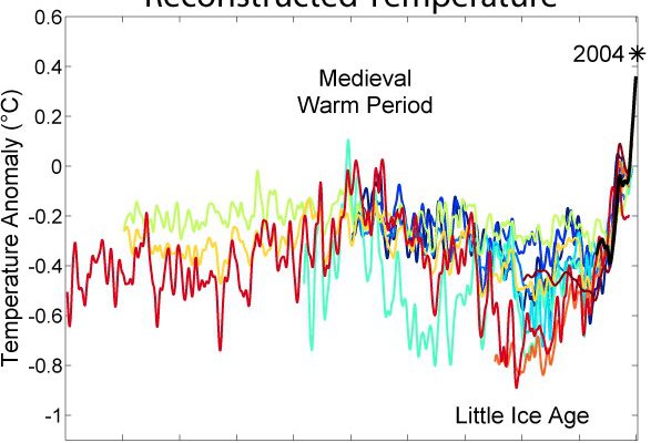
A new report released this week by the Intergovernmental Panel on Climate Change warns that the world is fast approaching the point where we will no longer be able to keep the earth’s temperature from rising more than 1.5 degrees C. This is the increase that most scientists think can minimize climate impacts from the…
Posted in: Climate and Ag in the news -

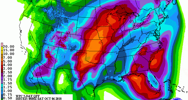
If you have not been paying attention to the tropics this week, now is the time to start. Tropical Storm Michael has formed in the Gulf of Mexico and is expected to make landfall along the Gulf Coast Wednesday afternoon. Because of the unusually warm water in the Gulf of Mexico, it has the potential…
-
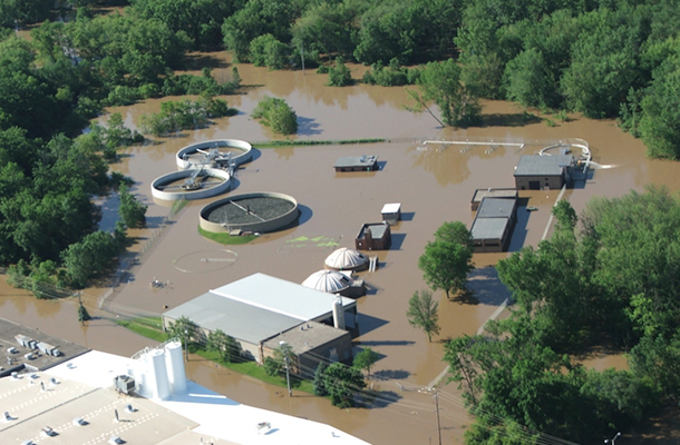
The flooding from Hurricane Florence caused a lot of different impacts around North and South Carolina, including impacts on agriculture, highways, businesses and residences, but one impact that I have not read much about is the impact on potable water supplies. Since many water treatment plants are built near rivers, deep floods can destroy them…
-

Even though Hurricane Irma hit Florida more than a year ago, agriculture is still feeling impacts from that devastating storm. Vegetable Growers News reported today that in addition to the loss of citrus farms, a number of tomato producers have also decided to call it quits after their severe losses last year. You can read…
-
Here is a good and comprehensive tabular summary of how increases in global temperature of 1.5 C, 2 C and beyond will affect a wide variety of weather and climate events, including sea level rise, heat waves, average and extreme temperatures and rainfall, and crop yields as well as other variables. A lot to take…
Posted in: Climate and Ag in the news -
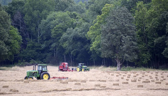
Another dry weekend is in store for most of the Southeast as the strong high pressure system continues to dominate the local weather. The high will gradually retreat to the east, allowing more flow from the Gulf of Mexico, bringing moisture back to the areas that have been quite dry. In addition, by midweek we…
Posted in: Climate outlooks