-

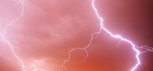
In a surprise to many meteorologists, Tropical Storm Bertha formed just off the coast of South Carolina as it was coming onshore. Overnight last night the National Hurricane Center said that it had only a 30 percent chance of development, but by 7:30 Wednesday morning it was bumped up to 70 percent, and by 8:30…
-

In today’s webinar (recording at https://www.youtube.com/watch?v=lWnEtfS6gVk&feature=youtu.be) on climate conditions in the ACF river basin in Georgia, Alabama, and Florida, David Zierden, the Florida State Climatologist, discussed some recent changes in the temperature profile of the Eastern Pacific Ocean. Over the last month, the ocean temperature distribution has started to look much more like a La…
-
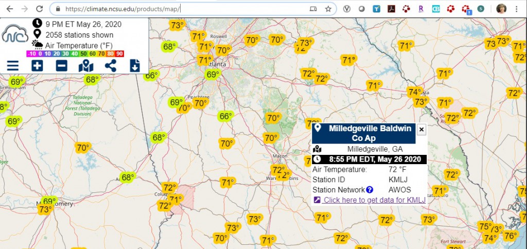
I received a request yesterday for reference evapotranspiration for a location in Alabama. While there are several mesonets that collect weather data in Alabama, none of them was at the location that the request was for. In my search I found that the North Carolina Climate Office weather data map site contained quite a bit…
-

It rained here in Georgia today. Not that unusual except that the rain came in from the southeast, which is not what we usually expect. The culprit is a tropical system, not organized enough to be named but carrying plenty of moisture with it, that has been drenching the Miami area today. (You can see…
-

If you like to plan outdoor work ahead of time, here is a site that might be useful to you this summer. The Weather Prediction Center has a bunch of very useful prediction maps, including predictions for heat index, which is related to high temperatures linked with high humidity. The map for this coming Friday…
-
If you are looking for more information about topics in weather and climate or if you just want to learn something new, you might want to check out a couple of sites that contain a lot of useful modules which explain various aspects of weather and climate at no cost, although for MetEd you will…
-
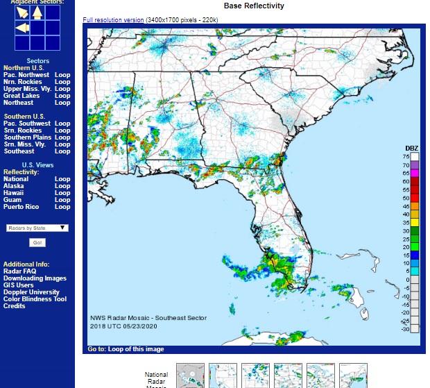
Almost everyone has seen radar images of precipitation on television or online in the past and knows at least a little about how to interpret them. While many television stations have their own low-power radars, the majority of weather radar images come from the National Weather Service. But their radar images come in two ways…