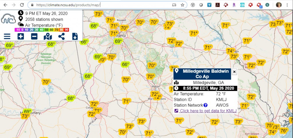
I received a request yesterday for reference evapotranspiration for a location in Alabama. While there are several mesonets that collect weather data in Alabama, none of them was at the location that the request was for. In my search I found that the North Carolina Climate Office weather data map site contained quite a bit of information that could be useful if there is no other weather station nearby, including all of the Southeast, not just North Carolina. To use it, go to https://climate.ncsu.edu/products/map/ and click on your station of interest. It will give you a link to the station data. Here is the link for Milledgeville GA, a site that does not have a UGA weather network station but does have an airport with hourly weather data (https://climate.ncsu.edu/cronos/?station=KMLJ&temporal=daily). If you pick the daily data tab, it will give you the option of downloading ET data. Keep in mind that these values are calculated using raw data that may have quality issues, so treat it with caution, but at least it will give you data in places that you might not otherwise be able to get it. There are lots of other weather variables available too, so check it out. You can get archived data too.