Tropical weather
-

Here is advice for grape growers in North Carolina from NCSU Extension. Short answer: if your grapes are near harvest, bring them in now! Note that the discussion is good but that the information is already somewhat dated with a western trend in the projected path which makes northern Georgia a more likely target for…
-
The day before Hurricane Katrina hit the Gulf Coast, I had a sick feeling in the pit of my stomach because I knew how bad it was likely to be. While the winds were not that strong when it made landfall, the huge storm surge and the loss of the levees in New Orleans made…
-
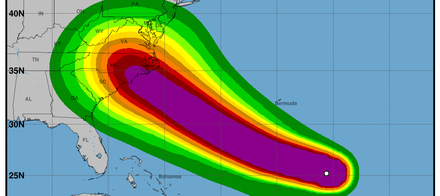
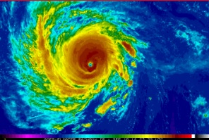
I sent out this email to my Extension colleagues in Georgia at noon today. Still valid as of 9 pm tonight. Key points: The current forecast path of Hurricane Florence reduces but does not eliminate the direct impacts of the storm on Georgia, including high winds, storm surge, and heavy rain. There is still considerable…
-
The latest monthly outlooks from NOAA’s Climate Prediction Center for September 2018 shows that warmer and wetter than usual conditions are expected again this month. Nighttime temperatures are likely to be more above normal than daytime temperatures due to the cloud cover associated with the rainstorms, although there should be plenty of sunshine, especially in…
-
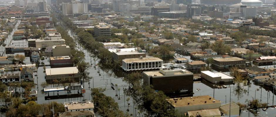
Thirteen years ago today, Hurricane Katrina came onshore in eastern Louisiana. While the winds were down to 75-80 mph, the storm surge was massive, in some places higher than 28 feet, and wiped out blocks along the coastline stretching from the Florida Panhandle well across most of Louisiana. Two days later, New Orleans started to…
-

Thirteen years ago today, Major Hurricane Katrina was barreling north towards the Gulf Coast as a category 5 storm. Robert Ricks of the National Weather Service put out one of the most chilling weather forecasts that I and my husband (also a meteorologist) had ever seen. Sadly, some people and even news agencies thought it…
-

After a very quiet couple of months, the Atlantic tropics are beginning to heat up, just as the most active period of hurricane development begins. The sea surface temperatures, which were near record-setting cold earlier in the year, are now close to normal, and the plumes of Saharan dust which were also inhibiting storm formation…