Tropical weather
-

The disturbance in the Gulf of Mexico today organized enough to be called Tropical Depression 2, but winds are not yet strong enough for it to be a named storm. If you live in the Florida Panhandle, southern Alabama or SW Georgia, you might have seen some high clouds from the storm’s circulation today. If…
Posted in: Tropical weather -
As we begin the 2023 Atlantic hurricane season, it’s worth looking back at past storms to see what lessons we can learn from the warnings that were given and how people responded (or didn’t respond) to the information provided by weather forecasters and emergency managers. Southeast Ag Net posted a helpful story this week describing…
-
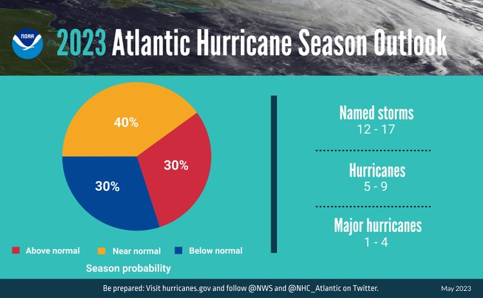
NOAA released their 2023 Atlantic hurricane outlook today. They expect a near-normal number of storms this year, with 12-17 named storms, 5-9 hurricanes, and 1-4 major hurricanes. This is less active than in the last few seasons due to the lack of a La Nina. However, because of the competing impacts of the developing El…
-
Many of our weekends this spring have been wet, and this coming holiday weekend is sadly no exception for the East Coast. A coastal low is predicted to form just off the coast of South Carolina and spin around for much of the weekend. That will bring rain to coastal areas over the weekend and…
-
The Land-Grant Press of Clemson Extension has a new publication on historical floods in South Carolina. It provides descriptions of different types of floods and a description of several historical events that have caused significant flooding in the state. While the historical events are focused on South Carolina, much of the background information is more…
-
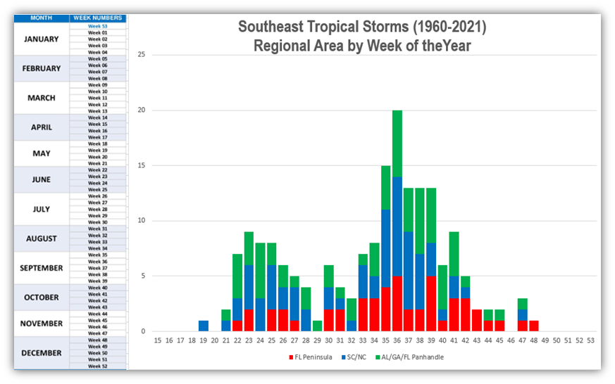
In the Southeast Climate Monthly Webinar today, Jeff Dobur from the NWS Southeast River Forecast Center posted this graphic showing how the weekly distribution of tropical storms looked for three subregions of the Southeast. The three regions are the Florida Peninsula, the Carolinas, and the Alabama-Florida Panhandle-Georgia region. As you can see from the graphic…
Posted in: Tropical weather -
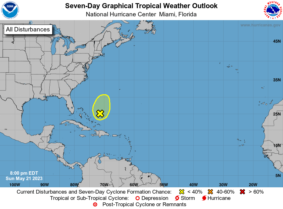
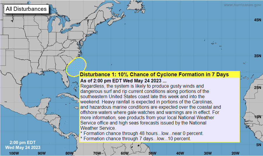
As we approach the official start of the Atlantic hurricane season, it should not be a surprise that we are starting to see some activity in the region. Today the National Hurricane Center posted a map showing a 10% chance of development in the next 7 days. Not much chance, but you never know. Even…
Posted in: Tropical weather