Tools for climate and agriculture
-
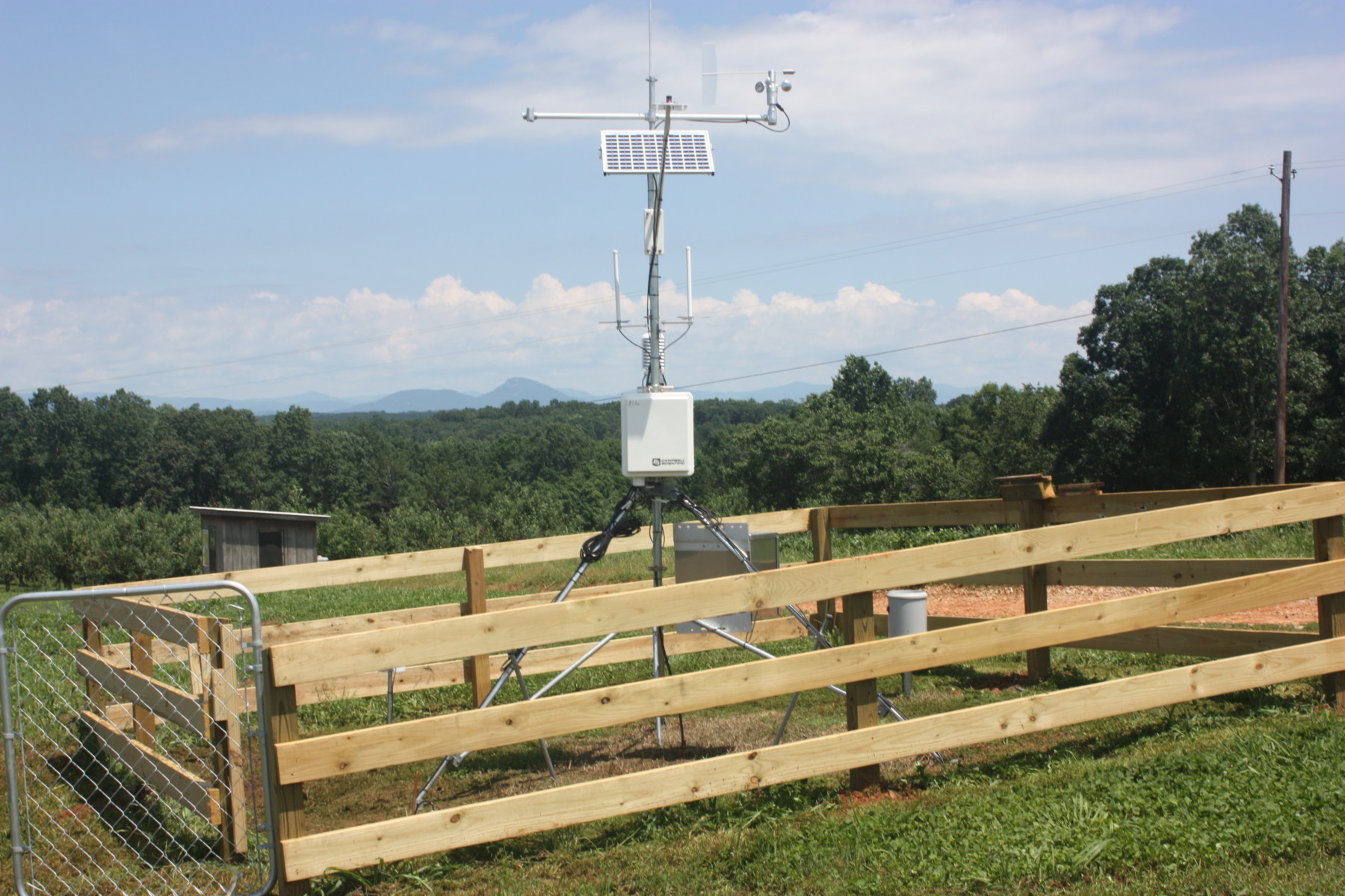
There are many different networks of weather observations that are taken across the country and the world. Some of the networks are run by the National Weather Service, US Geological Survey, and other federal agencies. Now, there are also many networks run within the states by different agencies. The University of Georgia weather network that…
-
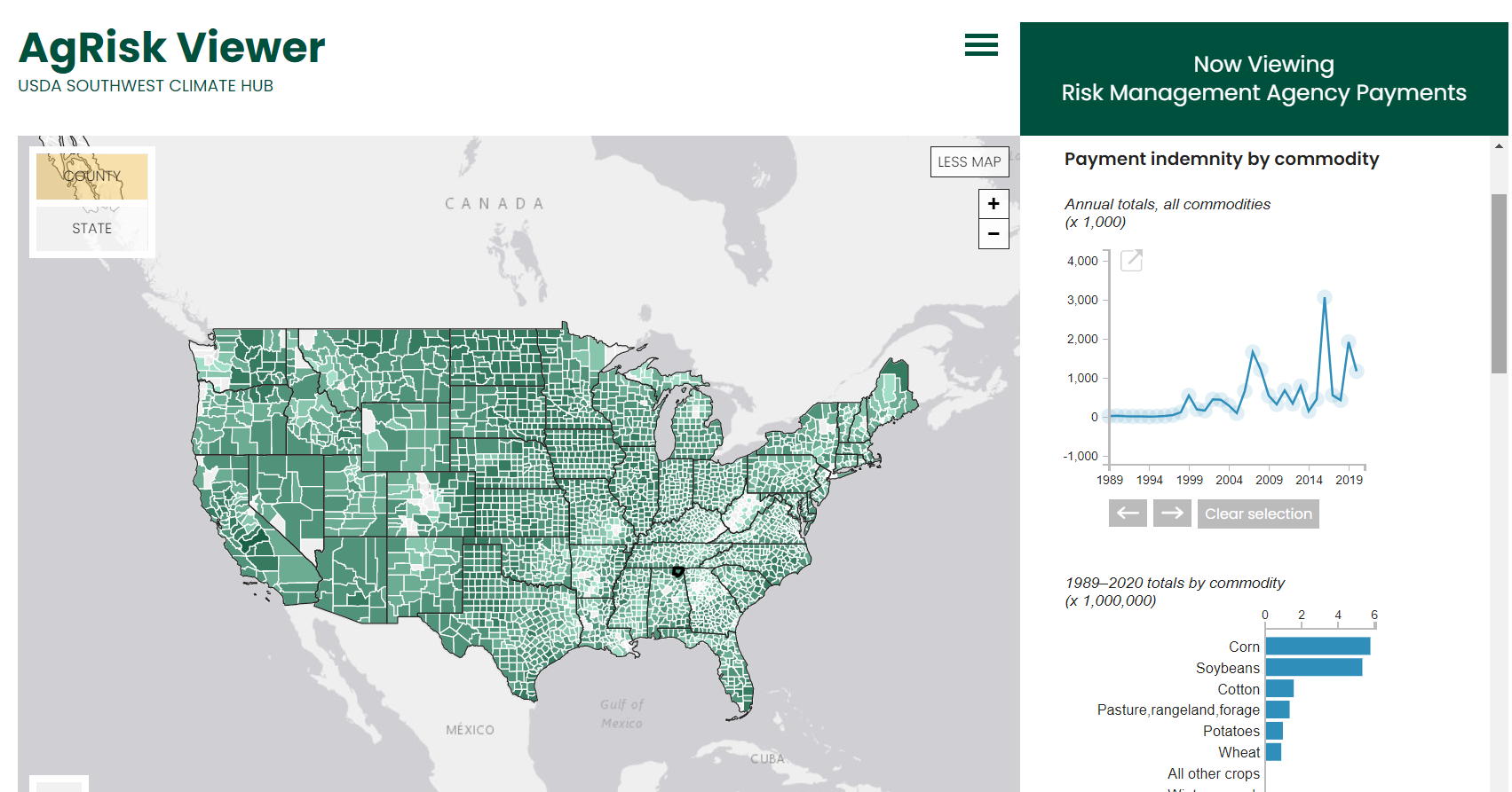
Here’s a tool that you might find useful. The USDA Southwest Climate Hub has an interactive viewer that allows you to look at financial losses due to climate for every county in the United States. You can read more about it at https://www.climatehubs.usda.gov/hubs/southwest/tools/agrisk-viewer or go right to the viewer at https://swclimatehub.info/rma/rma-data-viewer.html. I encourage you to…
-
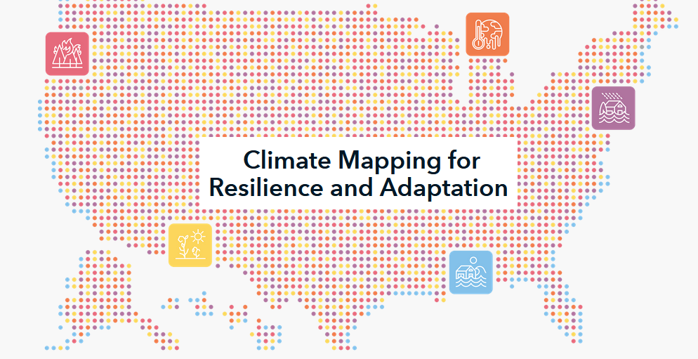
The Federal Government recently announced the launch of a new website related to mapping hazards and improving community resilience. The Climate Mapping for Resilience and Adaptation (CMRA) website at https://resilience.climate.gov/ integrates information from across the federal government to help people consider their local exposure to climate-related hazards. People working in community organizations or for local,…
Posted in: Tools for climate and agriculture -
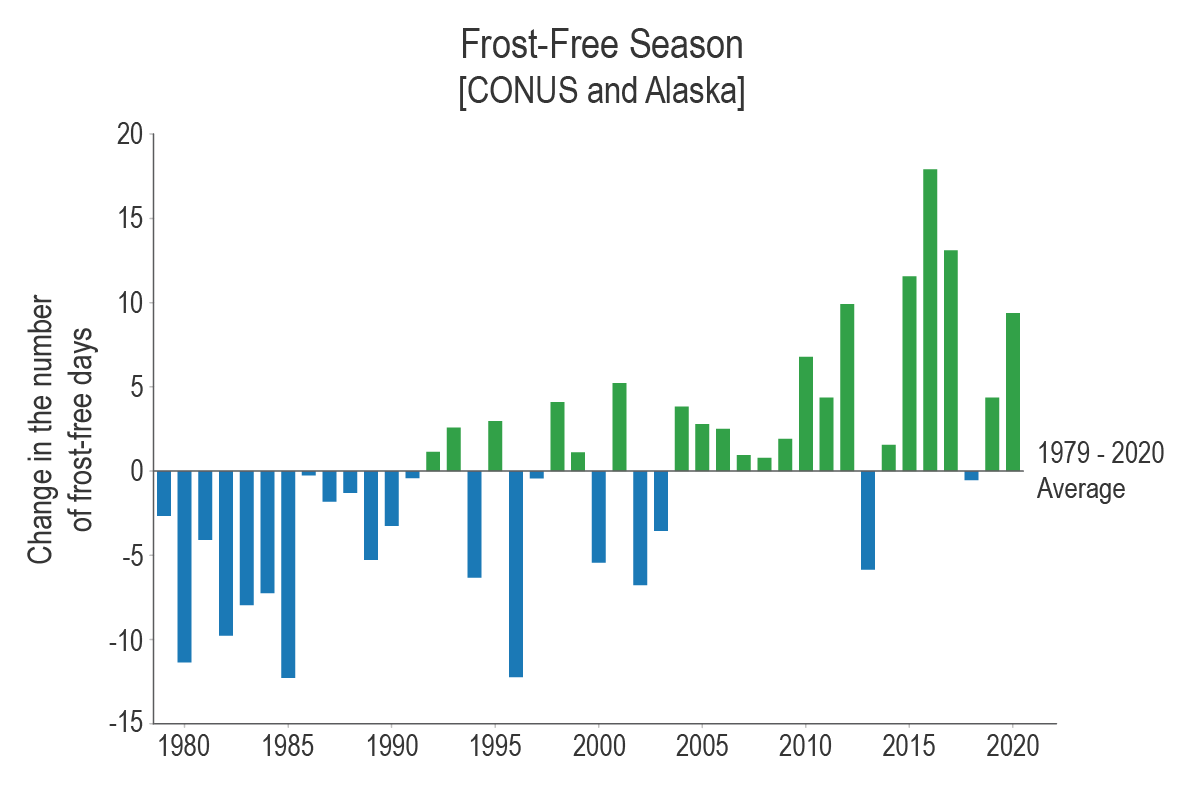
Indicators are observations or calculations that can be used to track conditions and trends. Indicators related to climate—which may be physical, ecological, or societal—can be used to understand how environmental conditions are changing, assess risks and vulnerabilities, and help inform resiliency and planning for climate impacts. The indicators listed include temperature, heating and cooling degree…
-

Today a new website dedicated to providing resources for dealing with extreme heat was introduced. It is Heat.gov and is a product of the National Integrated Heat Health Information System. I have not heard of this initiative before, but it seems to be similar to the National Integrated Drought Information System (NIDIS) that I work…
-
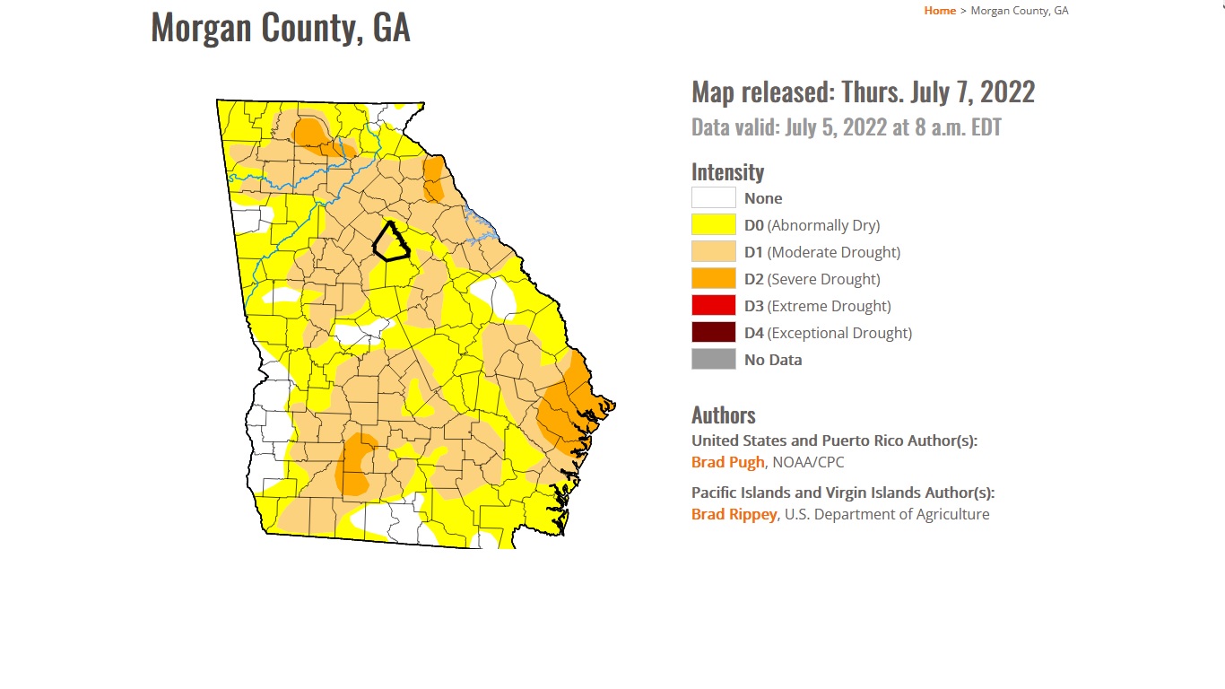
The USDM expanded its website capabilities in late June with the addition of county-level statistics on drought to their maps. When you go to their current map at https://droughtmonitor.unl.edu/CurrentMap.aspx and click down through region to state map and then click on your county, you will see a table of drought statistics for that county farther…
-
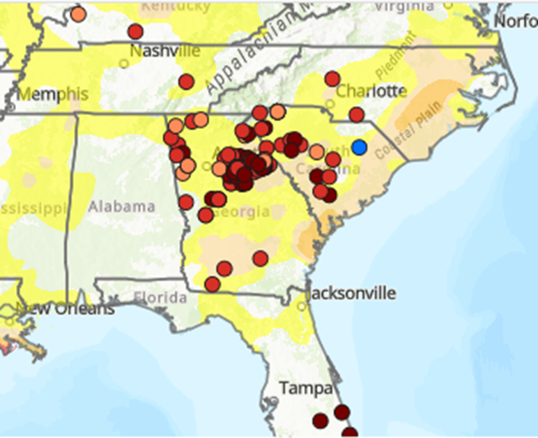
A few weeks ago, I wrote about how extension agents and agricultural producers in the Southeast can file reports on local conditions, including both droughts and floods. This hyper-local information is used by the weekly authors of the U. S. Drought Monitor to draw updated maps of drought conditions across the country. I took a…