Tools for climate and agriculture
-
Most of the readers of this blog probably do not use GIS in their daily work, but if you do, here is a unique opportunity to try out a new GIS portal for climate data from the High Plains Regional Climate Center. Here is information on how to access the GIS files from Natalie Humphlett…
-
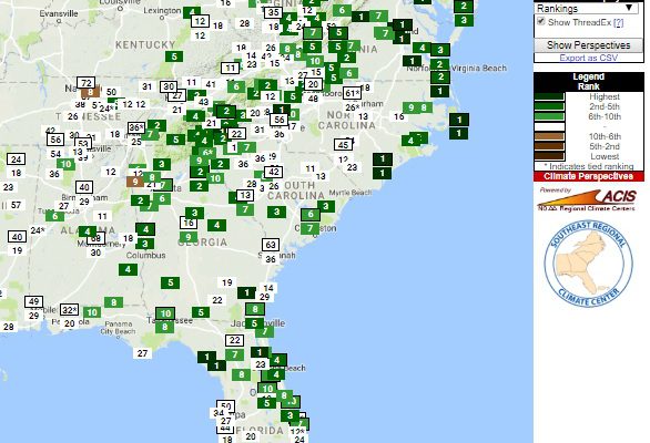
According to calculations provided by the Southeast Regional Climate Center on their Perspectives tool, the last May 3 through August 3 (three months) has been in the top ten wettest in many parts of the Southeast. In Virginia and at a few scattered locations elsewhere it has been the wettest on record. The only places…
-
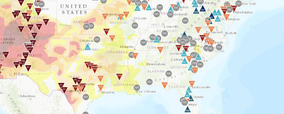
The U. S. Drought Risk Atlas from the National Drought Mitigation Center is an online resource that allows decision-makers to determine how drought has affected their community in the past and how frequently it occurs. The interactive map format allows you to search by station or by latitude/longitude or on a map and allows you…
-

Here’s a great site for looking at historical climate as well as projections of future climate. It’s called the Climate Explorer and is part of the US Climate Resilience Toolkit. It allows you to search by location anywhere in the contiguous US or by variable, including temperature, precipitation, and degree days and provides projections out…
-

NOAA’s Climate Prediction Center produces long-range forecasts for several time periods, including 6-10 days, 8-14 days, 3-4 weeks, and for one to three months at a time going out to as much as a year ahead. Most of these forecasts provide shading to indicate where the probabilities are tipped towards warmer or colder than normal…
-
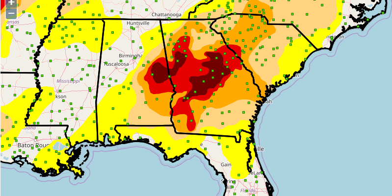
NASA’s new GRACE satellite can provide a snapshot look at soil moisture conditions across the entire US. The maps come out one a week at https://nasagrace.unl.edu/. This week’s map shows a streak of wet conditions stretching from Alabama north to Ohio, but dry conditions in southeast Georgia and north into most of South Carolina and central…
-
Most years I try to attend the annual meeting of the American Association of State Climatologists (AASC). I am a past president and enjoy the chance to catch up with old friends and learn some new things about applied climate. Here are some sources of data and some new web sites I discovered at the…