Sources of weather and climate data
-
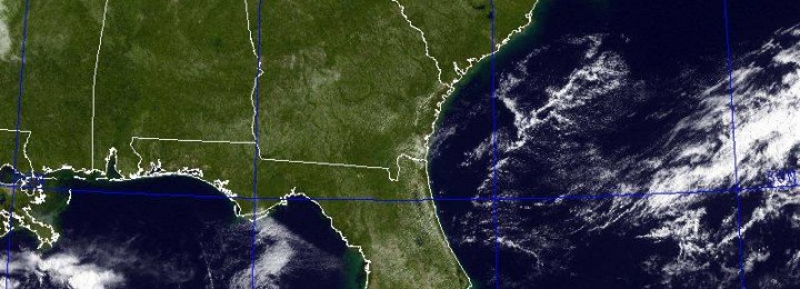
The satellite picture this morning showed the Southeast in all its glory, unmasked by clouds. This image, taken from the GOES-East geostationary satellite, is so crisp that you can see river valleys and even the “fall line” cutting through central Georgia, South Carolina and North Carolina. The clear conditions are courtesy of high pressure, which…
-
AgroClimate is a web site developed by scientists associated with the Southeast Climate Consortium. It contains climatological information for stations around the Southeast based on NWS cooperative observers as well as some mesonetworks like Florida’s FAWN. I’ll talk more about mesonetworks next week. One of the most useful things about AgroClimate is its ability to…
-
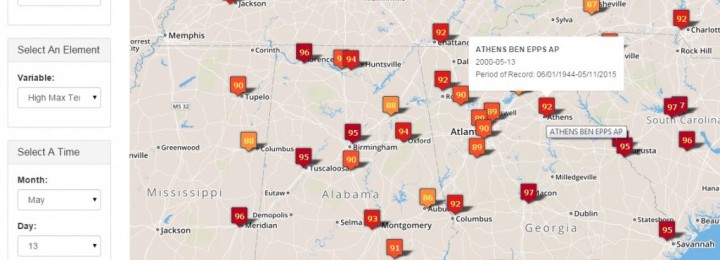
The Southern Regional Climate Center (based in Louisiana) announced a new Climate Extremes Portal today. It is available at https://extremes.srcc.lsu.edu/. This map-based product provides extremes of temperature and precipitation for each station across the country (not just the South). An example of the display for May 13’s record high maximum temperature is shown below. Note that…
Posted in: Sources of weather and climate data -
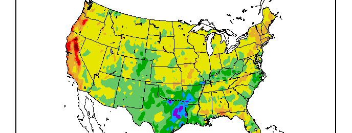
While the last couple of weeks have been very dry, they have followed a wet April. For the year to date, most of the Southeast is fairly close to normal in both temperature and precipitation. By comparison the West Coast has been much hotter and drier than normal and the Northeast has been cold and…
-

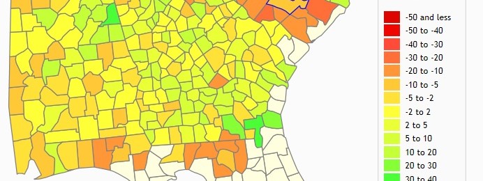
Compared to the wet April we just finished, May has started very dry this year. How does it rank compared to other years? You can use the SERCC’s Perspectives tool to help answer that question (even if you don’t live in the Southeast). The map below shows the regional map perspective on the ranking for…
-
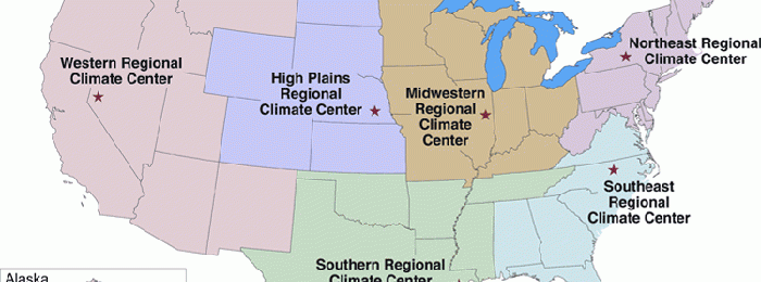
In this series on sources of climate and weather information, we’ve looked at the state climatologists and the National Climate Data Center (NCDC–now part of NCEI, the National Centers for Environmental Information) so far. In between these two levels of data sources are the regional climate centers, also part of NOAA. The map of regional…
-

In the universe of sources of weather and climate data across the Earth, NOAA’s National Climatic Data Center (NCDC) in Asheville, North Carolina has to be the big Kahuna. This center is the official federal archive of all weather and climate information collected by the National Weather Service as well as many other official climate…