AgroClimate is a web site developed by scientists associated with the Southeast Climate Consortium. It contains climatological information for stations around the Southeast based on NWS cooperative observers as well as some mesonetworks like Florida’s FAWN. I’ll talk more about mesonetworks next week.
One of the most useful things about AgroClimate is its ability to separate impacts like crop yields by ENSO phase. El Nino Southern Oscillation (ENSO) refers to the swing back and forth between El Nino and La Nina, which has a large effect on the climate of the Southeast. If we know what the phase of ENSO is (right now it is an El Nino and is expected to last for at least the next few months), then we can use statistics to determine what the impacts of the ENSO phase might have on agriculture in the Southeast.
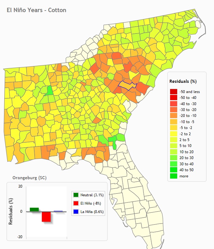
The map below provides one illustration for the kind of information that AgroClimate provides. This map shows the likely yield for cotton in an El Nino year. It shows that cotton does moderately well in Georgia in those years, but not well at all in most of South Carolina. A producer who knows this in advance might choose to plant a different crop that does better in these conditions, especially when market considerations are taken into account.