Sources of weather and climate data
-
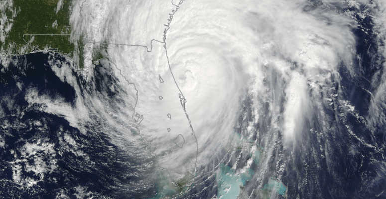
What do you do to prepare for hurricane season? Do you take an inventory of your belongings? Purchase flood insurance? Plan where to evacuate in case the storm comes right over your location? If you are like many Floridians, according to a recent AAA poll, you do none of the above. In fact, you probably…
-
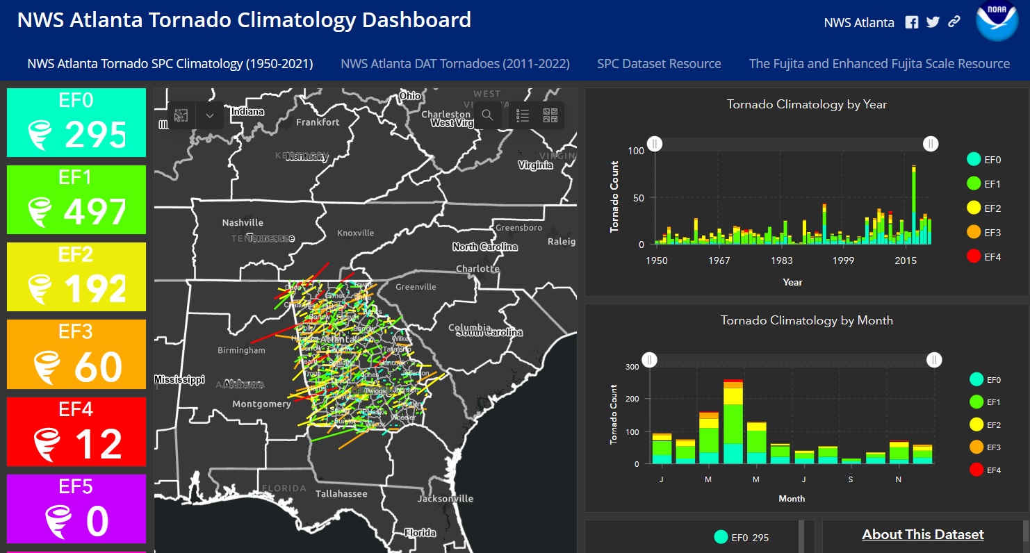
Those of you who are located in the County Warning Area for the Atlanta National Weather Service Office may be interested in trying out this new GIS-based tornado dashboard. You can check it out here. It contains tracks of all tornadoes that have occurred in those counties since 1950. The dashboard allows you to filter…
-

Do you ever get a question about climate that you can’t answer? There are many resources available across the country that you can use to help. The US Climate Resilience Toolkit has a page with many links devoted to identifying folks who can help you find answers to your climate-related questions. I can help too!…
-

Here is a simple-to-use database of historical tornadoes that you can sort by County Warning Area or individual county. You can also filter the data by strength and look at graphs of tornado frequency by time of day, month, and EF scale. Individual counties show maps of the historical tornado tracks. You can check it…
-

It’s raining outside my window right now, and I’m not really worried about drought in the near future, but the next drought is always around the corner and friends are currently experiencing one. Because of that, I want you to know about the new state pages on Drought.gov. They provided updated state-by-state information and resources…
-

The Climate Toolbox website is a collection of web tools for visualizing past and projected climate and hydrology of the contiguous United States. One of the sections that I find especially useful is the Agriculture page, which provides links to a variety of tools that can help producers plan for climate in the future at…
-
April is the month when we celebrate Earth Day on April 22. In preparation for this, Extension has put together a list of resources that anyone can use to provide education on earth sciences. A lot of the references have to do with weather and climate and might be of use and interest to the…