Interesting weather images
-
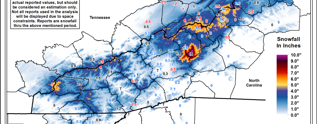
If you are longing for a taste of real winter, then you might enjoy this video of blizzard conditions on top of Mount Washington in New Hampshire from WeatherNationTV at https://www.weathernationtv.com/news/blizzard-conditions-whip-mount-washington-observatory/. Meanwhile, some areas in the Southeast got a little taste of snow yesterday with up to a few inches of snow reported at higher elevations in…
-

GOES 16, formerly known as GOES R, has sent its first pictures back from space, and they are great! This is the first in a series of new and better geostationary satellites that will be helping NOAA to monitor and predict weather, including severe weather outbreaks. You can see the pictures and read more about…
-
Do you like to watch time lapse photography? Here is a really great resource showing land use changes across the world. Google and Time magazine have teamed up together to show a three-decade time lapse of the entire Earth. You can zoom to areas of interest or check out the editors’ choices of some of…
-
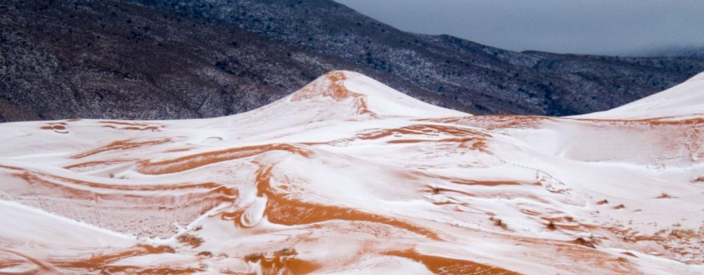
Today’s stunning picture is of a snowfall in the Sahara desert in an area that has not seen snow in the last 37 years. While summer temperatures in the Sahara can be stifling, winter can actually be quite chilly, especially in the higher elevation areas near the Atlas Mountains. I love the picture of white…
-
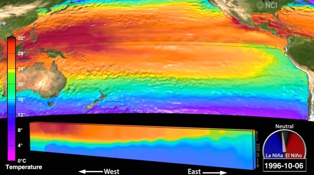
The Inertia published a news story this week describing a detailed new video of the oceanic and atmospheric circulation in the Pacific Ocean in El Niño and La Niña conditions. Most of you already know that both El Niño and La Niña affect the climate here in the Southeast, especially in winter. If you have…
-
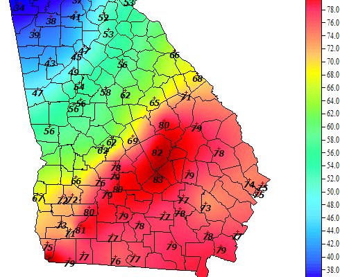
The air temperature map today from the Georgia Weather Network shows the strong gradient in temperature across the state. Strong winds from the southwest ahead of the front are bringing temperatures of low 80s into east-central Georgia right now (probably breaking a few records) but will be replaced in a few hours by much colder…
Posted in: Interesting weather images -
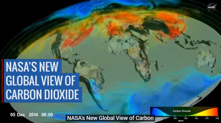
This week NASA announced that it has produced a new visualization of how carbon dioxide moves around the globe. It shows how CO2 moves around the earth and between the northern and southern hemispheres. You can really see the difference in the two hemispheres in terms of land area and plant life. You can read…