Climate outlooks
-
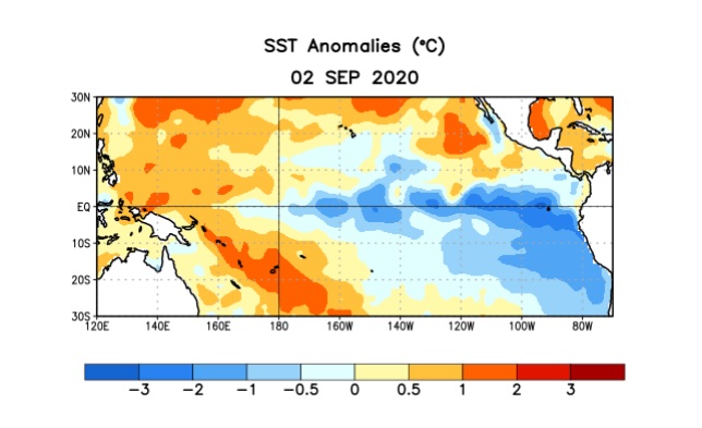
As expected, NOAA’s Climate Prediction Center has issued a La Nina Advisory this week to note that a La Nina has officially been observed to occur. You can find their text advisory at https://www.cpc.ncep.noaa.gov/products/analysis_monitoring/enso_advisory/ensodisc.pdf. There is a 75 percent chance that it will continue through Northern Hemisphere winter. In the Southeast, a La Nina is…
-

Tonight’s 5-day tropical outlook shows several areas of potential tropical activity. There are two weak areas of low pressure in the western Atlantic which have a small chance of developing. Both of them are probably only going to bring some rain to parts of the Southeast rather than other impacts, but should still be watched.…
-

A drier air mass is moving into the Southeast behind today’s front. That should mean cooler and less humid air will be in place for the next few days before humidity returns. Kirk Mellish of WSB has an excellent description of the forecast and how things are changing at his blog here. The forecast dewpoint…
-
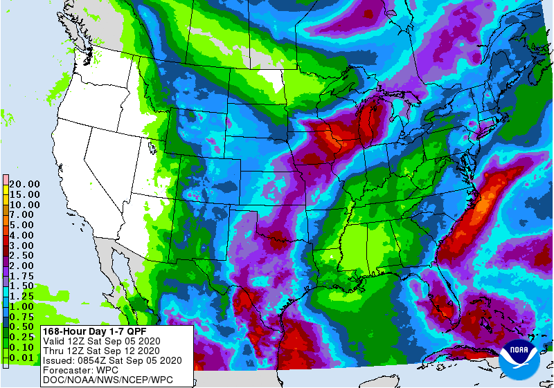
Western regions of the Southeast will receive only small amounts of rain this week. The biggest rainmaker will be an upper level low which is currently near Cuba but is expected to makes its way north over the next few days, bringing heavy rain to the Florida Peninsula and along the East Coast before it…
Posted in: Climate outlooks -
September 1 marks the start of climatological fall for atmospheric scientists like me. As I write this article (for the Peanut Pointers newsletter) on September 2, the tropics are active, with two named storms (Nana and Omar) and two more areas that could develop in the next week. Tropical activity is part of autumn in…
Posted in: Climate outlooks -
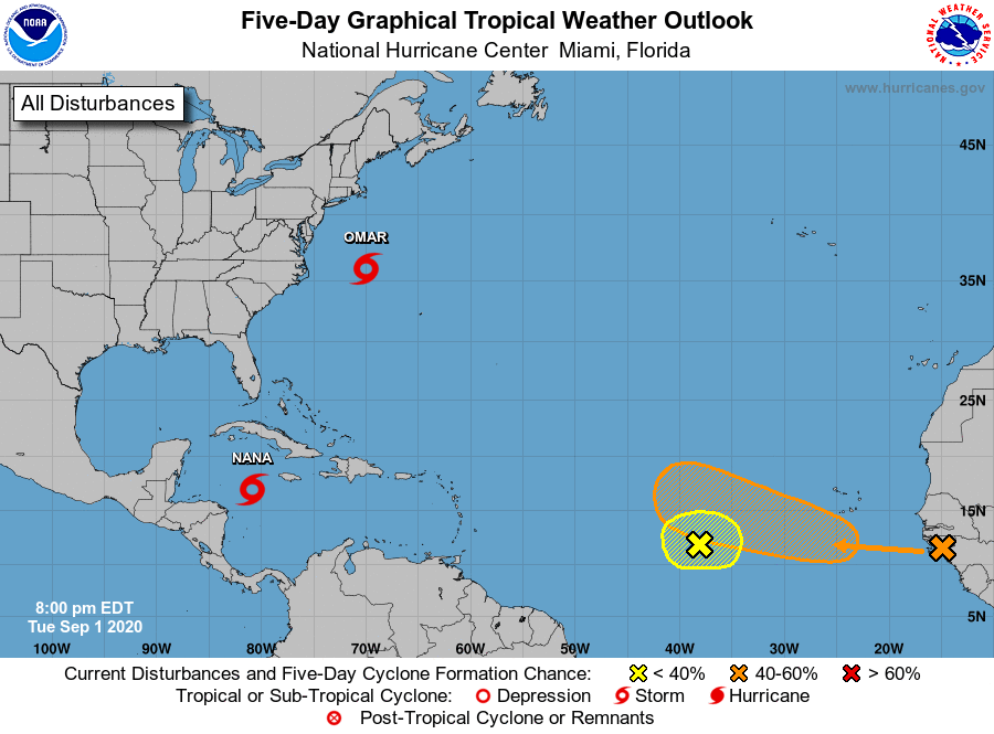
During the day today two new tropical storms formed. TS Nana formed in the Caribbean and is headed straight west towards Central American and the Yucutan, where it could drop quite a bit of rain. If it is strong enough, it could jump over into the Pacific. TS Omar formed a few hours later off…
-
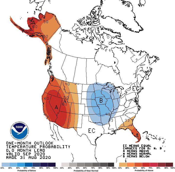
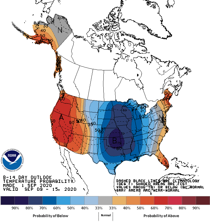
The latest monthly outlook for September 2020 shows that an outbreak of cold air is expected to move into the central US during the first two weeks of September and could bring cooler temperatures as far south as Georgia and Alabama, especially in the northern parts of those states. The Florida peninsula is expected to…
Posted in: Climate outlooks