Climate and Ag in the news
-

A number of news stories in recent weeks have shown the influence of the waning strong El Niño on climate around the world. Here is a sampling of stories on the agricultural impacts of droughts in some of these areas. News24 reported that drought in Zimbabwe has caused the deaths of at least 19,300 head…
-

Satellite data is the single most important source of weather data used to input into weather forecast models, providing millions of points of information that help to make forecasts accurate. And yet there was a time when there was no man-made satellite looking down on the earth. April 1, 1960 was the first date that…
-
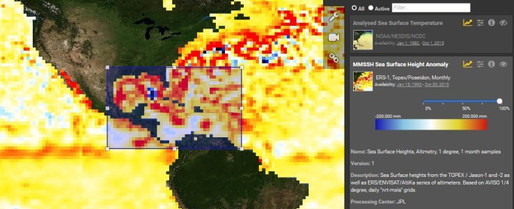
NASA has a new web site dedicated to providing resources on sea level for across the US. The site is available at https://sealevel.nasa.gov/. You can also read more about it at TechCrunch at https://techcrunch.com/2016/04/04/nasas-new-sea-level-site-puts-climate-change-papers-data-and-tools-online/. The site is focused on space-based observations (hence why it is coming from NASA instead of NOAA) but has plenty of land-based indicators…
-

Yale Climate Connections posted a story this week about the tough decisions that Southern California farmers are having to make after another winter with low rainfalls. One farmer says that she had to cut 100 acres of vegetables last year (out of 350 total) and another 100 this year due to lack of water. She…
-
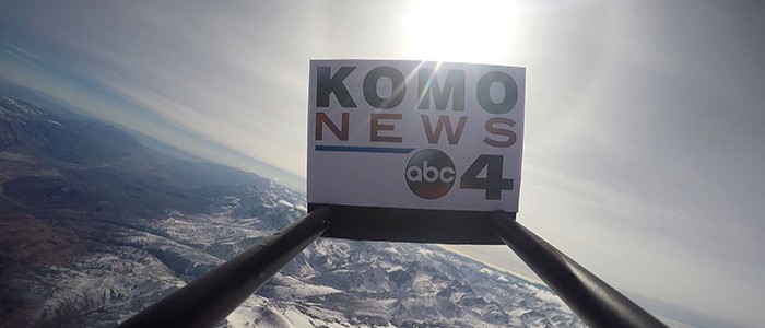
KOMO TV posted a fascinating video of a weather balloon making a 22-mile high flight through the atmosphere and falling back to earth. You can see it here. As a meteorologist, though, I am even more fascinated by the temperature profile that the balloon travels through. It shows not only the temperature decreasing with height…
-

In the past, distributions of raindrop size were made mainly by flying airplanes with special equipment through rainstorms or catching drops on a surface that shows the drop size. Now NASA has come up with a method for measuring the 3-dimensional pattern of raindrop sizes in a storm that may help computer modelers improve forecasts…
-
Nearly 2/3 of the land that NASA manages is within 16 feet of mean sea level, according to a news article published in the New York Times today. Because of this, and knowing the upward creeping sea levels around the world due to warmer waters and melting ice caps, they have been working for ten…