Pam Knox
-
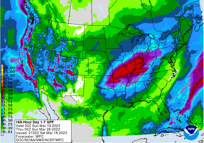
The latest 7-day QPF map shows the only rain this weekend is in Florida with the tail end of the front that passed through the region over the last two days. We should see relatively little rain through mid-week, then a heavy rain event in the Ohio River and Middle Mississippi Valleys that will drop…
Posted in: Climate outlooks -
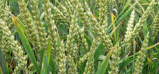
Here is an interesting story from AZCentral that describes how one Arizona farmer is growing wheat and other crops in the desert by careful use of water combined with regenerative agriculture, a process of rebuilding soil organic matter and restoring degraded soil biodiversity through cover crops and other conservative methods. By growing his crop organically,…
-
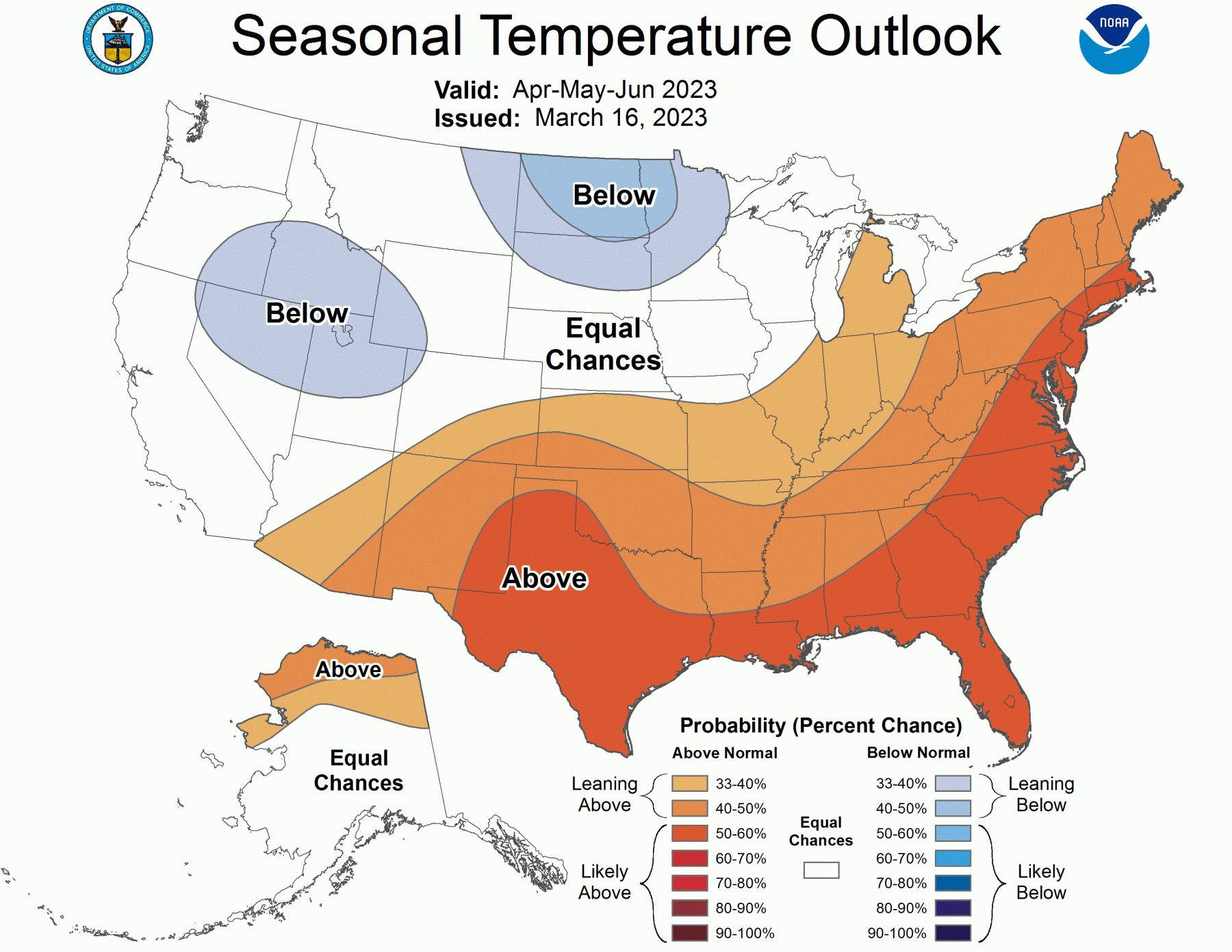
NOAA released its latest outlooks for April and the April through June period. Both the April and April-June outlook maps shows the likelihood of having warmer than normal temperatures during those periods. I am sure this is due in part to the trend towards warmer temperatures in recent years, which makes getting another warm year…
Posted in: Climate outlooks -
A study published in February 2023 in the American Meteorological Society’s Journal of Climate quantified a 50-year warming trend in the surface water of the Gulf of Mexico. The rate is twice the rate that the global ocean is warming. This is important to us in the Southeast because of the economic and environmental impacts…
-
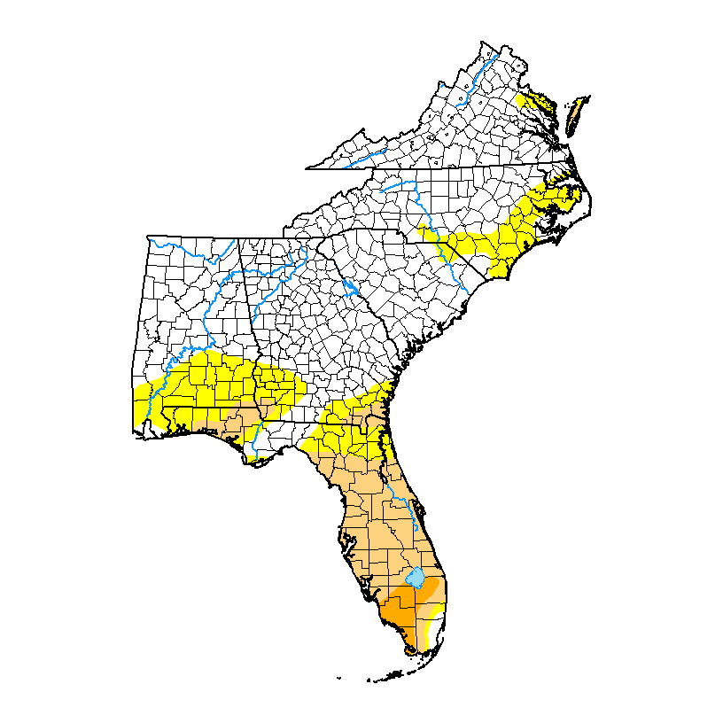
There were few changes to the drought condition across most of the Southeast. There were no changes in VA, NC and SC and small decreases in AL and GA. In Florida, there was a slight decrease in areal coverage overall but the area of severe (D2) drought expanded. Moderate drought (D1) was reintroduced to the…
Posted in: Drought -
If you are a citrus grower in Florida that has been affected by the wind and rain of Hurricane Ian, you might be interested in hearing about this new study that is being undertaken by scientists at the University of Florida. Over the next year, they will be looking at the continuing impacts of Hurricane…
-
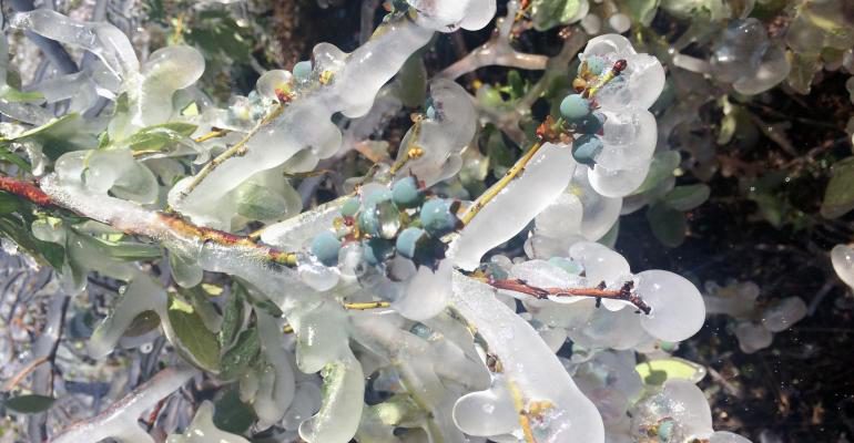
I posted this information about frosts and freezes in the UGA Viticulture blog today after getting a request from a grape grower in northern GA. Clearly, it has been on the mind of a lot of growers this week due to our return to cold conditions after a very warm February. This is some information…
Posted in: Climate science