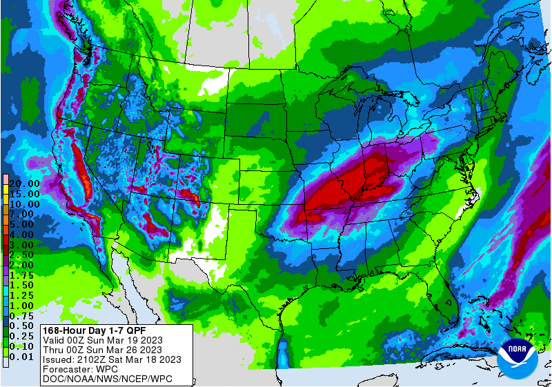
The latest 7-day QPF map shows the only rain this weekend is in Florida with the tail end of the front that passed through the region over the last two days. We should see relatively little rain through mid-week, then a heavy rain event in the Ohio River and Middle Mississippi Valleys that will drop some rain in our western edge of the region late in the week Week 2 has a slight chance of wetter than normal conditions with little trend in weeks three and four so far.
The biggest impact from temperature will come this week Sunday through Tuesday mornings, with frost fairly widespread all but coastal areas of the Southeast, especially on Monday morning. After that, the long range forecasts are not showing any frost except in the Southern Appalachians, but there is still a cold pool of air to the north that could get pulled towards us if the weather patterns are just right, so it is too early to rule out another frost in April at this point for northern areas, although it is less likely because the spring warming from longer days is working against it.