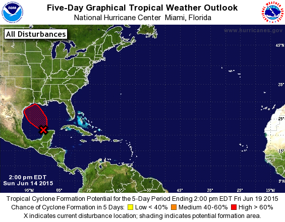
The National Hurricane Center reported today that a tropical disturbance off the Yucatan Peninsula of Mexico is 80 percent likely to become a tropical depression in the next few days. This area, currently called Investigation 91L, is expect to strengthen over the warm Gulf of Mexico and could develop into a tropical depression and perhaps a tropical storm. Upper level winds should keep it from gaining more intensity that a minimal tropical storm.
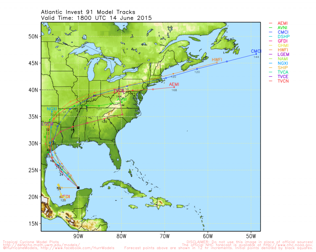
If it develops as expected, it is forecast to move north into Texas on Tuesday and Wednesday. Whether or not it becomes named storm Bill, it will bring copious rain to an area that is already awash from heavy rains earlier this month. This is likely to cause more flooding and delays in field work as well as contribute to moisture-related pests and diseases. The rain could extend a significant distance away from the center of circulation.
One effect that could be seen if the storm traverses the area of wettest conditions is the “brown ocean” effect seen in previous storm Erin over Oklahoma. This storm moved over saturated soils in Oklahoma and developed an eye far inland from the coast due to the saturated surface conditions. Dr. Marshall Shepherd of UGA and student Theresa Andersen wrote about this effect, which was described in a NASA press release here.
Here in the Southeast, our weather will continued to be controlled by the high pressure that is parked over our region, which will keep any rain from the tropical depression to our west and north.
You can read more about it at Dr. Jeff Masters’ WunderBlog or at Hurricane Track here. Another good source of information about the tropics is https://www.spaghettimodels.com.